-
Hello, please take a minute to check out our awesome content, contributed by the wonderful members of our community. We hope you'll add your own thoughts and opinions by making a free account!
You are using an out of date browser. It may not display this or other websites correctly.
You should upgrade or use an alternative browser.
You should upgrade or use an alternative browser.
Wintry Valentines Weekend Potential ?
- Thread starter SD
- Start date
Canadian was somewhat close. This one has as good a chance to hit a HR as it does a foul ball still.
Last edited:
Clem282340
Member
That look like at good run there
Hypsometric
Member
HurricaneSolomon
Member
- Joined
- Dec 6, 2021
- Messages
- 154
- Reaction score
- 276
WRAL says that snow lovers in the triangle will be disappointed about this Sunday system as “our northern communities” will see this most of the snow if there is any. How often do we here that in the Raleigh area? Haha. I know the models are all over the place and of course it still bears watching... and watch we will do as we’ve seen this movie before and always with different endings.
Sent from my iPad using Tapatalk
Sent from my iPad using Tapatalk
HurricaneSolomon
Member
- Joined
- Dec 6, 2021
- Messages
- 154
- Reaction score
- 276
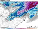
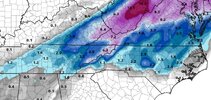
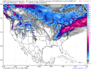
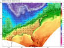
6z GFS was another improvement. Kuchera at hour 120:
View attachment 113141
That definitely looks better.
Sent from my iPad using Tapatalk
stephend122080
Member
Trough looks alot better vs last run.

Sent from my SM-A115U1 using Tapatalk

Sent from my SM-A115U1 using Tapatalk
06z much better nice Lee side enhancement too. Baby steps plenty of time.
Cad Wedge NC
Member
GSP just took away any mention of precip for Sunday.06z much better nice Lee side enhancement too. Baby steps plenty of time.
stephend122080
Member
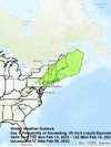
Here's Bernie Rayno's idea for this storm. He says he may have to include DC and Philly, but this is this the highlighted area for snow potential. He focuses on the 500mb pattern for alot of storms. He doesn't think the out to sea solution is likely right now.

Sent from my SM-A115U1 using Tapatalk

Sent from my SM-A115U1 using Tapatalk
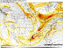
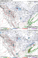
Be interesting to watch how this unfolds on the RDPS as our system will get inside 90hrs latter today. Some models do well with certain patterns/weighted features at times than others. This season that might be/might not be the case as to why the RDPS has been killing it for my neck of the woods. Here's the 6z run . It might just be the case where everything has been so NS dominated, that it has the leg up on all the others, higher skill set. Notice that 2 contour NS vort.


stephend122080
Member
The piece of energy at the top of the trough in Southern Canada is key. The further west it can hang back, the better the chance of the trough going neutral or even negative tilt causing the surface low to be closer to the coast IMO.Be interesting to watch how this unfolds on the RDPS as our system will get inside 90hrs latter today. Some models do well with certain patterns/weighted features at times than others. This season that might be/might not be the case as to why the RDPS has been killing it for my neck of the woods. Here's the 6z run . It might just be the case where everything has been so NS dominated, that it has the leg up on all the others, higher skill set. Notice that 2 contour NS vort.

Sent from my SM-A115U1 using Tapatalk
From what I read Monday they want to see some support from ensembles.GSP just took away any mention of precip for Sunday.
L
Logan Is An Idiot 02
Guest
Very close to what I said a few days ago just chew off the western edges by 4 counties and spot on actually. I can’t believe some are saying Raleigh is out of the game when actually they are in a more favorable spot than say Boone!Here's Bernie Rayno's idea for this storm. He says he may have to include DC and Philly, but this is this the highlighted area for snow potential. He focuses on the 500mb pattern for alot of storms. He doesn't think the out to sea solution is likely right now.
Sent from my SM-A115U1 using Tapatalk
NBAcentel
Member
06z euro more strung out/more pos tilt
Hypsometric
Member
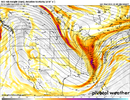
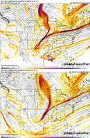
06z RGEM is most similar to the 00z UKMET but the overall trend seems to be heading this direction with that strong, possible closed ULL diving out of Manitoba/Ontario playing a bigger role. KMA went the most nuts with this idea. Manitoba Mauler time?!Be interesting to watch how this unfolds on the RDPS as our system will get inside 90hrs latter today. Some models do well with certain patterns/weighted features at times than others. This season that might be/might not be the case as to why the RDPS has been killing it for my neck of the woods. Here's the 6z run . It might just be the case where everything has been so NS dominated, that it has the leg up on all the others, higher skill set. Notice that 2 contour NS vort.

LukeBarrette
im north of 90% of people on here so yeah
Meteorology Student
Member
2024 Supporter
2017-2023 Supporter
RAH thoughts, seems I've read this story before
The critical forecast elements here remain the same. 1)Just how far
offshore the coastal low develops; 2) the evolution(timing,
magnitude, and track)of the trailing upper wave/trough into the
region; 3) How much, if any interaction will occur between these 2
features.
Based on latest guidance, the models have the coastal low too far
offshore to be a major player for central NC. Thus, the bulk of
precip/forcing will have to come from the upper trough. In this
case, thermal profiles initially would support rain through
midday/early afternoon. However, cooling, aloft and in the low-
levels, would yield increasing probabilities for a change-over to
snow during the mid/late afternoon and into the evening. The big
question then is that once the atmosphere is cold enough to support
all snow, will we have enough liquid qpf to get any measurable snow
before precip ends. Right now, it does not look good for measurable
snow across central NC.
FWIW the 06z Euro control run seemed to really like the upper wave, BL temps are an issue and it's mostly mountains, N NC and S Va but improvement


NBAcentel
Member
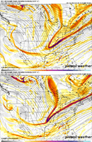
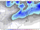
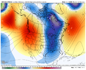
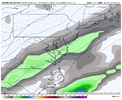
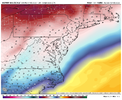
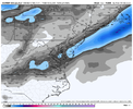
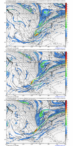
Getting late in the season for these light events to be much, would love to see one good bomb where time of day, soil temps, sun angle and all the other fail phrases don't matter.damn shame, helps so much if it happened at night View attachment 113150View attachment 113151View attachment 113152
Getting late in the season for these light events to be much, would love to see one good bomb where time of day, soil temps, sun angle and all the other fail phrases don't matter.
I hope this bombs and whoever gets a good snow...token flakes at 35F is such a waste.
That ukmet run was so close to being something special but imo we need to open up the wave in the lakes and feed it into the back of the trough
NCHighCountryWX
Member
- Joined
- Dec 28, 2016
- Messages
- 699
- Reaction score
- 1,918
Yeah it needs some cold air injected into it, almost see a comma head trying to get going just looking at the 700mb RH map. It was very close to somethingThat ukmet run was so close to being something special but imo we need to open up the wave in the lakes and feed it into the back of the trough

Z
Zander98al
Guest
Not the first , second or third time weve played this rodeo lol
Today means getting within the coveted 4-5 day range. Probably a big day in determining the scope of this between nothing, marginal event, and something special.
Hypsometric
Member
I agree. If the wave stays open and strong, perhaps it drives hard to the south and can catch the southern piece. An alternative/KMA solution is that the wave can stay open a tad longer and then close off and become the main system. The KMA has had the same solution the past two runs, with the 00z run a good bit further south. If it could take another jog south....I feel like I've made these if and but statements 1000x since joining this board already (embarrassing myself I suppose).That ukmet run was so close to being something special but imo we need to open up the wave in the lakes and feed it into the back of the trough
It's been nice to get snow so far this winter but frustrating that we have missed on what I thought could have been at least 1 6-10 type event if not 2 but the fast flow really tempered them down to what they were. I'm surprised in this flow that we haven't gotten a power house wave embedded that really went crazy but maybe the steep height gradient between the WC ridge and cold vortex in east Canada is shearing and accelerating everything so that's just not possible. Even with this storm you can see how easy it would be to dive energy into the base of the trough, tilt it, and really wind up a big low but is the flow just too fast to do so? Any semblance of -nao or a big system in SE Canada to clog the flow would be incredibly helpfulI agree. If the wave stays open and strong, perhaps it drives hard to the south and can catch the southern piece. An alternative/KMA solution is that the wave can stay open a tad longer and then close off and become the main system. The KMA has had the same solution the past two runs, with the 00z run a good bit further south. If it could take another jog south....I feel like I've made these if and but statements 1000x since joining this board already (embarrassing myself I suppose).
Last edited:
LukeBarrette
im north of 90% of people on here so yeah
Meteorology Student
Member
2024 Supporter
2017-2023 Supporter

RGEM looked like it was about to put down lots of snow somewhere on the East Coast
stephend122080
Member
With a surface low popping in the central Gulf of Mexico
RGEM looked like it was about to put down lots of snow somewhere on the East Coast
Sent from my SM-A115U1 using Tapatalk

