-
Hello, please take a minute to check out our awesome content, contributed by the wonderful members of our community. We hope you'll add your own thoughts and opinions by making a free account!
You are using an out of date browser. It may not display this or other websites correctly.
You should upgrade or use an alternative browser.
You should upgrade or use an alternative browser.
Wintry Valentines Weekend Potential ?
- Thread starter SD
- Start date
Lots of jokes I could make for us married folk.
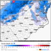
7” on the last two bufkit runs for CLT.
7” on the last two bufkit runs for CLT.
9” for RDU with 0z BUFKIT
Mid 60s+ to snow so it will prob snow somewhere east of the mtns. Common theme for a lot of winter storms around here.
Loganville Winter
Member
Obvious super whammy bammy banter for married folks.
Climo says we are in our wheelhouse in ATL. Let’s bring it home.
Climo says we are in our wheelhouse in ATL. Let’s bring it home.
06z EPS is kinda meh, seems like the 0z eps had more coastal precip inland where as the 06z is trying focus on the upper energy precip more (reminder 06 only goes out to 144 so might have been better on exit?) Anyway we all know that whatever the models are showing now will not verify this weekend but it seems we are in deja vu land again. Will we finally get some type of phase bomb (doubt it), will the coastal be the main player closer to the coast, will the coastal basically be a big nothing burger and then the upper level energy hit the area with a light event? Who knows, I don't know if models are worse or the pattern is this difficult but seems we used to have some idea once we had a threat under 6-7 days
Any who here it the 06 eps again through 144


Any who here it the 06 eps again through 144


Hypsometric
Member
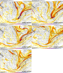
No doubt about it, the Euro/GFS/UKMET are all in the ballpark for showing the 00z GFS solution. If things would trend our way, for once this winter, we have that opportunity but the next couple days will reveal what type of threat this is, if any. Also, fwiw I would not be looking to the ensembles to lead the way with this type of complex phasing situation where higher model resolution would be key.Euro is getting better imoView attachment 113065
bigstick10
Member
KATL:
The main focus has
been on the weekend where models have had quite a bit of
discrepancy and run-to-run inconsistency on how amplified the
upper trough gets over the region and amount of possible enhanced
moisture gets phased in. For this set of runs, the GFS
deterministic run is quite robust with even cutting off the upper
trough and allowing for significant snow potential enhanced with
a deformation axis by Sunday/Sunday night.
Yeah I'd expect the ens to merge the individual waves into just a full latitude positive tilt dudNo doubt about it, the Euro/GFS/UKMET are all in the ballpark for showing the 00z GFS solution. If things would trend our way, for once this winter, we have that opportunity but the next couple days will reveal what type of threat this is, if any. Also, fwiw I would not be looking to the ensembles to lead the way with this type of complex phasing situation where higher model resolution would be key.
Hmmm ICON looks to have more consolidated energy in base of trough, looks like it might try to go for it here
L
Logan Is An Idiot 02
Guest
Stephenb888
Member
What gives with these lows not forming and ramping up in the gulf. I’m tired of seeing this look.
L
Logan Is An Idiot 02
Guest
Going to change a thousand times. I’m just worried about surface temperatures tbhWhat gives with these lows not forming and ramping up in the gulf. I’m tired of seeing this look.
What gives with the 90% complaining rating in the storm thread? It's what the Whamby thread is for.What gives with these lows not forming and ramping up in the gulf. I’m tired of seeing this look.
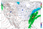
Upper trough has to phase in or it's likely going to be mostly rain.ICON marginal temp system with some backside snow on exit, not too far off from a bigger deal though imho

View attachment 113071
ForsythSnow
Moderator
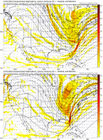
It's practically 1 step from a phase or is very close to one. Really a decent look that I don't want to lose or see go too far SW like a lot have this season. Hopefully we see some nice runs with the 12Z suite, especially the euro. We want to see some ens on both the GFS and Euro pick up on this too.Upper trough has to phase in or it's likely going to be mostly rain.
Phase >>> close off a few contours to our south situation is key to a good storm and the best solution, icon was closer to that


