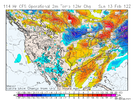
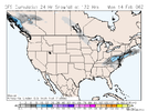
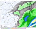
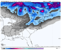
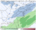
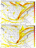
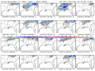
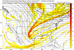
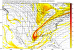
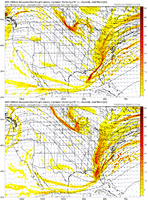
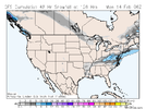
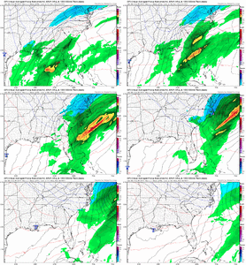
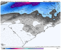
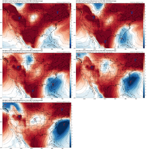
18Z GFS looks like a no as it looks even slightly worse than the not good 12Z so far. Cold air push is even weaker than the 12Z. Without the good cold air pushes of the 0Z/6Z, the chances are not good for anything widespread. Hope the 0Z reverses that.
-
Hello, please take a minute to check out our awesome content, contributed by the wonderful members of our community. We hope you'll add your own thoughts and opinions by making a free account!
You are using an out of date browser. It may not display this or other websites correctly.
You should upgrade or use an alternative browser.
You should upgrade or use an alternative browser.
Wintry Valentines Weekend Potential ?
- Thread starter SD
- Start date
NBAcentel
Member
Warmer, but energy was better bundled and nearly closed off compared to the open 12Z
I could live with that if it's colder! Wasted all my precip on rain.It’s 2 weekends ago all over again on the GFS View attachment 113106
NC/TN can so much more easily get wintry precip than a place like ATL and the 18Z demonstrates that well as the run was pretty sucky overall. But even if I were in ATL-AHN areas, I wouldn’t yet be giving up on this as we’re still 5 days out, an eternity in the models world because they’re so undependable that far out. I still wouldn’t bet on anything, but wouldn’t bet anything near the farm on nothing either. The tandem of +PNA and prime time climo says give it at least through tomorrow’s runs to see if they’ll trend back to the glory of the 0Z, which literally gave the SE the most widespread winter storm of the winter so far. Those areas could surely use a better cold air push and the energy also with it like the 0Z/6Z had.
Last edited:
lexxnchloe
Member
Trends look pretty good to me. Better than tracking 75 and pollen
GFS looks good to me. Still some snow for this event and another event for TN, AL, MS crowd a few days later!
dsaur
Member
At least we have the weak lp, and the low is in Fla for a change....not in Ga, or off the coast, lol. Plenty of time to shape up. Climo wants it, the moles are thrumming, I have a new Mavic 3 I'm dying to fly over deep snow. Winter Olympics to remind me what a covering of fake snow looks like...all the portents are there.18Z GFS looks like a no as it looks even slightly worse than the not good 12Z so far. Cold air push is even weaker than the 12Z. Without the good cold air pushes of the 0Z/6Z, the chances are not good for anything widespread. Hope the 0Z reverses that.
At least we have the weak lp, and the low is in Fla for a change....not in Ga, or off the coast, lol. Plenty of time to shape up. Climo wants it, the moles are thrumming, I have a new Mavic 3 I'm dying to fly over deep snow. Winter Olympics to remind me what a covering of fake snow looks like...all the portents are there.
Tony,
If the moles are excited about the possibilities, I am excited! I’m not saying that should this come back from this run and end up an ATL area hit that it will be mainly sleet, but interestingly enough, a good portion of the best ATL sleets were in mid Feb:
- 2/12/2014: had nice sleet in Dunwoody, my 3rd biggest sleet ever (up to 1.5” some areas)
- 2/17-18/1979: who can forget this 4” sleet? One of my all time favorites!
- 2/15/1958: 1” of sleet along with ~2” of snow
- 2/14-15/1902: 1.75” of sleet
NBAcentel
Member
Cary_Snow95
Member
GFS still way too jumpy to me to make any broad calls on this thing.
HSVweather
Member
I was about to post this too what a model
olhausen
Member
If my area gets snow this weekend it’ll also be 6 snows that accumulated in 6 straight weeks. I still had patches of sleet this morning from Friday’s little system. That’s what 4 straight nights of 21 degrees or lower and even a small amount of sleet can do for you.If GSO gets something wintry of note from this, it would be their 6th within 6 weeks!
Flotown
Member
A couple of good members.
Not bad Sunday may be interesting
ryanardo
Member
75 and pollen means severe weather, it's nice out, but have to keep the house closed, honestly I've had enough of winter in Central SC for the year. Ready for a changeTrends look pretty good to me. Better than tracking 75 and pollen
bigstick10
Member
So no real excitement at the moment from KATL, like earlier AFD.
For now, GFS has backed off of the potential for
significant snow potential indicated in the previous run. The
ECMWF solution continues to indicate a weaker trough and less
moisture. Slight chance PoPs have been included in portions of
north and east Georgia to account for the possibility of wrap-
around precipitation. With temperatures forecast to drop to near
freezing early Sunday morning, so there is also a slight chance
for a light rain/snow mix in far north Georgia during that time.
So no real excitement at the moment from KATL, like earlier AFD.
For now, GFS has backed off of the potential for
significant snow potential indicated in the previous run. The
ECMWF solution continues to indicate a weaker trough and less
moisture. Slight chance PoPs have been included in portions of
north and east Georgia to account for the possibility of wrap-
around precipitation. With temperatures forecast to drop to near
freezing early Sunday morning, so there is also a slight chance
for a light rain/snow mix in far north Georgia during that time.
Yeah. I fell for the earlier one too. All I saw was “significant snow potential enhanced with a deformation axis by Sunday/Sunday night”.
Even though I read everything else on either side it… Including FFC specifically calling it an outlier… That glorious sentence was still all I came away with.
Oh well. Maybe someday it will happen. Someday…
Stephenb888
Member
Alright I’m ready for another good GFS run like last night. Bring it on.
Blue_Ridge_Escarpment
Member
Was about to come and post the exact same thing.The 00z ICON is significantly improved over 18z.
View attachment 113122
Cold air feed is concerning
Storm5
Member
00z gfs was close . We are gonna get a run soon with a mega bomb
Sent from my iPhone using Tapatalk
Sent from my iPhone using Tapatalk
ATLwxfan
Member
GFS with signs of life tonight. Maybe some interesting runs tomorrow. It feels like it’s trying to inch back toward yesterday’s solution.
Sent from my iPhone using Tapatalk
Sent from my iPhone using Tapatalk
Cary_Snow95
Member
Cary_Snow95
Member
lexxnchloe
Member
That seems like a considerable improvement.
This is an interesting take on the uncertainty regarding Valentine's Day system.
Was an improvement but is it to be believed? I've got to see more than the GFS and some consistency before I'm remotely intriguedThat seems like a considerable improvement.
Not a cold setup it's why we need some phasing with the NS, not ideal not impossible.... did I mention not ideal?not a snowy setup as is View attachment 113131
Stephenb888
Member
Which is disappointing because that is pretty close to the track we’ve all been waiting for.not a snowy setup as is View attachment 113131

