-
Hello, please take a minute to check out our awesome content, contributed by the wonderful members of our community. We hope you'll add your own thoughts and opinions by making a free account!
You are using an out of date browser. It may not display this or other websites correctly.
You should upgrade or use an alternative browser.
You should upgrade or use an alternative browser.
Wintry Valentines Weekend Potential ?
- Thread starter SD
- Start date
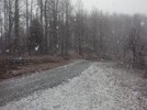
Pouring snow above the house ?
SWVAwxfan
Member
Snow is winding down here in Christiansburg VA. I got around 3" from this little event.
My camera really doesn't do this justice. My best photos are to large too.
Not sure if you have Snapchat but if you do I’ve found that if you open up the photo in Snapchat then re-save it, it will then post without issue.My camera really doesn't do this justice. My best photos are to large too.
Jessy89
Member
Any accumulation reports from this little mountain event?
Sent from my iPhone using Tapatalk
Sent from my iPhone using Tapatalk
Cad Wedge NC
Member
Rain/snow mix here now. 38 degrees
LukeBarrette
im north of 90% of people on here so yeah
Meteorology Student
Member
2024 Supporter
2017-2023 Supporter
Snowing good now with a dusting everywhere, good to see
Fountainguy97
Member
Just got back from a trip with friends up to Winterplace to snowboard. Had a great time. Woke up this morning to a solid coating.
21-22 total: 9 events, 16.5"
About dead center in the middle of my 3 year average.

21-22 total: 9 events, 16.5"
About dead center in the middle of my 3 year average.
LukeBarrette
im north of 90% of people on here so yeah
Meteorology Student
Member
2024 Supporter
2017-2023 Supporter

?
L
Logan Is An Idiot 02
Guest
Snowing in statesville
Hmmmm

10 o’clock this morning it was 41° and raining at 12:30 it’s 33.8 and SNOWING with the ground already white. But it’s at the end already probably hour or less left. Beautiful !

Sent from my iPhone using Tapatalk

Sent from my iPhone using Tapatalk
norcarolinian
Member
Rain just changed to snow in NW Guilford

Wintergreen Ski Resort Webcam in Virginia - Resort Cams
Wintergreen Ski Resort in Virginia shows that base webcam that shows slope conditions and beautiful views of the mountain via ResortCams.com.
 www.resortcams.com
Nice little thump at Wintergreen.
NCHighCountryWX
Member
- Joined
- Dec 28, 2016
- Messages
- 449
- Reaction score
- 1,268


Snowing in Richmond. Should be a really pleasant walk to the super bowl party
So I know the precip has moved out of CLT, but future AccuWeather radar shows precip filling back starting around 3:45pm(30mins from now). It fills in nicely from Central VA into Central NC stopping right at CLT.
The ceiling is low and honest it looks like it could start pouring (snow hopefully) any minute. For those that read models... any truth to this infill showing up on any of them???
I totally weenied out just now... but lol
The ceiling is low and honest it looks like it could start pouring (snow hopefully) any minute. For those that read models... any truth to this infill showing up on any of them???
I totally weenied out just now... but lol
lexxnchloe
Member
Hopefully you are right and the radar fills inSo I know the precip has moved out of CLT, but future AccuWeather radar shows precip filling back starting around 3:45pm(30mins from now). It fills in nicely from Central VA into Central NC stopping right at CLT.
The ceiling is low and honest it looks like it could start pouring (snow hopefully) any minute. For those that read models... any truth to this infill showing up on any of them???
I totally weenied out just now... but lol