• Hello, please take a minute to check out our awesome content, contributed by the wonderful members of our community. We hope you'll add your own thoughts and opinions by making a free account!

Severe Two-Part Severe Weather Threat 1/19 & 1/21 - 1/22

PDS tornado watch out and includes part of Atlanta Metro...
ww0021_overview_big_wou.gif
Wow, just outside of that watch. That is a large area that may expand north later in a tornado watch or just a severe thunderstorm watch.
 
Some of the highest probalilities across the board I ve seen since 2011...

Does anyone know what those probabilities (like 30%) mean? 30% chance of what exactly? I'm assuming it is more than just a 30% chance for a tornado within that large area but have seen nothing about what the %'s actually mean. Does anyone here know?

Edit: here's an interesting link I just found about PDS watches:

http://www.spc.noaa.gov/publications/dean/pdswatch.pdf

About 7% of tornado watches are PDS types.

44% chance of at least one F2 or stronger tornado in PDS tornado watch vs 15% chance in regular tornado watch. So, about three times the risk for that.
 
Last edited:
Does anyone know what those probabilities (like 30%) mean? 30% chance of what exactly? I'm assuming it is more than just a 30% chance for a tornado within that large area but have seen nothing about what the %'s actually mean. Does anyone here know?

Edit: here's an interesting link I just found about PDS watches:

http://www.spc.noaa.gov/publications/dean/pdswatch.pdf

About 7% of tornado watches are PDS types.

Here is snippet on SPC convective outlook page:
As an example, if you have a 15% probability for tornadoes, this means you have a 15% chance of a tornado occurring within 25 miles of your location. This may seem like a low number, but a tornado is very uncommon at any one location. Normally, your chances of getting hit by a tornado or other severe weather are small, purely based on statistical average. Let's say you have a 1% statistical (climatology) history of tornadoes within 25 miles on this day, which still is large. Having a 15% probability means 15 times the normal odds of a tornado nearby, meaning it should be taken seriously. The probabilities for severe thunderstorm wind and hail also have the same meaning as they do for tornadoes, but typically will be higher numbers than for tornadoes, since they are much more common.
Sometimes, a black hatched area will be overlaid with the severe probabilities. Black hatching means a 10% or higher probability for significant severe events within 25 miles of any point. "Significant" is defined as: tornadoes rated EF2 or greater, thunderstorm wind gusts of hurricane force (74 mph) or higher, or hail 2 inches or larger in diameter.

http://www.spc.noaa.gov/misc/SPC_probotlk_info.html
 
Anybody please help me figure out WHEN will the Warm Front start to move North, its not moving??? Please because I thought it been was suppose to move back up North??
 
^Holy wow, that map looks ominous! That's insane and scary looking. What does the 30% tornado risk actually mean? I assume it means the chance for a tornado within a certain number of miles of one's location. Anyone know for sure?
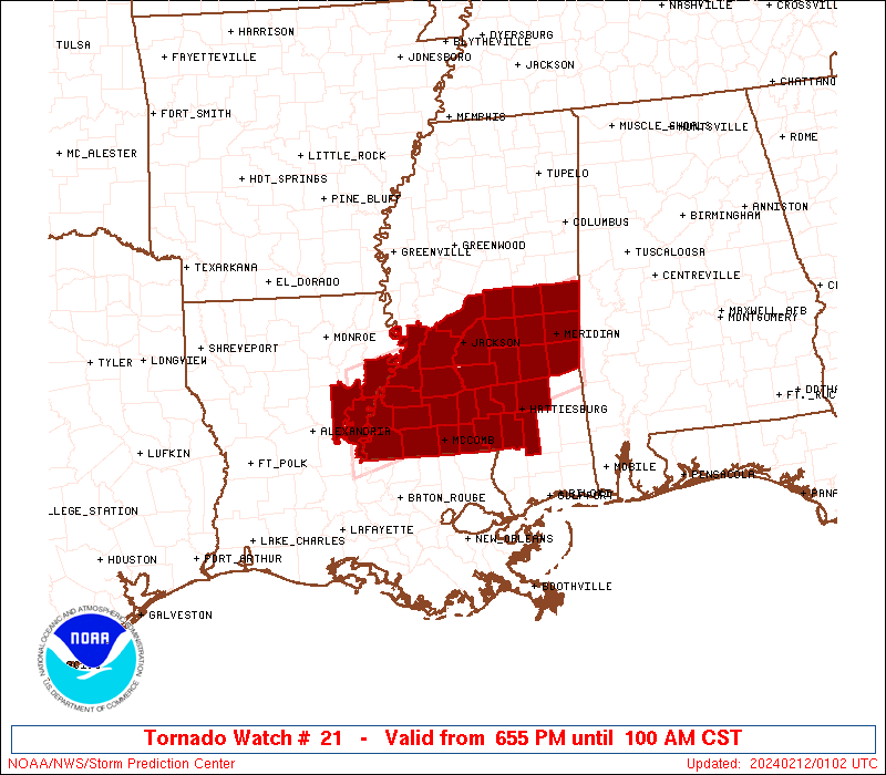
Within 25 miles of any point in that area and we are hatched so I think you add 10% more on that
 
^Thanks StoneMountainWx and Chris. That's quite ominous. Hopefully this won't verify anywhere near that bad. I love getting wintry precip. but have zero interest in being anywhere near a tornado. Stay away!
 
URGENT - IMMEDIATE BROADCAST REQUESTED Tornado Watch Number 21 NWS Storm Prediction Center Norman OK 1245 PM EST Sun Jan 22 2017

The NWS Storm Prediction Center has issued a

* Tornado Watch for portions of Southeast Alabama North Florida Central and Southern Georgia Coastal Waters

* Effective this Sunday afternoon and evening from 1245 PM until 800 PM EST.

...THIS IS A PARTICULARLY DANGEROUS SITUATION.


Sent from my iPhone using Tapatalk
 
Latest from WRAL' s Greg Fishel.

SEVERE WEATHER UPDATE-NO BIG CHANGES IN THINKING

I am very concerned about parts of Georgia, northern Florida, and even parts of South Carolina as a significant Tornado outbreak may very well be just hours away. But for North Carolina, the tornado risk is lower. And the farther north you live, the lesser the risk.The wind fields are very impressive, as is the instability aloft. Thus, thunder and lightning will be very possible if not likely throughout our entire viewing area tonight. But it is going to be very difficult to get rid of this shallow cool air near the surface. And without instability rooted at the surface, tornados are difficult to come by. Straight-line winds and hail are still possible, and that threat is not to be taken lightly. This event will be ongoing throughout much of the overnight period, and Aimee Wilmoth and myself will be monitoring developments closely. The latest update from the Storm prediction center lowered the severe probabilities slightly from their earlier update this morning, stating some of the same reasons I have mentioned in both of my posts-the shallow cool air near the surface. More to come.....
 
Thunderstorms just got under way here. Outside of one line that looks like it could be severe though, I might dodge the worst of it.
 
I wonder why the PDS all the way in Atlanta today ??


Sent from my iPhone using Tapatalk
There is a big football game going on... and it's better to alert people and trim back than to not have it up and kick themselves later.
 
Here is Dr. Forbes's latest TOR-CON. The idea with these maps is where he thinks the highest chances are. It works on a scale of 1-10.

I wish he would label/use better maps but anyway..

16195787_10154271994138201_2680422694425944204_n.jpg
 
Back
Top