Downeastnc
Member
Guess since its officially an invest and there are talks of watches or warnings today we need a thread....
Appreciate, busy day and got family Holden/Oak Island. need infoGuess since its officially an invest and there are talks of watches or warnings today we need a thread....
I just dont think it can get down to the 970's. Just not enough time.Regular NAM is going to end up sub 980 at this rate...cant wait to see how nuts the 3k is going to be
981 is possible. That would be a moderate cat1Regular Nam is looking like 981 landfall or at least the westside of the center landfalling around Cape Fear, this is going to be one of those west side scraps up the coast to Bogue Banks deal and get everyone in on the fun.

Large wind fieldNAM 3k would be a bit windy on the NW side given the strong low to the north...I 95 and I 40 corridors getting TS gust for sure maybe even 50+

Hard to say if it will spawh alot of severe weather but east of the center needs to watch carefullyMy parents and I both live (separately) in Emerald Isle, and my main concern is the tornados from these systems. I was at their house for the hurricane a couple of summers ago and our house was hit by the spout/nado that hit the waterpark and travel trailer park right along the beach which came across the island over the sound. It was a tad tense at that moment when you knew the house was being hit.
My parents and I both live (separately) in Emerald Isle, and my main concern is the tornados from these systems. I was at their house for the hurricane a couple of summers ago and our house was hit by the spout/nado that hit the waterpark and travel trailer park right along the beach which came across the island over the sound. It was a tad tense at that moment when you knew the house was being hit.
That is what I am worried about. Really only 24 hours to prepare and most folks are just thinking it's going to a little windy and rainy, not a potential cat 1 hurricane.they really have no choice given the model data showing a pretty much truly tropical Cat 1 into inland NC in 40ish hrs....most folks not weather nerds like us have no idea its even there.
Tomorrow will be the day to see how well organized it isThat is what I am worried about. Really only 24 hours to prepare and most folks are just thinking it's going to a little windy and rainy, not a potential cat 1 hurricane.
Thats good news so far. Thank youIf the 3k Nam is right then you will be right side of the center so figure you good for gust to near cane strength, the hi res models dont really have a lot of tornado threat in them right now...

I think the trend will be a little stronger thru tomorrow


Yeah it looked the opposite the other day (I got that all wrong lol)Stronger is likely to lean left with this one
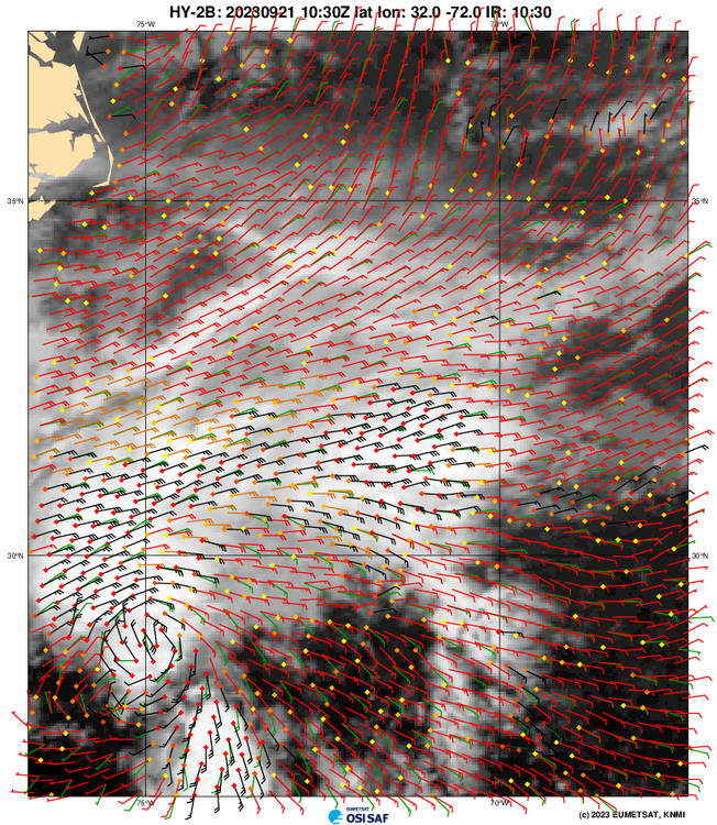
It's messy. As long as have this convection shaped like a 7 to the north, northeast, east of the center the tendency is going to be for the llc to chase the convection or centers to spin up and down with convective bursts. Then you add in new convective bursts closer to the LLC as it tries to get some tropical characteristics and you get a bouncy track like the 3k. If you build the convection near the center and start to stack this it'll likely lean left. If it stays void of convection and sheared it'll lean east. I'd personally go with the nhc forecast but any random convective bursts overnight or tomorrow that can wrap the actual center can quickly change this to a up 40 to 95 track vs the soundsYeah it looked the opposite the other day (I got that all wrong lol)
