• Hello, please take a minute to check out our awesome content, contributed by the wonderful members of our community. We hope you'll add your own thoughts and opinions by making a free account!

Tropical TS Jerry

hmmm...and Jerry right now looks terrible.

Yeah some of the data on some of those drops makes no sense, Jerry having a hell of a time.....seems to have leveled off though at 993 barely a cane but the last couple of fixes seem to indicate the weakening has slowed or stopped at least for now....
 
Convection is more impressive now than it was a few hours ago and it should be moving into a area with less shear so reorganization should be expected.
 
Hint on 5 pm discussion...,

"At longer range, a mid-latitude trough
will likely turn the hurricane northward and northeastward, but how
quickly that occurs is an open question. The guidance spread has
only increased this afternoon, although the model consensus hasn't
changed much, so the NHC forecast will hold the course on this
advisory."
 
The 18z GFS is not working on TT, but on the NCEP site, the 18z gfs is decently NE of the 12z.
 
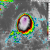
Looks like it’s almost wanting to go through RI just based on its presentation, one hell of a CDO with very cold cloud tops, eye looks like it’s wanting to clear, if it clears with such strong Convection around it, it may really ramp up, but that’s a big if, a unlikely if
 
Navgem 18z hanging on to the Fujiwhara effect in 12z and 06z.....still seeing a block...navgem_mslp_uv850_atl_25.png
 
Last edited:
Really starting to look good now, even have a small eye trying to pop out on the last frames, and the mid level eye structure is back.

Too bad we might not have recon as they had to turn around twice based off what I saw on the other board. It'd be a perfect time for them to be there.
 
Really starting to look good now, even have a small eye trying to pop out on the last frames, and the mid level eye structure is back.

Too bad we might not have recon as they had to turn around twice based off what I saw on the other board. It'd be a perfect time for them to be there.
AF300 IS IN FLIGHT NOW
 
Jerry tricked me, but it’s weird, it’s almost like a MCS in water, but with organization, and a nice outflow boundary ahead of it, weird
 
5 am discussion.....in 12 hours we went from "questions" to "excellent agreement".

Jerry has turned northwestward and the initial motion estimate is
now 310/13 kt. Jerry is forecast to continue moving northwestward
toward a break in the subtropical ridge today through Sunday,
followed by a northward turn on Monday. By Tuesday, a deep-layer
trough is expected to capture Jerry and accelerate the cyclone
northeastward in the general direction of Bermuda. There remains
excellent agreement among the track models on this developing
scenario, and the official track lies close to the tightly packed
consensus models TVCN, NOAA-HCCA, and FSSE.
 
Jerry: The Happy Hour EPS has 3 of 51 members getting left behind and 1 of these 3 later hitting the US (FL) by hour 144.
 
This is mainly for entertainment but look at what the 12Z UKMET does with Jerry: stalls him at hour 60 and then slowly moved him SSW 96-132 and then a turn WSW 132-144! Is this just its left bias playing a trick on us? I will remind folks that a very small number of ensemble members of various models have still been after moving him northward leaving Jerry behind and even then having him turn west fwiw. This is the first major operational doing anything like this that I can recall.


TROPICAL STORM JERRY ANALYSED POSITION : 25.5N 66.6W

ATCF IDENTIFIER : AL102019

LEAD CENTRAL MAXIMUM WIND
VERIFYING TIME TIME POSITION PRESSURE (MB) SPEED (KNOTS)
-------------- ---- -------- ------------- -------------
1200UTC 22.09.2019 0 25.5N 66.6W 1008 39
0000UTC 23.09.2019 12 27.2N 67.7W 1000 44
1200UTC 23.09.2019 24 27.7N 68.5W 997 45
0000UTC 24.09.2019 36 28.7N 68.9W 992 49
1200UTC 24.09.2019 48 29.9N 69.9W 977 54
0000UTC 25.09.2019 60 30.3N 70.0W 983 44
1200UTC 25.09.2019 72 30.5N 70.1W 988 41
0000UTC 26.09.2019 84 30.4N 70.1W 992 35
1200UTC 26.09.2019 96 30.4N 70.6W 993 34
0000UTC 27.09.2019 108 30.2N 70.9W 994 36
1200UTC 27.09.2019 120 28.9N 71.3W 989 49
0000UTC 28.09.2019 132 28.0N 71.0W 988 55
1200UTC 28.09.2019 144 27.8N 71.5W 991 49

**Edit: It looks like both the 12Z CDN ens and 12Z EPS hit S FL with one Jerry member on 9/30. But that's only 1 of each ensemble (2-5%).
 
Last edited:
Crazy 12Z UKMET run with Jerry moving WNW and a very weak Karen moving WSW as Karen rotates around the much stronger Jerry! I consider this purely entertainment as I couldn't see this as a viable option.

ukmet12Zof092219ShowingJerry&Karen.png
 
Jerry is a mess right now, strong westerly shear is exposing the center and it almost looks like a westward movement in the last couple of frames of vis imagery.... crazy. One model run several days ago was showing Jerry being sheared apart and the low level vorticity looping around. Is it just me or are the tropics really quirky right now?
 
Jerry is a mess right now, strong westerly shear is exposing the center and it almost looks like a westward movement in the last couple of frames of vis imagery.... crazy. One model run several days ago was showing Jerry being sheared apart and the low level vorticity looping around. Is it just me or are the tropics really quirky right now?

Yeah ole Jerry got decapitated, LLC is going NNW. the MLC is racing off to the NE, the LLC needs to make the turn NE to help keep it stacked otherwise.....bye bye Jerry.....LLC looks really good though.
 
Jerry is a mess right now, strong westerly shear is exposing the center and it almost looks like a westward movement in the last couple of frames of vis imagery.... crazy. One model run several days ago was showing Jerry being sheared apart and the low level vorticity looping around. Is it just me or are the tropics really quirky right now?

It looks to my eyeballs like Jerry has mainly moved only a hair west since 5AM, when the NHC had him at 27.8N, 67.7W. The 2PM prog by the NHC, which is matched well by the models, is 28.6N, 68.1W. He is going to have to gain a good bit of north component over the next 3 hours to get up to 28.6N or else models like the UKMET and some of the ensemble members leaving him behind as a low level swirl will have to start being looked at a little more.
 
Looks like Jerry is moving about due West at the moment. Interesting.
 
Looks like Jerry is moving about due West at the moment. Interesting.
It was almost completely sheared apart and headed due west, you can see that once the convection started forming around the center again it's slowed. These sheared systems are weird.... Lol
 
Jerry has lagged and continues to lag quite a bit today in gaining latitude. First of all, he had been progged to reach 28.6 N at 2 PM today per the 5 AM NHC advisory, but he only made it to 28.4 N at 5 PM, 3 hours later. Also, the 11 AM had him up to 29.2 as of 8 PM this evening but he's only up to 28.4 N as of 5 PM (only moved 0.3 N over last 6 hours). The implications may be large on the future tracks of not only Jerry, himself, but also Karen. The interaction between systems is one of the most fascinating things about weather!
 
18Z ICON lags Jerry more (consistent with his recent lack of motion) and this later results in a merge between Karen and Jerry!
 
Back
Top