Brent
Member
My only thing is its already at the Lesser Antilles northern latitude(the islands east of Puerto Rico) so clearly there has to be a prolonged southern motion here to change the overall narrative of OTS
The ensembles hint at just that scenarioMy only thing is its already at the Lesser Antilles northern latitude so clearly there has to be a prolonged southern motion here to change the overall narrative of OTS
I agree....such a long time for a forecast to hold. I wonder how many forecast made 10-11 days out actually held. I bet not many. Guess these could always be a first.
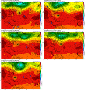
Odd that the stronger the system the more likely to take the western trackView attachment 174134

@lexxnchloe you really want to land falling hurricane don't you?The good news in the short term for the US is that Erin climbed slightly from 17.4N to 17.6N since the previous advisory (275 degree heading) vs a prog to stay at 17.4N or at 270 degrees. Maybe this is a sign that the latitude will be mainly maintained instead of losing much. We’ll see.
@lexxnchloe you really want to land falling hurricane don't you?
I admit I used to think it was cool to have hurricanes when I used to not live on the coast.At least she’s honest even though I think it’s crazy to want a MH hit at home!
0Z Icon is a fair bit SW of the 12Z.
I admit I used to think it was cool to have hurricanes when I used to not live on the coast.
You do realize that i dont have any power over the atmosphere, right? If wanting equaled having i would be living in Martha's vineyard now taking vacays to euope and still hoping for very active cane seasons.@lexxnchloe you really want to land falling hurricane don't you?
Icon ends up pretty far west and extremely strong btw
Something to watch to see if we get more models showing it View attachment 174154
Just waking up and checking but it seems the ensembles have shifted ever so slightly west at 0zStill mostly OTS Bermuda if anything the turn is sharper
Of note it appears the most extreme solution of a high end 4+ on the EPS winds up hitting Florida. How interesting View attachment 174156
The good news in the short term for the US is that Erin climbed slightly from 17.4N to 17.6N since the previous advisory (275 degree heading) vs a prog to stay at 17.4N or at 270 degrees. Maybe this is a sign that the latitude will be mainly maintained instead of losing much. We’ll see.

The satellite images show that Erin is not looking well organized at all this morning. The convection has been separated from the center by the strong trade winds and conditions don't appear conducive for intensification in the near term. The intensity forecasts may have to be adjusted in future updates if this trend continues.
Not to mention the “cooler” SST’s and the dry air it’s dealing with!The satellite images show that Erin is not looking well organized at all this morning. The convection has been separated from the center by the strong trade winds and conditions don't appear conducive for intensification in the near term. The intensity forecasts may have to be adjusted in future updates if this trend continues.
I think those are the two main issues, moreso than shear, though there is some shear. But things will improve later in the week into the weekend. The circulation is well-defined.Not to mention the “cooler” SST’s and the dry air it’s dealing with!
Yeah a very large circulation and well defined center.I think those are the two main issues, moreso than shear, though there is some shear. But things will improve later in the week into the weekend. The circulation is well-defined.
New 11AM. First time that PR is in the cone
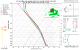
View attachment 174167
I get the model comparisons but 168hrs out? I hope it goes OTS but I’d like to see how fast it actually intensifies.12Z Icon 168 hr 150 miles NNE of that ominous 0Z Icon 180 hr map. Has less ridging and is moving NW to NNW instead of NW to WNW.
