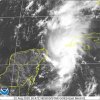
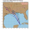
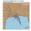
Yes, I won't be surprised to see a similar landfall like Hurricane Michael.Like... Florida panhandle?
Sent from my iPhone using Tapatalk
-
Hello, please take a minute to check out our awesome content, contributed by the wonderful members of our community. We hope you'll add your own thoughts and opinions by making a free account!
You are using an out of date browser. It may not display this or other websites correctly.
You should upgrade or use an alternative browser.
You should upgrade or use an alternative browser.
Tropical Tropical Storm Marco
- Thread starter ForsythSnow
- Start date
Brent
Member
What are the limiting factors in Marco becoming a major? Climatology and water temps are on his side. Is he going to run out of time? Dry air? Shear? Something else?
Shear
But the models have been terrible on intensity...
BHS1975
Member
Shear
But the models have been terrible on intensity...
If he take on more of a NNE track then shear will be less.
Sent from my iPhone using Tapatalk
I made a graphic that illustrates what should happen to the storms. It is worth mentioning that since Marco is a bit stronger than anticipated, it could fight off that shear a little more, but the change in impacts will be trivial.What are the limiting factors in Marco becoming a major? Climatology and water temps are on his side. Is he going to run out of time? Dry air? Shear? Something else?

Brent
Member
I will say the small size makes it suspectible for any negative though, if the shear really hits it could fall apart just as fast
But again, a lot of possibilities
But again, a lot of possibilities
accu35
Member

I think this HWRF run will be interesting. Last run had the pressure at 1009mb but starts now at 994mb wondering how it will track.
Brent
Member
Brent
Member
NoSnowATL
Member
Come to papa
lexxnchloe
Member
Not that i know anything but i have a hard time with both of them in almost the same spot. I bet tomorrow models will be taking whatever laura is much further east.
Hurricane and Tropical Storm watches has been issued for the Gulf Coast.ZCZC MIATCPAT4 ALL
TTAA00 KNHC DDHHMM
BULLETIN
Tropical Storm Marco Advisory Number 10
NWS National Hurricane Center Miami FL AL142020
400 PM CDT Sat Aug 22 2020
...BIG CHANGES TO THIS AFTERNOON'S FORECAST FOR MARCO...
...STORM SURGE AND HURRICANE WATCHES ISSUED FOR THE NORTHERN GULF
COAST...
SUMMARY OF 400 PM CDT...2100 UTC...INFORMATION
----------------------------------------------
LOCATION...21.9N 85.7W
ABOUT 50 MI...80 KM W OF THE WESTERN TIP OF CUBA
ABOUT 540 MI...870 KM SSE OF THE MOUTH OF THE MISSISSIPPI RIVER
MAXIMUM SUSTAINED WINDS...65 MPH...100 KM/H
PRESENT MOVEMENT...NNW OR 340 DEGREES AT 13 MPH...20 KM/H
MINIMUM CENTRAL PRESSURE...992 MB...29.30 INCHES
WATCHES AND WARNINGS
--------------------
CHANGES WITH THIS ADVISORY:
A Storm Surge Watch has been issued from Sabine Pass eastward to
the Alabama/Florida border, including Lake Pontchartrain, Lake
Maurepas, Lake Borgne, and Mobile Bay.
A Hurricane Watch has been issued from Intracoastal City Louisiana
eastward to the Mississippi/Alabama border, including Lake
Pontchartrain, Lake Maurepas, and Metropolitan New Orleans.
A Tropical Storm Watch has been issued from the Mississippi/Alabama
border eastward to the Alabama/Florida border.
The government of Mexico has discontinued the Tropical Storm Warning
for the northeastern Yucatan coast.
SUMMARY OF WATCHES AND WARNINGS IN EFFECT:
A Storm Surge Watch is in effect for...
* Sabine Pass to the Alabama/Florida border
* Lake Pontchartrain, Lake Maurepas, Lake Borgne, and Mobile Bay
A Hurricane Watch is in effect for...
* Intracoastal City Louisiana to the Mississippi/Alabama border
* Lake Pontchartrain, Lake Maurepas, and Metropolitan New Orleans
A Tropical Storm Warning is in effect for...
* Province of Pinar del Rio Cuba
A Tropical Storm Watch is in effect for...
* Mississippi/Alabama border to the Alabama/Florida border
A Storm Surge Watch means there is a possibility of life-
threatening inundation, from rising water moving inland from the
coastline, in the indicated locations during the next 48 hours.
For a depiction of areas at risk, please see the National Weather
Service Storm Surge Watch/Warning Graphic, available at
hurricanes.gov.
A Hurricane Watch means that hurricane conditions are possible
within the watch area. A watch is typically issued 48 hours
before the anticipated first occurrence of tropical-storm-force
winds, conditions that make outside preparations difficult or
dangerous.
A Tropical Storm Watch means that tropical storm conditions are
possible within the watch area, generally within 48 hours.
For storm information specific to your area, please monitor
products issued by your national meteorological service.
Based on the current cone of uncertainty, I might get rain from Marco!
Brent
Member
A quick glance at the Euro makes me think there is a fine line between a sheared storm and a highly ventilated one at landfall.
Dawgdaze22
Member
Anyone else think Marco is moving more NNE?
Sent from my iPhone using Tapatalk
Sent from my iPhone using Tapatalk
Big ol convective burst NE of the center ( at least I think that’s NE of the center lol)
That doesn’t surprise me, as Levi mentioned, the stronger the storm gets, the more it is steered by the LLC to the NNE.However if it’s weaker, you may see more steering from the MLC to the NW.Anyone else think Marco is moving more NNE?
Sent from my iPhone using Tapatalk
B
Brick Tamland
Guest
Thats gotta be one of the most drastic shifts I've ever seen at day 2 View attachment 46981
And then two days later Laura comes in almost the same spot. LA might be under water, especially New Orleans.

Dewpoint Dan
Member
Thats pretty incredible weakening going from a hurricane to depression in 24 hours. Isn't that pretty flat land in MS and LA?And then two days later Laura comes in almost the same spot. LA might be under water, especially New Orleans.
View attachment 46989
Brent
Member
Brent
Member
BULLETIN
Tropical Storm Marco Advisory Number 11
NWS National Hurricane Center Miami FL AL142020
1000 PM CDT Sat Aug 22 2020
...MARCO MOVING NORTH-NORTHWESTWARD ACROSS THE SOUTHERN GULF OF
MEXICO...
...STORM SURGE AND HURRICANE WATCHES IN EFFECT FOR PORTIONS OF
THE NORTHERN GULF COAST...
SUMMARY OF 1000 PM CDT...0300 UTC...INFORMATION
-----------------------------------------------
LOCATION...22.8N 86.3W
ABOUT 110 MI...175 KM NW OF THE WESTERN TIP OF CUBA
ABOUT 470 MI...755 KM SSE OF THE MOUTH OF THE MISSISSIPPI RIVER
MAXIMUM SUSTAINED WINDS...65 MPH...100 KM/H
PRESENT MOVEMENT...NNW OR 335 DEGREES AT 13 MPH...20 KM/H
MINIMUM CENTRAL PRESSURE...994 MB...29.36 INCHES
accu35
Member
Marco at 70 now?
accu35
Member
Marco is trying, but a sloppy 70 mph storm.
Hurricane Marco?
URNT15 KNHC 231521
AF301 0814A MARCO HDOB 39 20200823
151200 2445N 08735W 8426 01518 0016 +205 +116 349037 040 043 002 03
151230 2445N 08734W 8429 01504 9998 +219 +108 343039 040 047 003 00
151300 2446N 08732W 8431 01494 9981 +226 +108 343045 047 050 004 00
151330 2446N 08730W 8430 01481 9979 +207 +133 341050 053 038 009 00
151400 2446N 08728W 8407 01494 9976 +183 +144 333043 047 046 018 00
151430 2447N 08726W 8462 01427 9961 +196 +141 316044 048 056 032 03
151500 2448N 08725W 8430 01465 9971 +193 +159 328041 054 064 038 00
151530 2449N 08724W 8536 01352 9978 +177 +177 316049 056 058 042 03
151600 2450N 08722W 8534 01344 9945 +196 +187 099003 049 059 038 00
151630 2452N 08721W 8415 01467 9928 +228 +173 083013 019 051 004 03
151700 2453N 08720W 8429 01457 9944 +199 +194 120026 037 058 002 00
151730 2454N 08719W 8417 01478 9967 +189 //// 139048 053 063 003 05
151800 2455N 08718W 8443 01466 9977 +193 +193 145054 055 061 004 03
151830 2455N 08716W 8422 01488 9979 +190 //// 148056 057 063 002 01
151900 2454N 08716W 8429 01478 //// +189 //// 148063 065 063 002 01
151930 2453N 08715W 8423 01484 9977 +189 //// 151064 067 064 004 01
152000 2453N 08714W 8433 01470 9975 +188 //// 156066 069 064 003 01
152030 2452N 08713W 8439 01466 //// +186 //// 161065 070 068 001 01
152100 2451N 08712W 8421 01484 //// +186 //// 166066 067 069 001 01
152130 2450N 08711W 8442 01467 //// +185 //// 172068 070 070 000 05
$$
;
It's not impossible that Marco never makes landfall. If it gets sheared and decoupled later today into tomorrow the mlc and moisture may be pulled into the SE but the LLC may begin to bend W just south of La then start to orbit W then S around Laura
accu35
Member
Marco could do a last minute surprise today
ForsythSnow
Moderator
Everyone's talking about the shear but all I see is a soon to be hurricane about to intensify. Sat looks really good.
GeorgiaGirl
Member
Everyone's talking about the shear but all I see is a soon to be hurricane about to intensify. Sat looks really good.
Yep, this should get upgraded to a hurricane very soon and at least for now it has room to run. We'll see what happens later on though...
Hurricane Marco
We have Hurricane Marco
000
WTNT64 KNHC 231629
TCUAT4
Hurricane Marco Tropical Cyclone Update
NWS National Hurricane Center Miami FL AL142020
1130 AM CDT Sun Aug 23 2020
...MARCO BECOMES A HURRICANE...
...LIFE-THREATENING STORM SURGE AND HURRICANE-FORCE WINDS EXPECTED
ALONG PORTIONS OF THE U.S. GULF COAST...
Data from an Air Force Reserve Hurricane Hunter aircraft indicate
that Marco has strengthened into a hurricane with maximum winds of
75 mph (120 km/h) with higher gusts.
SUMMARY OF 1130 AM CDT...1630 UTC...INFORMATION
----------------------------------------------
LOCATION...25.0N 87.4W
ABOUT 300 MI...480 KM SSE OF THE MOUTH OF THE MISSISSIPPI RIVER
ABOUT 460 MI...740 KM SE OF LAFAYETTE LOUISIANA
MAXIMUM SUSTAINED WINDS...75 MPH...120 KM/H
PRESENT MOVEMENT...NNW OR 340 DEGREES AT 14 MPH...22 KM/H
MINIMUM CENTRAL PRESSURE...992 MB...29.29 INCHES
$$
Forecaster Latto


