• Hello, please take a minute to check out our awesome content, contributed by the wonderful members of our community. We hope you'll add your own thoughts and opinions by making a free account!

Tropical Tropical Storm Cristobal

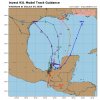
ICON now consistently showing stronger solutions. This is in line with what many of the EPS members are showing.
150D672B-CAB0-434A-AD8F-3B8A0A017542.gif
 
I wouldn't be surprised to see a little Shift East for the short term. Pretty healthy area of convection moving north toward the water (a little east of what most have been showing when pushing into the water). We shall see.
 
Pretty remarkable agreement with cmc, euro and gfs ops all into Texas. I know there is some spread in members but still overall good agreement. Looks like a up and over pattern..hot over Carolinas as leftover system goes into the plains.
 
With that said, I would lean toward the euro since it was first and consistent on cross-over. GFS was consistently garbage bringing a monster out of the Caribbean.
 
Recon is going to investigate tommorow.
871
NOUS42 KNHC 011644
REPRPD
WEATHER RECONNAISSANCE FLIGHTS
CARCAH, NATIONAL HURRICANE CENTER, MIAMI, FL.
1245 PM EDT MON 01 JUNE 2020
SUBJECT: TROPICAL CYCLONE PLAN OF THE DAY (TCPOD)
VALID 02/1100Z TO 03/1100Z JUNE 2020
TCPOD NUMBER.....20-006

I. ATLANTIC REQUIREMENTS
1. SUSPECT AREA (BAY OF CAMPECHE)
FLIGHT ONE - TEAL 71 FLIGHT TWO - TEAL 72
A. 02/1430Z A. 02/2330Z
B. AFXXX 01BBA INVEST B. AFXXX 0203A CYCLONE
C. 02/1200Z C. 02/2045Z
D. 20.0N 92.5W D. 19.5N 93.5W
E. 02/1400Z TO 02/1830Z E. 02/2300Z TO 03/0230Z
F. SFC TO 10,000 FT F. SFC TO 10,000 FT

FLIGHT THREE - TEAL 73
A. 03/1130Z
B. AFXXX 0303A CYCLONE
C. 03/0845Z
D. 19.0N 93.8W
E. 03/1100Z TO 03/1430Z
F. SFC TO 10,000 FT

2. OUTLOOK FOR SUCCEEDING DAY: CONTINUE 12-HRLY FIXES IF SYSTEM
DEVELOPS AND REMAINS A THREAT.
 
Keep in mind that you don't have to have a hot and steamy gulf water to create a strong storm, as long as the wind shear is low and no dry air to hinder the storm.
 
I smell a PTC coming

Satellite imagery and radar observations from Mexico show that
the area of disturbed weather centered near the west coast of the
Yucatan peninsula is gradually becoming better organized. The
disturbance will move west-northwestward over the Bay of Campeche
later this afternoon where environmental conditions are expected
to be conducive to support development, and a tropical depression
or storm is likely to form tonight or Tuesday.
The system is then
forecast to drift westward or west-southwestward over the southern
Bay of Campeche through the middle of the week. Interests
along the coast of the Bay of Campeche should monitor the progress
of this disturbance as tropical storm watches or warnings could be
required for a portion of this area later today or tonight.
Regardless of tropical cyclone formation, heavy rainfall is likely
to continue over portions of southern Mexico, Guatemala, El
Salvador, Belize, and western Honduras during the next few days.
For additional information on the rainfall threat, see products
from your national meteorological service.
* Formation chance through 48 hours...high...90 percent.
* Formation chance through 5 days...high...90 percent.
 
Good banding has been building all around the system all day so far. It looks like some kind of center is beginning to emerge into the BOC as well. Also seeing some more convection trying to fire up near the center. I really wouldn't be surprised if we get an advisory at 5 pm EDT.
 
Good banding has been building all around the system all day so far. It looks like some kind of center is beginning to emerge into the BOC as well. Also seeing some more convection trying to fire up near the center. I really wouldn't be surprised if we get an advisory at 5 pm EDT.
Yep looking at recent sat updates makes me think we’re about to see a pretty sizable flare up on the NE side cold towers starting to pop.
D0488E45-030A-4B8B-987F-AEAED4632400.jpeg
B8D2A8CA-5EC0-4050-9AAD-F128276B2E5D.jpeg
 
I feel like it should have kept the name Amanda. Sure would have helped with public communications given this will be a short notice hurricane in the making. It had some if not the majority of formation from Amanda. I realize storms die inland but I don't think this one did enough to lose the name Amanda. There is very few inland obs down there to begin with. Should have kept it post tropical Amanda then reforms Amanda.
 
I feel like it should have kept the name Amanda. Sure would have helped with public communications given this will be a short notice hurricane in the making. It had some if not the majority of formation from Amanda. I realize storms die inland but I don't think this one did enough to lose the name Amanda. There is very few inland obs down there to begin with. Should have kept it post tropical Amanda then reforms Amanda.
This is actually standard NHC procedure though. I believe there was another hurricane that crossed from the Pacific to the Atlantic and had to get a name change. But yeah, kinda weird
 
This is actually standard NHC procedure though. I believe there was another hurricane that crossed from the Pacific to the Atlantic and had to get a name change. But yeah, kinda weird

Only if the center survives does it keep the name

Very very hard to do across the mountains

On another note that was fast lol

Interesting
The NHC forecast favors the latter, but it is certainly possible that this tropical cyclone will move inland and dissipates and a new cyclone formation occurs
later this week. The latter portion of both the track and intensity forecast are of quite low confidence.
 
Back
Top