accu35
Member
Nam 3k had something like this to.Hrrr gets a tropical MCSish type rain band going tommorow, could see some damaging gusts from that View attachment 21072
Nam 3k had something like this to.Hrrr gets a tropical MCSish type rain band going tommorow, could see some damaging gusts from that View attachment 21072

Yep. It's a mercy Barry was up against all that shear and dry air so far. We might have had a major cane on our hands, which would have literally been a worst case scenario.Another day over water and this thing would have been a major probably the strengthening today in spite of the unfavorable conditions
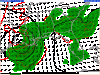
View attachment 21077
SUMMARY OF 1000 PM CDT...0300 UTC...INFORMATION
-----------------------------------------------
LOCATION...28.6N 91.0W
ABOUT 75 MI...125 KM S OF MORGAN CITY LOUISIANA
ABOUT 120 MI...195 KM WSW OF THE MOUTH OF THE MISSISSIPPI RIVER
MAXIMUM SUSTAINED WINDS...65 MPH...100 KM/H
PRESENT MOVEMENT...WNW OR 300 DEGREES AT 3 MPH...6 KM/H
MINIMUM CENTRAL PRESSURE...993 MB...29.33 INCHES
I've not paid any attention since this morning... what's the chatter about "could have been a major with more time?" Is it just its current structure?
.gif")
 not sure how that happened but poor timing
SOMEHOW THE RECON MISSION WAITING UNTIL DAYBREAK HAS ME PUZZLEDReally starting to look good now recon somehow isnt due til daybreak
SOMEHOW THE RECON MISSION WAITING UNTIL DAYBREAK HAS ME PUZZLED
.gif")

Yeah, it's kind of surreal down here with Barry. Not much rain last night. In an otherwise healthy storm, the rains should have begun yesterday afternoon with solid banding etc. At least we'll get less time with tropical storm conditions with Barry.I don’t remember seeing a storm classified as a hurricane that has zero convection around any side of the immediate c of c. Pretty amazing actually.
I don’t remember seeing a storm classified as a hurricane that has zero convection around any side of the immediate c of c. Pretty amazing actually.
Yeah, that’s about right normally. It’s radar presentation currently looks like an organizing depression or minimal tropical storm.Yeah, it's kind of surreal down here with Barry. Not much rain last night. In an otherwise healthy storm, the rains should have begun yesterday afternoon with solid banding etc. At least we'll get less time with tropical storm conditions with Barry.

Well, they did have some verified wind reports on the LA coast to verify the decision, but I do see a little bias on their part to check off the first hurricane for 2019, maybe.Not seeing anything that screams cat 1. Kinda feels like NHC just wanted the 1st out of the way.
Sent from my iPhone using Tapatalk
Well, they did have some verified wind reports on the LA coast to verify the decision, but I do see a little bias on their part to check off the first hurricane for 2019, maybe.
According to TWC center still 40 to 50 miles off shore lol.I've never seen a hurricane landfall with no rain lol
View attachment 21088
According to TWC center still 40 to 50 miles off shore lol.
That’s what bathwater temps gets you.
Sent from my iPhone using Tapatalk
I don’t remember seeing a storm classified as a hurricane that has zero convection around any side of the immediate c of c. Pretty amazing actually.
I'm in the training bandAnybody here from west Alabama to report on the outer banding setting up from Barry this morning?
Agree! Almost a “ pity “ naming! It’s radar and satellite presentation , doesn’t scream HurricaneNot seeing anything that screams cat 1. Kinda feels like NHC just wanted the 1st out of the way.
Sent from my iPhone using Tapatalk