NoSnowATL
Member
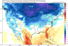
What do you think is going to differentiate last years -EPO/+TNH torch fest versus 14/15 colder option? We hoping for some form of Npac low and scandi. ridge
View attachment 28375
View attachment 28374
Question, last year would have been cold if we didn’t lose to the SER correct? And looks like we will be rolling the dice again? Trying to make sure I’m reading you and Webb right.
Sent from my iPhone using Tapatalk


.png")


")