Let'er rip
Got a quick rain shower out of itBust

Referring to the severe that was forecasted yesterday that didn’t result in anything, and SD already calling it a bust based on that performance. In other words, I’ll get a brief shower out of itIt hasn't happened yet
We had a pretty decent afternoon storm yesterday.Referring to the severe that was forecasted yesterday that didn’t result in anything, and SD already calling it a bust based on that performance. In other words, I’ll get a brief shower out of it
Any rain is good rain to me!!!We had a pretty decent afternoon storm yesterday.
Brick?Bust
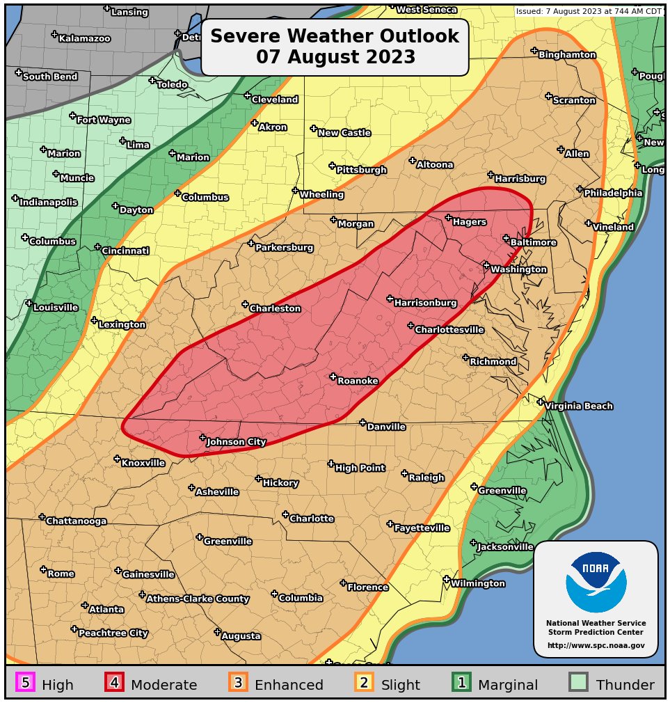
Considering SPC keeps upping their threat level at go time, I think this will pan out! Always leery of what the mountains can do to a good line of storms, but sometimes they re-fire over the piedmont! Somebody gets ping pong sized hail in NC today!Any predictions from anyone? Looks to heat up here quite a bit before the main action starts this evening. Straight line winds look to be bad this evening. Rain and storms as usual will be local driven!
To be fair, I'm sure @SD response of bust was based on a little more than yesterday's performance. Most guidance yesterday favored the western areas and storms diminishing as they moved east. Now he as well as yourself (others in and around C NC) have had numerous "under performers" over the last several weeks that's for sure. Also modeling is still all over the place in this area for today. None really show a solid line moving through, so kinda hit and miss for sureReferring to the severe that was forecasted yesterday that didn’t result in anything, and SD already calling it a bust based on that performance. In other words, I’ll get a brief shower out of it
It'll be easy here for storms to be tied to better forcing N of our area and richer moisture just to our south with a skip in the middle. Doesn't mean that's what happens and obviously SPC and the local NWS offices are bullish on storm formation today. I have my personal concerns with the aerial coverage of the setup but the severe parameters that are in place are impressive and very much so for August that part can't be ignored with anything that formsTo be fair, I'm sure @SD response of bust was based on a little more than yesterday's performance. Most guidance yesterday favored the western areas and storms diminishing as they moved east. Now he as well as yourself (others in and around C NC) have had numerous "under performers" over the last several weeks that's for sure. Also modeling is still all over the place in this area for today. None really show a solid line moving through, so kinda hit and miss for sure