• Hello, please take a minute to check out our awesome content, contributed by the wonderful members of our community. We hope you'll add your own thoughts and opinions by making a free account!

Severe weather potential May 2 - 4

Z

Zander98al

Guest
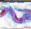
Severe weather season in the south. Looks like may be potential for some bad weather in this time frame not sure on just how severe. But it looks like the southeast will be in the southeast quadrant of a negatively tilted zone lol.
 
Btw mods or whoever can edit. Change the time period if it seems fit. I just put the time frame of when the surface low ejects over the southeast. Doesn't look like a bowling ball on the 500mb heights but more like a kiddy bowling ball. So I imagine somebody is going to get some severe weather.
 
While not there yet, this is about as classic as you get for a big outbreak across the SE on the Euro. Primer system on Monday with the second and likely larger threat on Tuesday. Low amp wave with surface low moving from MO into KY.
Lol I thought this event didn't look like much.
 
While not there yet, this is about as classic as you get for a big outbreak across the SE on the Euro. Primer system on Monday with the second and likely larger threat on Tuesday. Low amp wave with surface low moving from MO into KY.
Agree 100 percent ... winds per now looked backed also... euro is a legit outbreak parts western Tennessee north central ms into much Alabama also
 
Thing to note for the southeast as well. We're starting to transition into the early summertime pattern. Looking at CAPE probabilities for the south the entire state of alabama is forecast to have a 100% chance of 1000+ CAPE during this time frame. What's the real make or break is the wind shear. And how deep this low will get when it ejects to our northwest. Say we get a sub 1000 mb closed low near memphis or even missouri. Wind shear would be very sufficient. Not many severe events in may for alabama that I can recall. And usually not many events this late in the spring were the low tracks this far southeast. Always thought april was prime for us and then may was prime for the plains. Just a little nugget from my noodle. I'd like to hear anybody's weather noodle knowledge.
 
Thing to note for the southeast as well. We're starting to transition into the early summertime pattern. Looking at CAPE probabilities for the south the entire state of alabama is forecast to have a 100% chance of 1000+ CAPE during this time frame. What's the real make or break is the wind shear. And how deep this low will get when it ejects to our northwest. Say we get a sub 1000 mb closed low near memphis or even missouri. Wind shear would be very sufficient. Not many severe events in may for alabama that I can recall. And usually not many events this late in the spring were the low tracks this far southeast. Always thought april was prime for us and then may was prime for the plains. Just a little nugget from my noodle. I'd like to hear anybody's weather noodle knowledge.
What u say makes a lot sense ... but this year seems little different . Euro per that run only ,would be nasty for a lot Dixie area
 
What u say makes a lot sense ... but this year seems little different . Euro per that run only ,would be nasty for a lot Dixie area
Definitely. This year's been a boomer in terms of producing which is odd a surface low being in prime position in may for alabama.
 
Thing to note for the southeast as well. We're starting to transition into the early summertime pattern. Looking at CAPE probabilities for the south the entire state of alabama is forecast to have a 100% chance of 1000+ CAPE during this time frame. What's the real make or break is the wind shear. And how deep this low will get when it ejects to our northwest. Say we get a sub 1000 mb closed low near memphis or even missouri. Wind shear would be very sufficient. Not many severe events in may for alabama that I can recall. And usually not many events this late in the spring were the low tracks this far southeast. Always thought april was prime for us and then may was prime for the plains. Just a little nugget from my noodle. I'd like to hear anybody's weather noodle knowledge.

Wind shear is definitely key. Right now my biggest question is 850mb and does it align with the best shear at 500mb. Right now on the Euro, the LLJ is around 35knts which is on the lower side of events. However if I remember right 4/8/98 had a LLJ of around 40knts so it’s in the same ballpark. Higher instability drops the number of helicity needed for storm tornadoes.
 
Wind shear is definitely key. Right now my biggest question is 850mb and does it align with the best shear at 500mb. Right now on the Euro, the LLJ is around 35knts which is on the lower side of events. However if I remember right 4/8/98 had a LLJ of around 40knts so it’s in the same ballpark. Higher instability drops the number of helicity needed for storm tornadoes.
That's what the trade off will probably be. High cape a little lower shear. Unless that low decides to bomb out. Which either way I think shear will be a little underdone. It seems to always be until the mesoscale models come in. Wouldn't be surprised to see a 4000+ cape possibly ins some areas around that time frame of severe weather.Screenshot_20210429-100806.png
 

Attachments

  • Screenshot_20210429-100813.png
    Screenshot_20210429-100813.png
    1 MB · Views: 8
Back
Top