• Hello, please take a minute to check out our awesome content, contributed by the wonderful members of our community. We hope you'll add your own thoughts and opinions by making a free account!

Severe weather 2020

Track seems be Dixie alley again... hard believe here midsouth we keep missing the big ones... Memphis area I’m referring to... usually mid April to mid May is our best peak time catch something on the high end.
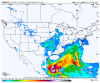
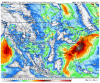
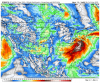
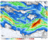
So you're thinking the potential next week will again be further South and away from the Memphis (Midsouth) area?
 
Hard to say right now, but the plains into the southeast (Dixie alley) would be favored rn, as we head further into spring things should start shifting into the plains

Could see a pretty busy next 14 days. We always have the chance of seeing the threats dropped like this weekends event was. Quite frankly we saw enough already and we dont need to see anymore. With the 12 confirmed NC tornados and the outbreak earlier in the year we are already pushing strong numbers.
 
Wouldn’t take much to trend into something much bigger.


500h_mslp.conus.png
 
Wouldn’t take much to trend into something much bigger.


500h_mslp.conus.png

Models keep this low too flat west to east. If the went from GSP to Richmond then that would have been worse for the carolinas piedmont and coastal zones but as of now the models are in good agreement so this is a deep south threat. The gfs has 989mb 30 miles south of me.
 
So Webber thinks surface low will trend north west so big time severe for western NC again and everyone? All lows have corrected north as time got closer since December
 
So Webber thinks surface low will trend north west so big time severe for western NC again and everyone? All lows have corrected north as time got closer since December
Well given that the gfs is once again building heights more and more each run ahead of the system, it’s quite possible
 
Hey, at least we have a one day break between the severe threats next week.
 
I just hope that the next ones aren't going to be early in the morning/late at night if they're going to be tornado threats. Those were some legitimately frightening moments for me around 4:45-5:00 AM earlier this week where that storm with a hook signature was closing in and I wasn't for sure on how close it was (as it turned out it was definitely too close for comfort).

Think the one that might be on Sunday might thankfully turn out to be south/southwest of the area though.
 
Geez.... this looks so similar to the one we had on Sunday
 

Attachments

  • 33A1C964-36A9-46D0-95D2-15951EABFCAB.png
    33A1C964-36A9-46D0-95D2-15951EABFCAB.png
    130.6 KB · Views: 66
  • 68B25B38-1449-4509-B9E0-7CEB3253B4AD.png
    68B25B38-1449-4509-B9E0-7CEB3253B4AD.png
    272.9 KB · Views: 64
  • DBEBF50A-6C45-4A5A-A7E5-378B46804E88.png
    DBEBF50A-6C45-4A5A-A7E5-378B46804E88.png
    277.7 KB · Views: 63
  • 35502C55-7C91-4755-8548-01C8C04B1F9E.png
    35502C55-7C91-4755-8548-01C8C04B1F9E.png
    214.7 KB · Views: 59
On top of severe weather you got quite a bit of rain falling with each of these systems over areas that are already having some of their rainiest starts to a year so far. My area for example is at just under 31 inches of rain so far this year.

Of course the 00z Euro is just ugly rain wise. 10 inches of rain near Birmingham over the next 10 days and some pretty hefty totals elsewhere.7021462D-FD63-421F-9006-DEE8BCF8FF9F.gif
 
If there’s any better news, it’s that This stuff will likely start shifting towards the plains, it’s possibly why the GFS/GEFS show that ridge around day 12-16, GWO looks to swing towards phase 8/1 around the beginning of May F56666DD-0ED1-4E0C-88D0-EE3C8A6A4F78.pngphase 8/1 are typically supportive of a -PNA/west coast trough and correlate to increased heights East of the Rockies, it’s probably why the GFS/GEFS showed ridging to towards the end of there runs, and the GWO switch happened last May as well, if this switch does indeed happen, it’s time to open up the pools CA68E28B-CB9C-4824-8253-07225A8191D4.jpeg
as you can see around day 16 on the gefs as the GWO begins to head towards phases supportive of ridging, ridging appears East of the Rockies 89CB2ADA-D4F8-4692-8414-0DA60B0F62FA.png
 
With back-to-back storms systems the 2nd half of next week, I almost wonder if there's the possibility they could just merge into one large, multi-day storm event. :(
 
At least 3 more threats of severe weather on the horizon thru the next 10 days in the southern US. I'll have to admit, even though it's over 7 days out, the last one is generally the most concerning to me & would have the most potential to challenge the Easter weekend outbreak especially from a large-scale forcing standpoint. If you see a deep cut-off upper trough over the Ohio & Tennessee Valleys like this in late April... whoever is southeast of that (most of this forum), you're in big trouble.

ecmwf_z500a_us_10.png


gfs_z500a_us_37.png
 
Back
Top