-
Hello, please take a minute to check out our awesome content, contributed by the wonderful members of our community. We hope you'll add your own thoughts and opinions by making a free account!
You are using an out of date browser. It may not display this or other websites correctly.
You should upgrade or use an alternative browser.
You should upgrade or use an alternative browser.
Pattern Outside of the SE thread
- Thread starter SD
- Start date
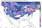
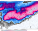
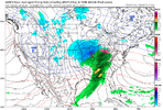
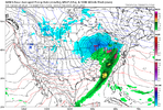
Workable! Nice not having to worry about rain in mid/late January! View attachment 130667View attachment 130668
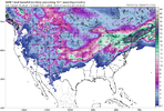
Drizzle Snizzle
Member
Snow for every state except Louisiana, Florida, and South Carolina !
NoSnowATL
Member
WOWSnow for every state except Louisiana, Florida, and South Carolina !
WOOHOO! I'm gonna get some good snow finally!!!!!
**********************************************************************
URGENT - WINTER WEATHER MESSAGE
National Weather Service Caribou ME
345 PM EST Thu Jan 19 2023
MEZ029-030-200445-
/O.UPG.KCAR.WS.A.0003.230120T0600Z-230121T0000Z/
/O.NEW.KCAR.WS.W.0003.230120T0600Z-230120T2200Z/
Coastal Hancock-Coastal Washington-
Including the cities of Bucksport, Castine, Perry, Cherryfield,
Eastport, Ellsworth, Orland, Bar Harbor, and Machias
345 PM EST Thu Jan 19 2023
...WINTER STORM WARNING IN EFFECT FROM 1 AM TO 5 PM EST FRIDAY...
* WHAT...Heavy snow expected. Total snow accumulations between 5 and
10 inches. Winds gusting as high as 35 mph.
* WHERE...Coastal Hancock and Coastal Washington Counties.
* WHEN...From 1 AM to 5 PM EST Friday.
* IMPACTS...Plan on slippery road conditions. The hazardous
conditions could impact the Friday morning and evening commutes.
Gusty winds could bring down tree branches. Patchy blowing snow is
expected, reducing visibilities.
PRECAUTIONARY/PREPAREDNESS ACTIONS...
A Winter Storm Warning for snow means severe winter weather
conditions will make travel extremely dangerous. If you must travel,
keep an extra flashlight, food, and water in your vehicle in case of
an emergency.
The latest road conditions for Maine can be obtained by going to
newengland511.org.
***************************************************************
YAY!!!!!!!! Fingers crossed school gets cancelled tonight so we can all play in it tomorrow!!!!
BufordWX
Member
Brent
Member
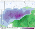
Ok Canada…View attachment 130696
I'm getting very intrigued with this potential because this is gonna be a heavy wet snow... Which I really haven't seen in awhile. It's been dry powder in the previous storms and even February 2021
Last edited:
Take pictures. ?WOOHOO! I'm gonna get some good snow finally!!!!!
BufordWX
Member
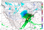
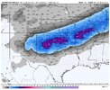
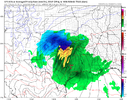
? 12z goofy was epic06z EPS looking good for next week!View attachment 130712
BufordWX
Member
Drizzle Snizzle
Member
Fire up the storm thread for next week. Or is this the storm thread ?
So hard to nail down the southern extent of the cold push and where that boundary line will setup in the plains. Whoever is on the northern side is going to get nuked thoughFire up the storm thread for next week. Or is this the storm thread ?
NoSnowATL
Member
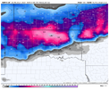
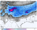
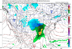
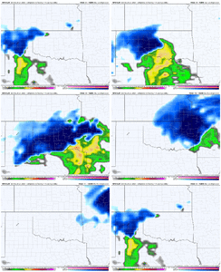
You suck12z GFS just dropped the sledgehammer! Can’t unsee this run.View attachment 130716View attachment 130715
olhausen
Member
snows around 31 degrees are some of my favorite. It looks like someone took a giant whip cream can and unloaded it on the city!I'm getting very intrigued with this potential because this is gonna be a heavy wet snow... Which I really haven't seen in awhile. It's been dry powder in the previous storms and even February 2021View attachment 130698
Brent
Member
12z GFS just dropped the sledgehammer! Can’t unsee this run.View attachment 130716View attachment 130715
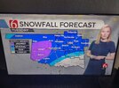
Not sure I believe it but yeah I can't unsee it now. Then again the news has been unusually talking about it already so they've probably seen big potential
BufordWX
Member
Drizzle Snizzle
Member
Sucks for Brent. Looks like he’s in between the 2 jackpot zones.12z EPS is the best looking run so far.View attachment 130754
Brent
Member
Brent
Member
Drizzle Snizzle
Member
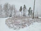
Dang. I thought you would get more than that. 5" is still a good storm though.I ended up with right at 5 inches of snow!View attachment 130761Which is not really noticeable here but I thought the pic was pretty! This is a 3 min walk from my back porch!
Drizzle Snizzle
Member
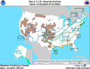
This looks so confusing in parts of the southeast.
BufordWX
Member
Brent
Member
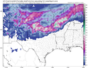
Can’t really get a much better track and evolution of this system then what the GFS shows. I am sure there will be some changes still, but this system is certainly getting very interesting.View attachment 130764
Makes you wonder if it's onto something. Consistently showing some huge totals somewhere
Brent
Member
Drizzle Snizzle
Member
Kind of vague. Several and few.
Need a 100 Mike NW trend, then we goldenCan’t really get a much better track and evolution of this system then what the GFS shows. I am sure there will be some changes still, but this system is certainly getting very interesting.View attachment 130764
Brent
Member
Kind of vague. Several and few.
I mean it is day 4 still I was surprised to even see a map
BufordWX
Member
Brent
Member
Webberweather53
Meteorologist
Blue_Ridge_Escarpment
Member
It’s like models don’t have a clue or something….Oh boy. We're trending to a potential snow event here at the last second.
???
View attachment 130783
Brent
Member
Drizzle Snizzle
Member
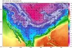
Only 100 degrees warmer in Orlando than in Dubuque.Coldest model run for my area that I have ever seen! ? View attachment 130855
Brent
Member

