WEATHERBOYROY
Member
2019 october was a sizzler here too.....oct 3 2019 101degrees!It got to 100 here in early October 2019, which set our all-time record. Of course, that’s the RDU sensor…
2019 october was a sizzler here too.....oct 3 2019 101degrees!It got to 100 here in early October 2019, which set our all-time record. Of course, that’s the RDU sensor…
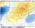
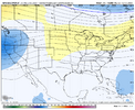
Ha! Everything is big on the GFS at day 10That's a big front on the GFS at day 10
Your coldest temp in September was on the 1st ? That has to be extremely unusual.We may get our first sub-50 degree reading of the season Friday morning! Oddly, the closest we’ve been to it so far (53) was way back on September 1st!
Your coldest temp in September was on the 1st ? That has to be extremely unusual.
000
CXUS52 KRAH 011445
CF6RDU
PRELIMINARY LOCAL CLIMATOLOGICAL DATA (WS FORM: F-6)

                                          STATION:   RALEIGH NC
                                          MONTH:     SEPTEMBER
                                          YEAR:      2025
                                          LATITUDE:   35 52 N
                                          LONGITUDE:  78 47 W

  TEMPERATURE IN F:       :pCPN:    SNOW:  WIND      :SUNSHINE: SKY     :pK WND
================================================================================
1   2   3   4   5  6A  6B    7    8   9   10  11  12  13   14  15   16   17  18
                                     12Z  AVG MX 2MIN
DY MAX MIN AVG DEP HDD CDD  WTR  SNW DPTH SPD SPD DIR MIN PSBL S-S WX    SPD DR
================================================================================

 1  79  53  66 -11   0   1 0.00  0.0    0  7.0 17  40   M    M   5        32  40
 2  79  54  67  -9   0   2 0.00  0.0    0  4.8 17  30   M    M   4        23  20
 3  84  54  69  -7   0   4 0.00  0.0    0  1.7  9  30   M    M   2        24 120
 4  89  56  73  -3   0   8 0.02  0.0    0  6.8 21 220   M    M   5        28 250
 5  93  67  80   4   0  15 0.00  0.0    0  8.1 15 230   M    M   3        19 200
 6  94  70  82   6   0  17 0.16  0.0    0  6.6 17 220   M    M   6 13     27 230
 7  74  62  68  -7   0   3    T  0.0    0  6.2 18  20   M    M   9 1      27  40
 8  77  58  68  -7   0   3 0.00  0.0    0  8.8 20  30   M    M   5        28  50
 9  76  56  66  -9   0   1 0.00  0.0    0  7.9 18  40   M    M   8        26 360
10  74  64  69  -5   0   4    T  0.0    0  7.6 15  50   M    M   9 1      21  30
11  79  63  71  -3   0   6 0.54  0.0    0  4.4 12  80   M    M   8 1      17 130
12  82  61  72  -2   0   7 0.00  0.0    0  5.3 18  40   M    M   5 12     24  40
13  81  55  68  -6   0   3 0.00  0.0    0  5.8 15  40   M    M   3        20  40
14  80  57  69  -4   0   4 0.00  0.0    0  3.4 13  40   M    M   7        17  30
15  79  61  70  -3   0   5 0.00  0.0    M  7.0 16  50   M    M   8        24  40
16  72  62  67  -6   0   2    T  0.0    0  5.5 17  30   M    M   7        24  20
17  74  61  68  -4   0   3    T  0.0    0  6.0 14 280   M    M   8        19 290
18  85  59  72   0   0   7 0.00  0.0    0  2.6  9 140   M    M   3        14 300
19  91  62  77   5   0  12 0.00  0.0    0  2.6  8  40   M    M   2        14 240
20  89  64  77   6   0  12 0.00  0.0    0  4.3 15  40   M    M   3 1      22 100
21  81  64  73   2   0   8 0.00  0.0    0  7.0 14  40   M    M   5 1      18  50
22  86  59  73   2   0   8 0.00  0.0    0  3.7  8 120   M    M   5        22 120
23  92  58  75   5   0  10 0.00  0.0    0  3.1 12 210   M    M   4        17 210
24  95  69  82  12   0  17 0.00  0.0    0  7.4 17 240   M    M   5        26 220
25  93  73  83  13   0  18 0.04  0.0    0  6.9 21 210   M    M   7 3      29 220
26  89  72  81  12   0  16 0.21  0.0    0  4.0 13 220   M    M   9 13     18 180
27  81  68  75   6   0  10 0.07  0.0    0  1.4  8 290   M    M   8 1      13 290
28  78  66  72   4   0   7 0.01  0.0    0  6.5 15  40   M    M   9        20  30
29  70  67  69   1   0   4 0.68  0.0    0  7.5 14  40   M    M  10 1      21  20
30  71  66  69   1   0   4 0.19  0.0    0  9.4 16  20   M    M  10 1      26  20
================================================================================
SM 2467 1861         0 221  1.92  0.0    169.3          M      182
================================================================================
AV 82.2 62.0                               5.6 FASTST   M    M   6    MAX(MPH)
                                 MISC ---->  # 21 220                 32  40
================================================================================
NOTES:
# LAST OF SEVERAL OCCURRENCES

COLUMN 17 PEAK WIND IN M.P.H.

PRELIMINARY LOCAL CLIMATOLOGICAL DATA (WS FORM: F-6) , PAGE 2

                                          STATION:   RALEIGH NC
                                          MONTH:     SEPTEMBER
                                          YEAR:      2025
                                          LATITUDE:   35 52 N
                                          LONGITUDE:  78 47 W

[TEMPERATURE DATA]      [PRECIPITATION DATA]       SYMBOLS USED IN COLUMN 16

AVERAGE MONTHLY: 72.1   TOTAL FOR MONTH:   1.92    1 = FOG OR MIST
DPTR FM NORMAL:  -0.5   DPTR FM NORMAL:   -3.23    2 = FOG REDUCING VISIBILITY
HIGHEST:    95 ON 24    GRTST 24HR  0.82 ON 29-30      TO 1/4 MILE OR LESS
LOWEST:     53 ON  1                               3 = THUNDER
                        SNOW, ICE PELLETS, HAIL    4 = ICE PELLETS
                        TOTAL MONTH:   0.0 INCH    5 = HAIL
                        GRTST 24HR  0.0            6 = FREEZING RAIN OR DRIZZLE
                        GRTST DEPTH:  0            7 = DUSTSTORM OR SANDSTORM:
                                                       VSBY 1/2 MILE OR LESS
                                                   8 = SMOKE OR HAZE
[NO. OF DAYS WITH]      [WEATHER - DAYS WITH]      9 = BLOWING SNOW
                                                   X = TORNADO
MAX 32 OR BELOW:   0    0.01 INCH OR MORE:   9
MAX 90 OR ABOVE:   6    0.10 INCH OR MORE:   5
MIN 32 OR BELOW:   0    0.50 INCH OR MORE:   2
MIN  0 OR BELOW:   0    1.00 INCH OR MORE:   0

[HDD (BASE 65) ]
TOTAL THIS MO.     0    CLEAR  (SCALE 0-3)   5
DPTR FM NORMAL   -15    PTCLDY (SCALE 4-7)  19
TOTAL FM JUL 1     0    CLOUDY (SCALE 8-10)  6
DPTR FM NORMAL   -13

[CDD (BASE 65) ]
TOTAL THIS MO.   221
DPTR FM NORMAL   -22    [PRESSURE DATA]
TOTAL FM JAN 1  2025    HIGHEST SLP 30.25 ON  8
DPTR FM NORMAL   286    LOWEST  SLP 29.80 ON 25

[REMARKS]
#FINAL-09-25#August's coolest temp here was 60ºF, while September's was 61ºF. August also had a lower average high than September by over a degree, 85.8ºF vs 87.0ºFYour coldest temp in September was on the 1st ? That has to be extremely unusual.
Gone at 12z. Replaced by a closed ridge. 90-95 temps for many of us at day 10 on the GFS.That's a big front on the GFS at day 10
Yeah, never mind that it still comes through the next day, which actually aligns it more closely with the Euro from this morning; not to mention it's the 2 week GFS and is subject to big swings anyway.Gone at 12z. Replaced by a closed ridge. 90-95 temps for many of us at day 10 on the GFS.
B P calling out JHS
B P calling out JHS
B P calling out JHS
I don't know, tbh. I tried the Vulcan mind meld technique with my computer with his post on the screen, but that route didn't yield any success.How can he be so certain there will be no more 90s ? One day next week is forecast to be around 85 in Charlotte. Just a few degrees higher and it could be close to 90!
Pretty big shifts on mid to long range models.
Greensboro has hit 90 only once since July: August 17th. It will be late next April / May, before we have a chance to hit it again, at the earliest.How can he be so certain there will be no more 90s ? One day next week is forecast to be around 85 in Charlotte. Just a few degrees higher and it could be close to 90!
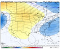
just for fun here's a nuke of a trough the 6z euro ai dropped dead south from eastern canada
View attachment 175331
verbatim its lows in the 20s for the mtns, upper 30s/low 40s for the rest of the carolinas/northern third of GA. highs in the upper 50s/low 60s with sun. ask the ensembles though...Out of curiosity, what kind of temps is it spitting out with that?
Also, wasn’t that the time period that was supposed to be a torch a day or two ago?


That might be enough cold air intrusion to bring an early frost to many areas in North Carolina. I know this is only one model and it is ten days away and out in fantasy land but it would be the first time in quite a while that we have had frost in the RDU area before Halloween and an even more rare occurrence before the State Fair begins in mid October.just for fun here's a nuke of a trough the 6z euro ai dropped dead south from eastern canada
View attachment 175331
Back door cold frontjust for fun here's a nuke of a trough the 6z euro ai dropped dead south from eastern canada
View attachment 175331
We need the warmth to continue for a bit. The sick and elderly aren’t prepared for chilly nights on the porch huddled in blankets just to keep themselves warm so they can enjoy their evening.The 18z GFS is crazy in the long range for the southern plains. Day after day of 90-95+ with one day over 100 from near Dallas to Houston. The Carolinas and east GA look to escape this for now.
