What ever happened to Mr. Golf?
-
Hello, please take a minute to check out our awesome content, contributed by the wonderful members of our community. We hope you'll add your own thoughts and opinions by making a free account!
You are using an out of date browser. It may not display this or other websites correctly.
You should upgrade or use an alternative browser.
You should upgrade or use an alternative browser.
Pattern October '22
- Thread starter ForsythSnow
- Start date
Itryatgolf
Member
That's me. Changed my name. Moved to TennesseeWhat ever happened to Mr. Golf?
It’s weird hearing rain again. I kept looking for the source of the sound around the house and took me a minute to realize it’s pouring.
That line will go kapoof east of the apps. Write it down.
It’s weird hearing rain again. I kept looking for the source of the sound around the house and took me a minute to realize it’s pouring.
Whatever database the Tempest updates its rainfall estimate from has been awful tonight. Its backtracked .1" twice. My old school rain gauge has .6" and the Tempest says exactly half that amount, and it is still raining.
I turned off that and haven’t looked back after it took away a verified deluge that happened to be very local. I got .59” tonight so looks like we matched up pretty close.Whatever database the Tempest updates its rainfall estimate from has been awful tonight. Its backtracked .1" twice. My old school rain gauge has .6" and the Tempest says exactly half that amount, and it is still raining.
SnowwxAtl
Member
Sidenote: that is not Anthony Anderson...lol...carry on!I need that Anthony Anderson meme, where he’s in the yellow suit licking his lips and rubbing his hands!
Currently 43
I need that Anthony Anderson meme, where he’s in the yellow suit licking his lips and rubbing his hands!
Currently 43
That's not Anthony Anderson, but someone named Anthony Adams.
My bad, but y’all fingered it out! Currently 34That's not Anthony Anderson, but someone named Anthony Adams.
- Joined
- Jan 23, 2021
- Messages
- 4,603
- Reaction score
- 15,199
- Location
- Lebanon Township, Durham County NC
The NAM is really cold on Friday ?
Looks like a midnight high temp today.
Currently 54.3F @ 1PM
Currently 54.3F @ 1PM
gawxnative
Member
Well it has been announced during the 4 pm newscast thet after almost 41 years, Glenn Burns is retiring from WSB TV effective end of the month. No surprise that Brad Nitz will be the new Chief Met there.
Drizzle Snizzle
Member
Actually his last day is November 22. He says that he has been asked to come back and join Brad Nitz for major storm coverages so this may not be the last we see him.Well it has been announced during the 4 pm newscast thet after almost 41 years, Glenn Burns is retiring from WSB TV effective end of the month. No surprise that Brad Nitz will be the new Chief Met there.
Last edited:
gawxnative
Member
I based the "end of the month" off the Facebook post of his comments initially on the air. The "official" posts are for November 22nd.Actually his last day is November 22. He says that he has been asked to come back and join Brad Nitz for major storm coverages so this may not be the last we see him.
- Joined
- Jan 5, 2017
- Messages
- 3,775
- Reaction score
- 5,985
I remember when he took over for Russ Minshew.I based the "end of the month" off the Facebook post of his comments initially on the air. The "official" posts are for November 22nd.
Euro (12z) continues to show a wet forecast for ~6pm on Halloween.
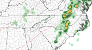
The GFS is trending that way as well.
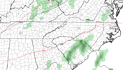
And RAH thinks there'll now be rain:
"Precipitation chances increase Monday into Monday night as
subtropical ridging builds into the Southeast ahead of the
amplifying trough to the west, strengthening a 70-100kt jet from
southern TX into the southern Mid-Atlantic by 18z Monday/00z
Tuesday. The enhancement in upper forcing will work in tandem with a
trailing cool/occluded front and increased moisture transport in the
925-850mb layer Monday night into Tuesday. Mostly light to moderate
stratiform is expected, but latest runs of the GFS depict 50-150
MUCAPE overspreads central NC Monday night which may slightly
enhance precipitation rates during this time."

The GFS is trending that way as well.

And RAH thinks there'll now be rain:
"Precipitation chances increase Monday into Monday night as
subtropical ridging builds into the Southeast ahead of the
amplifying trough to the west, strengthening a 70-100kt jet from
southern TX into the southern Mid-Atlantic by 18z Monday/00z
Tuesday. The enhancement in upper forcing will work in tandem with a
trailing cool/occluded front and increased moisture transport in the
925-850mb layer Monday night into Tuesday. Mostly light to moderate
stratiform is expected, but latest runs of the GFS depict 50-150
MUCAPE overspreads central NC Monday night which may slightly
enhance precipitation rates during this time."
I do as well ... I always thought Russ was a good Met back in the day. But he got himself into a mess ... I wonder where he is today?I remember when he took over for Russ Minshew.
(Update: Just saw that Minshew passed away from a brain tumor back in 1993.) Also read that he was acquitted of accusations.) Sorry for the banter!! Glenn Burns has had a good run on WSB-TV
Last edited:
JHS
Member
| U.S. Drought Monitor
Getting worse with no end in sight. Thanks to Ian most of NC and SC not too bad yet but that looks to change.
By the end of November, the whole Midwest and SE, will be dryer than Death Valley, CA| U.S. Drought Monitor
droughtmonitor.unl.edu
Getting worse with no end in sight. Thanks to Ian most of NC and SC not too bad yet but that looks to change.
Light rain 54
NoSnowATL
Member
Cloudy 70.
NBAcentel
Member
Looking somewhat likely (not a lock) that the +SCAND along with weakening MJO pulse should favor a slow but eventual process of a -NAO later in the month, next 3 weeks look dominated by a -PNA/strong southeast ridge, but there are hints that we’re gonna eventually try to get blocking going later in the month, note the Scandinavian ridge, typically -NAO follow a couple weeks after. As for the pacific side of things, the effect off +AAM typically is seen weeks to a month later, watch for some sort of jet extension around the end of the month. Twitter peeps have noted this, but it’s almost of if we’re watching last year all over again evolve, but a month earlier. Just remember, that things can go wrong and have before. But still, over the next few weeks we’re gonna see a significantly strong -PNA (some models throw a TPV near Seattle (same ish happened last year as well).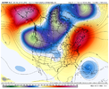


At least we're not having a cold November.Looking somewhat likely (not a lock) that the +SCAND along with weakening MJO pulse should favor a slow but eventual process of a -NAO later in the month, next 3 weeks look dominated by a -PNA/strong southeast ridge, but there are hints that we’re gonna eventually try to get blocking going later in the month, note the Scandinavian ridge, typically -NAO follow a couple weeks after. As for the pacific side of things, the effect off +AAM typically is seen weeks to a month later, watch for some sort of jet extension around the end of the month. Twitter peeps have noted this, but it’s almost of if we’re watching last year all over again evolve, but a month earlier. Just remember, that things can go wrong and have before. But still, over the next few weeks we’re gonna see a significantly strong -PNA (some models throw a TPV near Seattle (same ish happened last year as well).View attachment 123308View attachment 123313
Good evening. I'm reporting 59 and overcast in N Raleigh.
Long time no see gents! Looking forward to another disappointing winter outside the mountains. ??️
Long time no see gents! Looking forward to another disappointing winter outside the mountains. ??️
HugeSnowStick
Member
Wow, what an amazing rain event for Atlanta this morning...
Who knows. Just another four weeks and we can start looking at the models to hope for a winter storm. That would also align with when Webber is talking about favorable blocking setting up.Good evening. I'm reporting 59 and overcast in N Raleigh.
Long time no see gents! Looking forward to another disappointing winter outside the mountains. ??️
HugeSnowStick
Member
You guys do know I am kidding, I hope???Wow, what an amazing rain event for Atlanta this morning...
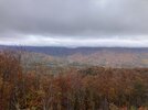
Took a trip over to Ellijay and back over Fort Mtn. The wind has blown half our leaves off at the house but the sheltered side of the mountain was stunning.
Great pics! I just went up to the Sylva area for the weekend. Anywhere above 3500' is just about bare, mostly above 1500' is past peak, although there are good spots. Our area is around peak now.
Outside Sylva, NC 10/29 - 2400'

Carters Lake, Gilmer County, GA 1076' - 10/24

Downtown Roswell, GA 1072' - 10/26

MBY 1135' - 10/30

Last edited:
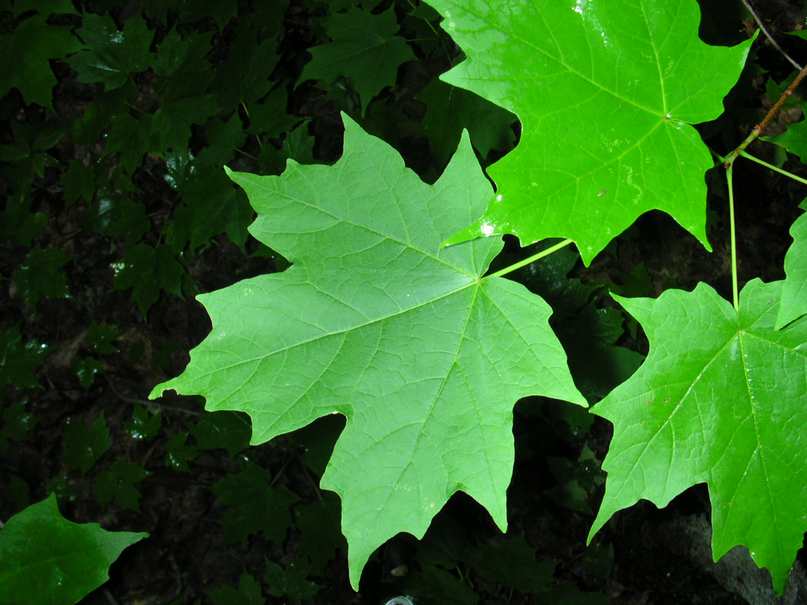
@J.C. Since you’re a fellow tree nerd, I just found this big Sugar Maple on an island in our big creek. I’ve now found 4 species that we sit on the fringe of. Sugar maple, pin oak, Osage orange, and honey locust.
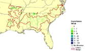
I would almost say that is a Southern Sugar, but it looks to be to big to even make that assumption. They look almost identical except the southern has slightly smaller leaves, and is mostly understory. Looks like you may have found one of the ones that are in our area. They definitely reproduce here because there are several renegades around.
Range of "Southern Sugar"
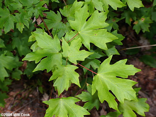
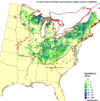
Range of Sugar Maple
Little definitely spotted the original in your area.
Attachments
The creek is too deep for me to get to it but the leaves are pretty large so I think it is a northern. We had some Southern’s where I grew up in Cherokee county and the leaves are a lot smaller than these. Might need to tap it if I can figure out how to bridge the creek well enough for the floods.I would almost say that is a Southern Sugar, but it looks to be to big to even make that assumption. They look almost identical except the southern has slightly smaller leaves, and is mostly understory. Looks like you may have found one of the ones that are in our area. They definitely reproduce here because there are several renegades around.
Range of "Southern Sugar"

View attachment 123347
Range of Sugar Maple
Little definitely spotted the original in your area.

View attachment 123349
Nice line of rain coming
Pouring at the house. Kids did get their trick or treating in before the rain started.Nice line of rain coming
Best rain events of the year coming after the growing season is basically over. Lame
TruthBest rain events of the year coming after the growing season is basically over. Lame
Soil moisture is good anytime of year!Best rain events of the year coming after the growing season is basically over. Lame

