If this went out further I would say there was about to be a sneaky link between that Alaskan ridge and western ridge that both blew up on the last frame 
They were close though just nothing concrete had the right moving partsLooks like 0 gefs had snow
Yeah want to see if there's any action on the eps. Might be a case of the progressive gfs suite pushing this ots too much. We will see.They were close though just nothing concrete had the right moving parts
If we could get that to swing through Southern Georgia we could really get a quick burst of snow east of the Apps in the upstate and most of NC.

One in 51 chance!
I'd just be happy to get some flakes in the air.One in 51 chance!
I posted this a.m. it wasnt far off on all 3 ops from 0z @ h5. Trending even better at 12z/ euro espacilly. Need to back the flow just a tad more and sharpen the trough, notch quicker and we have a decent shot. Doable definitely and Not Guranteed as well


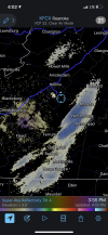
Gotta be like the 5th or so time virga has occurred this November.47 degrees and dropping here in Roanoke. Wind is absolutely freezing as I’m closing up the golf course tonight. Some virga overhead is interesting, must be a little piece of energy still left.
KATL, itself, will be close to a freeze tonight. They do much better with cold air advection/wind than with radiational cooling/calm. Will there be just enough NW wind to get them there? I think so but it will be close:
KFFC NWS forecast:
PRELIMINARY POINT TEMPS/POPS
ATHENS 31 53 29 56 / 0 0 0 0
ATLANTA 32 52 32 56 / 0 0 0 0
This 12Z GFS 2m map implies a slight warm bubble that may just keep them barely above 32:
View attachment 95616
But the 12Z Euro and CMC say right on 32:
View attachment 95617
View attachment 95618
This is why I never believed it would happen. The models were complete trash with today's air mass, essentially 5 days ago it was supposed to be in the 40s today and mid 20s tonight. Here we are 5 days later experiencing upper 50s and my low is only forecast to be 30, and I'm usually a good 4 degrees cooler than KATL. My guess is they hit 34 or 35.
1. Yes, I remember you saying over the weekend that KATL first freeze may not be til (mid?) December and I then said it had a good chance for tonight.
2. What elevation are you at? Higher elevations may do better tonight since it isn't radiational.
3. When KATL has enough NW wind bringing in enough CAA, even they do reasonably well in relation to other ATL areas nearby as opposed to sticking out real badly like a warm thumb. I still say the amount of NW wind will be the key. Will it be too light to help them or not? When a NW wind is blowing pretty steadily, they sometimes have been within about 2 F of much of the ATL metro outside of far N burbs.


Geez , I wasn’t aware Atlanta city proper has yet to record a freeze . It’s amazing that it’s UHI has essentially pushed its average first freeze date all the way to December . That’s similar to a typical coastal location . Imagine if we had an Atlanta sized city on the coast, place probably wouldn’t freeze till January . NYC actually averages it’s first freeze almost in December at la guardia. Granted LGA is a terrible station and runs 2 degrees warmer than other city stations so I don’t see it’s averages as reflective at all and complete rubbish . Same for Baltimore .
I’d imagine the city proper is worse though, downtown , buckhead , perimeter . Now the rest of city proper is more suburban in nature so you are right . Though I think the airport and the dense areas are bad.Well, we're technically talking about the airport, not the city proper. I think that even the city proper, which is 15 or so miles north, is a little colder than the airport on radiational nights. The airport is THE worst and is thus quite unrepresentative for the ATL area on good radiational cooling nights.
The location needs to be moved north. I think TWC location would be a great place.Well, we're technically talking about the airport, not the city proper. I think that even the city proper, which is 15 or so miles north, is a little colder than the airport on radiational nights. The airport is THE worst and is thus quite unrepresentative for the ATL area on good radiational cooling nights.
No place ITP is suburban. You have to go OTP for that. It’s a zoo inside 285.I’d imagine the city proper is worse though, downtown , buckhead , perimeter . Now the rest of city proper is more suburban in nature so you are right . Though I think the airport and the dense areas are bad.

The location needs to be moved north. I think TWC location would be a great place.
Yea took a late lunch and went for a chilly walk at 330. I could tell the sky had that look.Gotta be like the 5th or so time virga has occurred this November.
It’s terrible in my opinion. JB sure loves it when he is desperate for cold.I have a question. Is the aussie mjo chart good? Dt wxrisk seems to think so
Same for me. I was in the bullseye that morning for the heaviest totals. For an hour or so, it was right up there with February 2014 for rates and intensity.April 2019 ?View attachment 95623
20 years ago there was talk about changing the Gwinnett County airport into a international airport.. Atlanta definitely needs a huge airport on the north side.The location needs to be moved north. I think TWC location would be a great place.
That's crazy there's part of North Carolina that hasn't seen an inch since 2011April 2019 ?View attachment 95623
I'm not too surprised by that, coastal areas do not average a whole lot especially the southeastern part of the state which probably has a median snowfall of like T lol. I'll dig into some of that data later, most years see under an inch there anyways if anything.That's crazy there's part of North Carolina that hasn't seen an inch since 2011
You are correct… especially areas along the southern coastal areas. I think Wilmington has only had two snowfalls of greater than 3 inches since the December 1989 Christmas BlizzardI'm not too surprised by that, coastal areas do not average a whole lot especially the southeastern part of the state which probably has a median snowfall of like T lol. I'll dig into some of that data later, most years see under an inch there anyways if anything.
The funniest part is @Myfrotho704_ hasn't seen an inch since 2018That's crazy there's part of North Carolina that hasn't seen an inch since 2011
You are correct… especially areas along the southern coastal areas. I think Wilmington has only had two snowfalls of greater than 3 inches since the December 1989 Christmas Blizzard