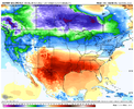
Why don't you fire up the Dec thread with this post?That's not a horrible look. Depending on how blocking continues to evolve, cold air could easily make it into the SE.
View attachment 124105
EPS is similar fwiw.
View attachment 124106
-
Hello, please take a minute to check out our awesome content, contributed by the wonderful members of our community. We hope you'll add your own thoughts and opinions by making a free account!
You are using an out of date browser. It may not display this or other websites correctly.
You should upgrade or use an alternative browser.
You should upgrade or use an alternative browser.
Pattern November 2022
- Thread starter Metwannabe
- Start date
- Status
- Not open for further replies.
1.48, over performer this morningWaking up to so nice rain this morning, .5 and still coming down
43° with light drizzle in Blowing Rock this morning. Maybe a trace of precip.
Darklordsuperstorm
Member
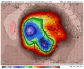
Agreed… and enough cold air and snow cover is building up in Canada where it won’t take a real tall western coast ridge to tap into itGefs slowly trending to dropping that low and it’s energy around the Aleutian Islands is pretty ideal View attachment 124115
bigstick10
Member
Pretty clever writing from KATL
Locally, the strong southerly jet ahead of the dominant low-pressure
system should provide enough lift to form some scattered light
showers ahead of the main storm system from late afternoon through
midnight. Just after midnight, an unorganized wave (or possibly
multiple waves) of storms is expected to push into the forecast area
out of Alabama. There will be enough lift from the low- and mid-
level jet for some isolated to scattered thunderstorms to form, and
while storms are expected to generally be weak with minimal upper-
level instability available, momentum transfer from a 40-50kt jet at
850hPa is a concern. The airmass in the lower kilometer will be
stable, but not by much, and therefore any water-loaded downdrafts
will have potential for strong winds gusts to occur. Even outside of
the storms, wind gusts could be up to 20-30 mph given the strong low-
level jet near the ground so be sure to secure any holiday
decorations that may be out, as inflatable Santas may take flight
tonight, which would be about a month earlier than expected.
Brent
Member
Much needed rain here... Hopefully we can at least keep the moisture train going if nothing else
Brick Tamland
Member
Wednesday night WRAL said it was going to rain all weekend here.
3.12” last night. Finally over performed.
3.12” last night. Finally over performed.
Nice! 3.1” here.
ForsythSnow
Moderator
3.02" here and also an overperformer. Pretty good amount so hopefully that dents the drought here a bit.3.12” last night. Finally over performed.
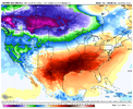
WOOOOMPLosing our medium range warmup. likely a result of models catching on to stronger blocking and cold low level air oozing down from the TPV and it’s energyView attachment 124385View attachment 124386
There's some members in the Dec thread that need to see thisLosing our medium range warmup. likely a result of models catching on to stronger blocking and cold low level air oozing down from the TPV and it’s energyView attachment 124385View attachment 124386
Done ?There's some members in the Dec thread that need to see this
We're going to close this month out with just over 5"(close to 3" in the last week) IMBY.
iGRXY
Member
Solid 2.25" overnight and this morning. SO much for that drought here now.
- Status
- Not open for further replies.

