• Hello, please take a minute to check out our awesome content, contributed by the wonderful members of our community. We hope you'll add your own thoughts and opinions by making a free account!

Pattern November 2022

Status
Not open for further replies.
Just in time for winter.
e2c6cd06ef0fb5297976d96a66d53864.jpg


Sent from my iPhone using Tapatalk
I get so tired of seeing this year after year.
 
I really don’t see warm temps anytime soon, maybe a few warm days, week 3-4 imo might trend colder to AVG-Slightly BN. Even if we have a -PNA/-NAO, the Carolina’s is gonna deal with lot of wedging. Ridge position up around greenland is a kelvin benjamin becoming a tight end from a Popeyes biscuit away from being undercut/breaked by a cutoff and causing a decent duration -NAO around day 7-14. Only issue is, the MJO is entering a warmer phase, but looks to head to phase 7 in early December
 
I really don’t see warm temps anytime soon, maybe a few warm days, week 3-4 imo might trend colder to AVG-Slightly BN. Even if we have a -PNA/-NAO, the Carolina’s is gonna deal with lot of wedging. Ridge position up around greenland is a kelvin benjamin becoming a tight end from a Popeyes biscuit away from being undercut/breaked by a cutoff and causing a decent duration -NAO around day 7-14. Only issue is, the MJO is entering a warmer phase, but looks to head to phase 7 in early December
Is it just me or does it seem like we’re following a pattern that you would see more so in neutral ENSO year? It’s interesting to follow because I’ve always read that the MJO has much less impact on North America when the ENSO is in a neutral phase
 
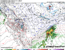
00z HRRR would be something. Almost no snow in OKC while places to the south get hammered. Unless this moves north overnight, I would be tempted to go south tomorrow. Might not be able to due to my schedule though.

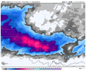
Looking like a band of heavy wet snowfall with what could be 1-2” an hour rates. Couple that with some fall colors still on the trees it would be a sight to see!D6BA278A-A528-4BE3-BB96-0968EAB062B2.png
 
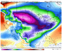
Very rare to see a footprint like that View attachment 123821
That actually looks a lot like a typical Niña cold footprint, like a lot of winter outlooks we’re showing in the fall! Just off of memory, with regards to temps using mostly climo, I would assume
 
00z HRRR would be something. Almost no snow in OKC while places to the south get hammered. Unless this moves north overnight, I would be tempted to go south tomorrow. Might not be able to due to my schedule though.

Looking like a band of heavy wet snowfall with what could be 1-2” an hour rates. Couple that with some fall colors still on the trees it would be a sight to see!View attachment 123823

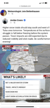
I thought I was done going south to chase when I moved to Tulsa but if that verifies... ? I'm definitely gonna be watching trends
 
I wonder where the actual temp bottom is here tonight. We've already blown past the 31 from the NWS tonight (sitting at 29.1) and still falling.
You know how it is though…if you’re in a low lying spot like @EmersonGA, the bottom can fall out. I’m already at 31.1F, but I would anticipate my regular rise that happens around midnight, then the settling back off right around 30-31F.
 
You know how it is though…if you’re in a low lying spot like @EmersonGA, the bottom can fall out. I’m already at 31.1F, but I would anticipate my regular rise that happens around midnight, then the settling back off right around 30-31F.
25.3 here. The breeze never completely quit.
 
Status
Not open for further replies.
Back
Top