HSVweather
Member
Still sunny here and wind is howling1500 SB cape for most of central Alabama now. Cape is rising fast. Not good.
Still sunny here and wind is howling1500 SB cape for most of central Alabama now. Cape is rising fast. Not good.

I feel like they pulled the trigger too early in trimming that.i honestly think they need to move the enhanced risk back south to at least cover the tuscaloosa, bibb, shelby, chilton and jefferson co areas. even out BMX NWS took basically off of central bama out of their enhanced risk as well
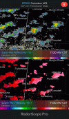
View attachment 100597

Yep.Is that the same storm chaser who was on scene at the joplin tornado?


Four tornado warnings in Kentucky right now.Listening to Franklin County Bowling Green Fire Police scanner, Fire Rescue, and police are responding to more than one building collapse. Also power lines down and injuries from debris.


Bowling green Kentucky just got hit a few weeks ago by a tornado. This ---- is ridiculous and down right annoying at this point. It’s 74.5 degrees here for gods sake! I cannot wait for the cold to come and put an end to this crap. Sorry for the rant but it’s frustrating when Tennessee and southern Kentucky have had more tornado days then snow days in December and now January.Listening to Franklin County Bowling Green Fire Police scanner, Fire Rescue, and police are responding to more than one building collapse. Also power lines down and injuries from debris.
 , HRRR shows some healthy supercells forming and moving northeast through here. And producing some long track characteristics.
 Two weak rotations headed toward Loretta TN out of AL