Cary_Snow95
Member
Currently 34/20 in Cary
I would argue that its the most historic winter in at least 20 years maybe more.
Now I'm starting to get bigger flakes, but less of them, lol. I plan on getting the numbers I had with the small flakes, but with the big flakes....then I'll have something to talk aboutThanks! This is a truly historic winter that will be mentioned on this board along with the 09-10, 10-11, and 13-14 winters.
I would argue that its the most historic winter in at least 20 years maybe more.
Hard to argue with that, this will be Florida's third winter storm of the season for crying out loud haha.
Snow map at the end of the season is gonna be ridiculous, I guess this is why we suffered so much the last two winters.


Incredible...... different radar sites
For the record no, its not snowing

Sent from my SM-J320VPP using Tapatalk

Dry air just above the surface. Boo...
This is my area, and its still snowingClarke County EMA: An Impassable Travel Advisory has now been issued for all roads and bridges in Clarke County, AL.
Incredible...... different radar sites
For the record no, its not snowing
Sent from my SM-J320VPP using Tapatalk
I understand that this really wasn't supposed to be that much here in my location, and I'm good with that, after we got a foot of snow in December. We have close to an inch from this system and its still snowing some. I'm curious as to what is going to make the system go boom tomorrow for NC? I hope yall overachieve and get a foot.
Enchanced southwestery winds as the base of the trough tilts and tightens up (potentially closing off).
Long story short, moisture is infiltrating the midl-evels from the Gulf and Northern SC & NC will see a little bit of Atlantic moisture also.
Tbh, height falls look good to increase frontogenesis (basically precipitation). From about North Central SC into NC.
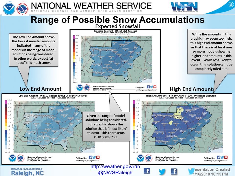
They're gonna have to move the goalposts again... The latest NWP suites and potential for urrher increase in QPF in the next run or so definitely support 5-10 near or just west of RaleighWell this prediction didn't take long to come to fruition.

I wonder how many warm Winters we will have starting next year, since we've had such a cold winter this year
Probably the driest snow I’ve ever experienced in Alabama. Reminds me of the “champagne powder “ as they call it in Steamboat Springs Colorado.Incredible...... different radar sites
For the record no, its not snowing

Sent from my SM-J320VPP using Tapatalk
We have a climate change thread; and if you're not speaking on climate change as a whole, that is a good question. This is supposed to ba a La Nina year, where it is dry and warmer in the Southern United States. I think we will potentially see Neutral to weak El Nino state showing up in the upcoming couple of years and I think things will be around normal.
There are many talented members on this board that are much better with all that teleconnection and long range stuff than I. Definitely check out our long range pattern threads, and the Enso thread we have going on!
Once we move out of this Winter, it will be focused on more because it has to deal with hurricane season etc.
Next band almost here, excited!
Yeah it was extremely dry. Not sure I remember the last time it was like this .Probably the driest snow I’ve ever experienced in Alabama. Reminds me of the “champagne powder “ as they call it in Steamboat Springs Colorado.
My ground is completely whiteHope those bands SW of Atlanta can move into the city. Radar trends looking pretty good.
