• Hello, please take a minute to check out our awesome content, contributed by the wonderful members of our community. We hope you'll add your own thoughts and opinions by making a free account!

Wintry More SE Snow ? (1/16-1/18)

Live thread is off, due to very high traffic in this thread currently.
 
It could be more in some spots, especially northside (as much as an inch), but it won't be anything near the 3-4+ that BPATL just mentioned a few posts above.

Edit: The euro has nothing for ATL or nearby.
Should we even trust the Euro at this range?
 
I don't see this having anything even close to the moisture potential of 12/8/17. That being said, the problem here is that even a dusting could cause driving problems since it would be much colder than 12/8/17.

That and much higher ratios.


Sent from my iPhone using Tapatalk
 
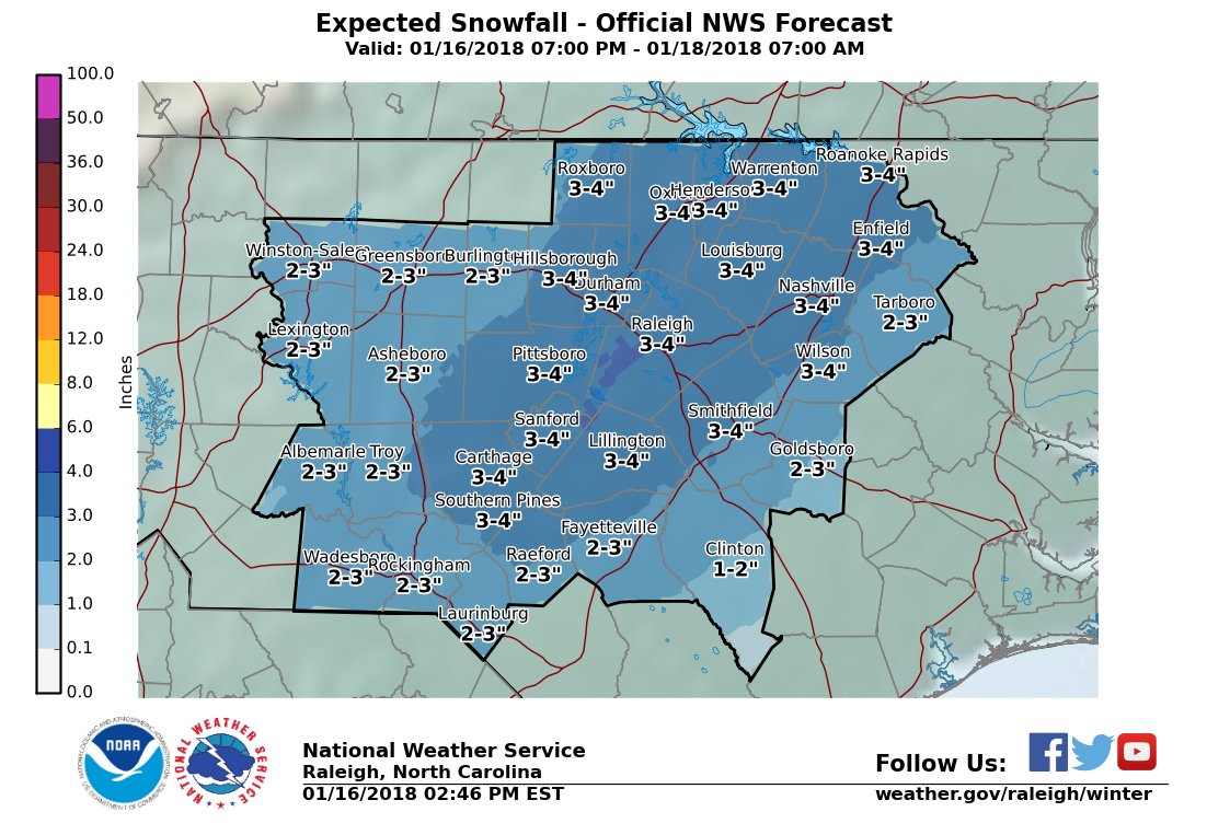
Euro goes boom for Raleigh to Roanoke Rapids!

us_model-en-087-0_modez_2018011512_57_480_215.thumb.png.7ec4340ae59ecdb49f351192f6fe5414.png
 
Really think anywhere from Charlotte to Roanoke Rapids can be the sweet spot. The models have been showing various spots. Euro looks between the GFS and NAM, and like the UK.
 
Should we even trust the Euro at this range?

No, but it gives an indication that moisture is limited and that durations should be pretty short. So, even with high ratios, I'd say ~1" tops ATL area with that more likely northside. But anything could be dangerous. Anything measurable would be a pretty big deal.

What are you predicting?
 
Euro not buying the ptype concerns for NC/SC, nor am I. To be fair, if it came in later then it could briefly start as rain/snow mix, but it would rapidly changeover for most even in that scenario.

View attachment 2961
The ICON & CMC hold off on the precipitation til 18z which is part of the reason why they're so much warmer than the Euro in the boundary layer. Sure their sfc temps may be overdone but if the timing of the s/w and precipitation is slower that will favor a warmer BL than the Euro is advertising at the onset of the event. Timing is key to minimize p-type issues
icon_mslp_pcpn_frzn_seus_18.png
gem_mslp_pcpn_frzn_seus_9.png
 
No, but it gives an indication that moisture is limited and that durations should be pretty short. So, even with high ratios, I'd say ~1" tops ATL area with that more likely northside. But anything could be dangerous. Anything measurable would be a pretty big deal.

What are you predicting?
I would probably be on the safe side like you and say up to an inch. Until we get closer we won't really know either. Certainly much different than last month with plenty of cold around.
 
Back
Top