-
Hello, please take a minute to check out our awesome content, contributed by the wonderful members of our community. We hope you'll add your own thoughts and opinions by making a free account!
You are using an out of date browser. It may not display this or other websites correctly.
You should upgrade or use an alternative browser.
You should upgrade or use an alternative browser.
Tropical Melissa
- Thread starter SD
- Start date
Brent
Member
Brent
Member
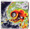
Satellite images indicate that maximum sustained winds have rapidly
increased to near 140 mph (220 km/h) with higher gusts. Melissa is
a category 4 hurricane on the Saffir-Simpson Hurricane Wind Scale.
Bruh...
Brent
Member
Bruh...
It doesn't help a lot of areas on the island are in extreme poverty and not well off
It's almost like Puerto Rico after Maria or the lower 9th during Katrina basically
Aaron Rigsby cancelled his flight at the last minute he's so worried about the aftermath
BULLETIN
Hurricane Melissa Intermediate Advisory Number 20A
NWS National Hurricane Center Miami FL AL132025
800 AM EDT Sun Oct 26 2025
...NOAA HURRICANE HUNTERS SAMPLING MELISSA...
...LIFE-THREATENING AND CATASTROPHIC FLASH FLOODING AND LANDSLIDES
EXPECTED IN PORTIONS OF JAMAICA AND SOUTHERN HISPANIOLA THROUGH
MIDWEEK...
SUMMARY OF 800 AM EDT...1200 UTC...INFORMATION
----------------------------------------------
LOCATION...16.3N 76.4W
ABOUT 120 MI...195 KM SSE OF KINGSTON JAMAICA
ABOUT 280 MI...450 KM SSW OF GUANTANAMO CUBA
MAXIMUM SUSTAINED WINDS...140 MPH...220 KM/H
PRESENT MOVEMENT...W OR 270 DEGREES AT 5 MPH...7 KM/H
MINIMUM CENTRAL PRESSURE...952 MB...28.12 INCHES
Maximum sustained winds are near 140 mph (220 km/h) with higher
gusts. Melissa is a category 4 hurricane on the Saffir-Simpson
Hurricane Wind Scale. Further rapid intensification is expected
through tonight, followed by fluctuations in intensity. Melissa is
expected to be a major hurricane when making landfall in Jamaica
Monday night or Tuesday morning and southeastern Cuba late Tuesday.
Hurricane-force winds extend outward up to 25 miles (35 km) from
the center and tropical-storm-force winds extend outward up to 175
miles (280 km).
The minimum central pressure estimated by aircraft dropsonde data
is 952 mb (28.12 inches).
Brent
Member
GeorgiaGirl
Member
It doesn't help a lot of areas on the island are in extreme poverty and not well off
It's almost like Puerto Rico after Maria or the lower 9th during Katrina basically
Aaron Rigsby cancelled his flight at the last minute he's so worried about the aftermath
Josh is there, but he realistically expects to “be” in Jamaica for a while if this storm is as powerful as concerned on the island from what I read, kinda like his Dorian chase.
Brent
Member
Josh is there, but he realistically expects to “be” in Jamaica for a while if this storm is as powerful as concerned on the island from what I read, kinda like his Dorian chase.
Yeah Rigsby said he has friends there who are completely terrified of what this storms potential is
WTNT33 KNHC 261456
TCPAT3
BULLETIN
Hurricane Melissa Advisory Number 21
NWS National Hurricane Center Miami FL AL132025
1100 AM EDT Sun Oct 26 2025
...MAJOR HURRICANE MELISSA CONTINUES SLOWLY WESTWARD WITH LITTLE
CHANGE IN STRENGTH...
...LIFE-THREATENING AND CATASTROPHIC FLASH FLOODING AND LANDSLIDES
EXPECTED IN PORTIONS OF JAMAICA AND SOUTHERN HISPANIOLA THROUGH
MIDWEEK...
SUMMARY OF 1100 AM EDT...1500 UTC...INFORMATION
-----------------------------------------------
LOCATION...16.4N 76.6W
ABOUT 110 MI...180 KM S OF KINGSTON JAMAICA
ABOUT 280 MI...445 KM SSW OF GUANTANAMO CUBA
MAXIMUM SUSTAINED WINDS...140 MPH...220 KM/H
PRESENT MOVEMENT...W OR 270 DEGREES AT 3 MPH...6 KM/H
MINIMUM CENTRAL PRESSURE...953 MB...28.15 INCHES
WTNT43 KNHC 261459
TCDAT3
Hurricane Melissa Discussion Number 21
NWS National Hurricane Center Miami FL AL132025
1100 AM EDT Sun Oct 26 2025
After rapidly intensifying over the past day or so, NOAA-P3 aircraft
data indicates that Melissa's intensity has leveled off this
morning. Melissa remains a very formidable hurricane on satellite
imagery, with a clearing eye quite evident on morning visible
imagery, and the eye temperature has warmed to +15-20C. Meanwhile
the eyewall convection continues to remain robust with cloud tops as
low as -75 to -80C encircling the core. With that said, the eye
presentation from the Kingston, Jamaica radar is not as pristine,
with the eyewall occasionally open on the east side, and some
evidence of concentric bands forming off and on. Zooming out a bit,
there still remains some evidence of light to moderate westerly
shear undercutting the expanding storm outflow, and Melissa’s
primarily rainbands are distributed mostly on the eastern side of
the circulation. NOAA-P3 aircraft data this morning had a peak 700-
mb flight level wind of 120 kt, and Tail Doppler Radar (TDR) wind
retrievals were up to 129 kt at 0.5 km, and 129 kt in the 500 m
average of a dropsonde launched in the north eyewall. While this
data would support a somewhat lower intensity, the subjective and
objective satellite based intensity estimates are mostly higher,
ranging from 115 to 140 kt. The initial intensity will be held at
120 kt, on the lower end of those estimates, and this value could be
a little generous based on the aircraft data.
The major hurricane is moving westward this morning, from aircraft
fixes estimated at 270/3 kt. This motion is expected to continue for
the next 24-36 h as a narrow mid-level ridge to the north of Melissa
imparts the majority of the steering. Thereafter, a short-wave
trough moving into the southeastern United States is expected to
erode this ridge, allowing Melissa to turn sharply to the northeast,
with gradual acceleration. On the forecast track, Melissa's core
is expected to be near the Jamaica coastline by Tuesday morning,
moving across the island and then approaching and moving over
eastern Cuba by Tuesday night. While the track guidance has become
tightly clustered over the first 24-48 hours, the along-track spread
starts to increase significantly after that time period, with Google
DeepMind ensemble solutions on Wednesday morning ranging from
between Jamaica and eastern Cuba in the Caribbean Sea, over eastern
Cuba, or in the Southwestern Atlantic near the Southeastern Bahamas
and Turks and Cacaos Islands. The latest NHC track forecast was
nudged just a little westward of the prior track, once again
blending the reliable track aids HFIP Corrected Consensus Approach
(HCCA), and Google DeepMind ensemble mean (GDMI).
It is unclear if the current pause in Melissa's intensification is
temporary. While there have not been obvious indications of a
secondary eyewall formation yet, there are some concentric
reflectivity bands appearing on both Jamaica and NOAA-P3 TDR data
occasionally, though the inner eyewall remains strong. Some of the
guidance this morning has actually increased from yesterday at this
time, and notably both the HAFS-A/B explicitly forecast a Category 5
hurricane shortly before they show landfall in Jamaica. The latest
NHC intensity forecast will continue to show a peak intensity of 140
kt. However, inner-core fluctuations like eyewall replacement cycles
could occur at any time. Regardless, Melissa is forecast to reach
Jamaica as an upper-end category 4 hurricane, which will only
exacerbate any damages caused by heavy rainfall and flooding over
the next 2 days. Melissa will likely weaken some as it traverses
over the higher terrain of Jamaica, but it is still forecast to be a
major hurricane when it subsequently moves over eastern Cuba in
60-72 hours. Thereafter, increasing southwesterly shear should
cause gradual weakening, but Melissa could still be near hurricane
intensity when it makes it closest approach to Bermuda in about 5
days. The latest NHC intensity forecast is on the high end of the
intensity guidance, but not far off the GDMI, and HAFS-A/B intensity
aids.
——————-
FORECAST POSITIONS AND MAX WINDS
INIT 26/1500Z 16.4N 76.6W 120 KT 140 MPH
12H 27/0000Z 16.4N 77.1W 130 KT 150 MPH
24H 27/1200Z 16.6N 77.8W 140 KT 160 MPH
36H 28/0000Z 16.9N 78.0W 140 KT 160 MPH
48H 28/1200Z 17.8N 77.7W 135 KT 155 MPH
60H 29/0000Z 19.2N 76.6W 110 KT 125 MPH
72H 29/1200Z 20.9N 75.1W 95 KT 110 MPH
96H 30/1200Z 25.5N 71.0W 85 KT 100 MPH
120H 31/1200Z 32.0N 65.5W 75 KT 85 MPH
$$
Forecaster Papin
Looks like latest recon is 945mb
Northern eyewall looking potent. Pressure down to 939 mb.
760
URNT15 KNHC 261922
AF307 1613A MELISSA HDOB 30 20251026
191300 1638N 07700W 6969 02953 //// +087 //// 085093 096 078 030 01
191330 1636N 07700W 6974 02921 //// +092 //// 085092 094 090 013 01
191400 1635N 07700W 6966 02898 //// +105 //// 081099 103 096 007 01
191430 1633N 07700W 6963 02856 //// +094 //// 078110 113 101 025 01
191500 1631N 07700W 6980 02764 //// +098 //// 078121 129 115 055 01
191530 1629N 07659W 7005 02653 //// +117 //// 070094 124 132 036 01
191600 1628N 07659W 6961 02668 9416 +179 +116 071036 070 111 007 00
191630 1626N 07659W 6967 02655 9402 +192 +078 081014 020 036 002 03
191700 1624N 07658W 6970 02649 9401 +194 +072 131003 010 012 001 00
191730 1623N 07658W 6972 02650 9404 +194 +073 225010 011 013 001 00
191800 1621N 07657W 6978 02653 9410 +194 +074 236017 021 014 001 03
191830 1620N 07658W 6972 02656 9415 +186 +082 252017 021 /// /// 03
191900 1621N 07659W 6967 02655 9405 +192 +075 271013 017 /// /// 03
191930 1622N 07658W 6965 02655 9399 +195 +071 203008 012 /// /// 03
192000 1622N 07656W 6966 02660 9406 +195 +072 208017 019 022 001 03
192030 1621N 07655W 6988 02642 9419 +186 +086 207024 029 048 002 03
192100 1619N 07654W 6942 02700 9445 +146 +136 229064 092 089 015 03
192130 1618N 07653W 6986 02707 //// +098 //// 230121 126 096 030 01
192200 1617N 07652W 6954 02808 //// +105 //// 229124 127 096 027 01
192230 1616N 07651W 6963 02851 //// +102 //// 227110 119 094 010 01
$$
Shaggy
Member
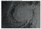
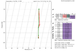
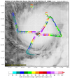
Eye has really cleared out and shrunk a bit. See no reason this doesn't get upgraded at 5pmDropsonde now showing Cat 5 winds way up in the atmosphere in the northern eyewall. View attachment 175697
SUMMARY OF 500 PM EDT...2100 UTC...INFORMATION
----------------------------------------------
LOCATION...16.4N 77.2W
ABOUT 115 MI...185 KM SSW OF KINGSTON JAMAICA
ABOUT 295 MI...470 KM SSW OF GUANTANAMO CUBA
MAXIMUM SUSTAINED WINDS...145 MPH...230 KM/H
PRESENT MOVEMENT...W OR 270 DEGREES AT 5 MPH...7 KM/H
MINIMUM CENTRAL PRESSURE...941 MB...27.79 INCHES
145/941
WTNT43 KNHC 262100
TCDAT3
Hurricane Melissa Discussion Number 22
NWS National Hurricane Center Miami FL AL132025
500 PM EDT Sun Oct 26 2025
After an earlier pause in intensification, this afternoon's Air
Force Reserve reconnaissance mission has found Melissa intensifying
again. The minimum pressure has fallen 12 mb from this morning
NOAA-P3 mission, with the last dropsonde indicating a minimum
pressure of 941 mb, and the plane reported a shrinking eyewall down
to 6 n mi in diameter. In addition to the low pressure, the
satellite presentation of Melissa remains very impressive, with
1-minute visible satellite images from a GOES-19 meso-sector showing
a very clear eye with a stadium effect. The eye temperature on water
vapor imagery has continued to warm, while the thick ring of eyewall
cloud tops remains between -75 to -80 C around the eye. The
presentation of Melissa on radar reflectivity from Kingston, Jamaica
has also improved, though there still appear to be hints of a moat
forming around the inner eyewall, though without an obvious
secondary eyewall formation yet. Subjective Dvorak CI-numbers from
both SAB and TAFB were T7.0/140 kt, with objective satellite
estimates between 132-143 kt. However, Melissa's peak winds from the
last couple of recon missions have been lagging the satellite-based
estimates. The last fix had peak 700 mb flight level winds of only
129 kt, but a dropsonde launched in the north eyewall also reported
a 500 m layer average of 142 kt, with an earlier dropsonde in the NE
eyewall with a surface wind gust of 131 kt. This data is enough to
raise the maximum sustained winds of 125 kt, and given the satellite
presentation, this could be conservative.
Melissa continues to move slowly westward, estimated at 270/4 kt.
The hurricane has been moving a little faster to the west today, and
this motion will likely continue for another 12-18 hours while the
narrow mid-level ridge to the north remains in place. Soon, a
short-wave trough will be moving into the SE United States, and this
feature should create a weakness that Melissa will turn
sharply northeast into, as it gradually accelerates. The track
guidance has shifted a little westward again this cycle, and the NHC
track forecast was nudged a little west again, but still shows
landfall on Tuesday morning along the south coast of Jamaica. There
remain some timing differences thereafter, but a second landfall is
anticipated along the southeastern Cuba coast by Tuesday night or
early Wednesday morning. As Melissa then accelerates into the
southwestern Atlantic, it will move through the Bahamas and
potentially approach Bermuda by the day 4-5 time frame, with a
reinforcing trough helping to kick it farther out to sea. The latest
NHC track forecast is a little west in the first 24-60 h, but falls
back near the previous forecast track thereafter. The track is
roughly a blend of the reliable HFIP Corrected Consensus Approach
(HCCA) and Google Deep Mind ensemble mean (GDMI).
Now that Melissa is intensifying again, it seems more clear that the
earlier pause in intensification was a temporary oscillation, and
the hurricane now appears poised to intensify more in the
short-term. The latest NHC intensity forecast shows a little more
intensification in 12 h, but continues to show a peak intensity of
140 kt, which is supported by HAFS-B which shows landfall of Melissa
as a catastrophic Category 5 hurricane. The Google DeepMind ensemble
members also continue to indicate this peak, with now 48/50 members
reaching this lofty intensity. However, inner-core processes like
ERCs could occur at any time, and the current small eye of Melissa
likely suggests an ERC could begin in the next 24 hours or so,
though it is very difficult to predict these occurrences with much
skill. After landfall in Jamaica, Melissa will likely weaken some
due to the interaction with that Island's high terrain, but it is
still expected to be a major hurricane when crossing the Cuba
coastline on Tuesday night. After emerging into the southwestern
Atlantic Ocean, increasing vertical wind shear should continue
gradual weakening through the end of the forecast, with the
possibility that Melissa could start extratropical transition by day
5. The NHC intensity forecast continues to be on the high side of
the guidance, but falls closer to the HCCA and IVCN aids towards the
end of the forecast period.
————
Monday.
FORECAST POSITIONS AND MAX WINDS
INIT 26/2100Z 16.4N 77.2W 125 KT 145 MPH
12H 27/0600Z 16.4N 77.7W 135 KT 155 MPH
24H 27/1800Z 16.6N 78.2W 140 KT 160 MPH
36H 28/0600Z 17.2N 78.2W 140 KT 160 MPH
48H 28/1800Z 18.4N 77.5W 115 KT 130 MPH...INLAND OVER JAMAICA
60H 29/0600Z 20.0N 76.1W 105 KT 120 MPH...ON THE SE CUBA COAST
72H 29/1800Z 22.1N 74.4W 90 KT 105 MPH...OVER WATER
96H 30/1800Z 28.0N 69.5W 80 KT 90 MPH
120H 31/1800Z 37.0N 60.0W 70 KT 80 MPH
$$
Forecaster Papin
jay.p
Member
The reporter had an error early on when he said Jamaica has never been hit by a MH whereas they’ve been hit by 4 in the 1900s, including Gilbert (1988) and Charlie (1951).
Last edited:
932 extrapolated
Darn SFMR data is screwed up.
932 extrapolated
| 8:00 PM EDT Sun Oct 26 Location: 16.4°N 77.3°W Moving: W at 5 mph Min pressure: 933 mb Max sustained: 145 mph |
Wonder what the N/NE quad looks like when they make another pass.
8:00 PM EDT Sun Oct 26
Location: 16.4°N 77.3°W
Moving: W at 5 mph
Min pressure: 933 mb
Max sustained: 145 mph
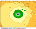
18z HAFS-A gets to 905 mb and makes landfall around 910. Terrifying.
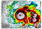
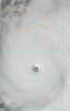
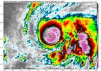
Big blowup on the NW eyewall. Seen some talk on Twitter about some sort of pseudo-EWRC ongoing but no one really seems to know what’s going on for sure or how it will impact intensification.
View attachment 175698
Probably a eyewall meld as the eye went from 8 miles to 15 miles. Also the CDO on the west side is much better then it was 30 minutes ago.
928 mb.
202
URNT15 KWBC 270034
NOAA2 1713A MELISSA HDOB 23 20251027
002500 1640N 07705W 6961 03070 9933 +101 +120 114066 070 /// /// 05
002530 1638N 07706W 6968 03048 9927 +096 +117 116074 076 /// /// 05
002600 1636N 07707W 6951 03056 9909 +097 +120 117080 082 /// /// 05
002630 1635N 07708W 6955 03035 9886 +101 +123 124085 088 /// /// 05
002700 1633N 07709W 6953 03024 9867 +104 +126 128089 092 /// /// 05
002730 1631N 07710W 6959 02993 9845 +105 +122 126094 096 /// /// 05
002800 1630N 07711W 6950 02976 9813 +103 +125 128102 104 /// /// 05
002830 1628N 07712W 6954 02936 9771 +104 +127 130110 114 /// /// 05
002900 1627N 07713W 6951 02886 9709 +108 +125 134121 128 /// /// 05
002930 1625N 07714W 6937 02845 9639 +115 +156 135122 128 /// /// 05
003000 1624N 07714W 6873 02865 9567 +123 +324 140120 127 /// /// 05
003030 1622N 07715W 6960 02708 //// //// +399 ////// /// /// /// 29
003100 1621N 07717W 6955 02680 9354 +221 +388 138039 /// /// /// 05
003130 1619N 07718W 6961 02645 9344 +224 +170 133036 040 /// /// 03
003200 1618N 07719W 6970 02604 9317 +227 +137 141011 032 /// /// 03
003230 1616N 07721W 6969 02600 9338 +202 +135 296026 036 /// /// 03
003300 1614N 07722W 6969 02639 9384 +191 +130 293064 076 /// /// 03
003330 1612N 07723W 6981 02701 9471 +181 +137 297098 109 /// /// 03
003400 1611N 07724W 6968 02808 9574 +169 +140 296107 112 /// /// 03
003430 1609N 07725W 6966 02874 9673 +140 +146 292098 101 /// /// 05
ThomeWx
Member
I think Irma had one of these:Probably a eyewall meld as the eye went from 8 miles to 15 miles. Also the CDO on the west side is much better then it was 30 minutes ago.
Looks like both rapid cooling in CDO and mesovorts in the eye on latest frames.

