rooting for this little backdoor wedge to nab as much as the board as possible, we probably don't have many more sub-60 DP days left in the tank until september
-
Hello, please take a minute to check out our awesome content, contributed by the wonderful members of our community. We hope you'll add your own thoughts and opinions by making a free account!
You are using an out of date browser. It may not display this or other websites correctly.
You should upgrade or use an alternative browser.
You should upgrade or use an alternative browser.
Pattern May Thread
- Thread starter Detective WX
- Start date
RollTide18
Member
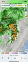
We’ve been getting rain bands here all day, almost like a tropical system
Me shame and Liz got a bet going for total precip from now until 8pm on Tuesday.
I say over 2.5 inches for RDU and over 1.5 inches for Shane’s house. Shane took the under on both and Liz says over 2.0 for Shane’s place and over 1.0 for RDU … let’s see where things shake out but I believe we’re in for a sizable rain maker in NC
I say over 2.5 inches for RDU and over 1.5 inches for Shane’s house. Shane took the under on both and Liz says over 2.0 for Shane’s place and over 1.0 for RDU … let’s see where things shake out but I believe we’re in for a sizable rain maker in NC
We needed this soaking rain desperately.
How are things now? Looks like a deluge throughout all of Georgia right nowI just had a brief sprinkle, the humidity has only come up to 58% after 9PM. I wonder how much time we have before the Allatoona and Lanier really start to drop levels. The prior wet periods have the river flow probably fairly close to normal, at least for now. To go 40 to 50+ days without any significant rainfall into June could really start some serious evaporation out of both lakes.
Yeah less than ideal if you didn't protect them. Hopefully wind stayed up or too dry for frost, they may be okI hope my maters are ok????
Not a veggie growing expert, but this can’t be good View attachment 118692
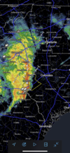
It’s great, thankfully! I really thought we might miss the bulk to the west based on some short range guidance during the 00z runs, but the It’s been good. Most stations are reporting over an inch already.How are things now? Looks like a deluge throughout all of Georgia right now
gawxnative
Member
Well as of now here in central Walton County 1.98 in gauge so farHow are things now? Looks like a deluge throughout all of Georgia right now
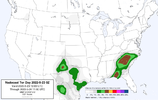
AI driven or not, i almost always take summer nado forecasts with a grain of salt. There's a paper i saw years ago (but still feels very true, it has completely stuck with me) that basically implied once you get into summer regimes you can basically throw STP and all of the model driven supercell/tornado parameters out (or at least respect them way less) as their accuracy of predicting outbreaks goes down a lot.View attachment 118693
Interesting
1.5 in. so far this morning.
Rosie
Member
Not .50 here so far?Well as of now here in central Walton County 1.98 in gauge so far
I’m at .67” so far.Not .50 here so far?
whatalife
Moderator
My Tempest is at 1.15", but it is generally 10-20% low, there are two stations on each side of me that I keep tabs on and one has 1.46" and 1.36".
You just got a new tempest didn't you? Its probably a little low, they are getting better, but are still generally short.I’m at .67” so far.
It took mine about 2-3 years to really dial in now it matches my old Davis or is within a few hundredths each event.You just got a new tempest didn't you? Its probably a little low, they are getting better, but are still generally short.


