NBAcentel
Member

Mar01, bitter cold and a low off the coast? 1980?
I don’t know if anyone has mentioned this but that TPV staying set up over Hudson Bay could also increase severe weather chances in the southeast as we go further into March and into AprilTPV has been relentless in Canada this year. Looks to continue into at least early March. Impossible to rule anything out because of that.
Yeah same exact thing we had in April 2020I don’t know if anyone has mentioned this but that TPV staying set up over Hudson Bay could also increase severe weather chances in the southeast as we go further into March and into April
If I remember correctly, wasn’t a good bit of that the result of thunderstorms along the wedge boundary in the Piedmont and UpstateYeah same exact thing we had in April 2020
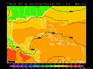
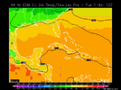
... and somewhere in the middle reality will meet up ... figuring high 60's/40's Hogtown ...Both yesterday’s 12Z GFS and the Sunday 18Z GFS had 32 at 12Z on March 1st all the way down to Pasco County in Florida:
View attachment 114220View attachment 114221
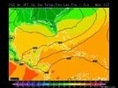
But today’s 12Z GFS has Pasco County 25 warmer (upper 50s) and ATL above 32:
View attachment 114222
The cows down there will love it ...For 12Z on 3/1, the Happy Hour GFS takes back 10 of those added 25 degrees at Pasco County, FL, with it in upper 40s vs upper 50s on today's 12Z (so, only another 15 degrees to go), and 32 on yesterday's 12Z. It also gets ATL back down to near 32. Thus, no toss from me:
View attachment 114234
What’s the difference vs posting cold maps and cold trends several times in January like I did, it’s the same thing just the opposite, it generated no issues. only difference is I’m doing warm now and since it’s not liked, then it has issues. it’s a impressive change that’s still happening and adjusting on models and I see no issue with posting it, we have warmed nearly 40F on some models, this is stuff that matches the February 2021 failHey massive changes warm warm warm
It would be more efficient to just set an automated message so you don't have to go to the trouble of posting it several times a day.
For 12Z on 3/1, the Happy Hour GFS takes back 10 of those added 25 degrees at Pasco County, FL, with it in upper 40s vs upper 50s on today's 12Z (so, only another 15 degrees to go), and 32 on yesterday's 12Z. It also gets ATL back down to near 32. Thus, no toss from me:
View attachment 114234
CPC, pretty classic -PNA/-EPO/SER look View attachment 114303View attachment 114304
Really love the big blocking signals up in the cold regions but that -PNA is really cutting into our fun .. if can’t fix that that SER isn’t going to have a problem winning all these battles through March. I’d lose hope (already have really) for any winter precip come late March if we can’t see any drastic changes + increasingly worse climoIt’s a pattern that could get us very warm days, but a breakdown of this sort of pattern would easily get us pretty cold, cold is on our side View attachment 114306View attachment 114307
Seems like we only get blocks when the -PNA is present lol (December for example), honestly a somewhat similar pacific configuration to December being modeled, difference is the Hudson Bay vortex, normally a -NAO ruins the fun for warmth but a Hudson Bay vortex could do the sameReally love the big blocking signals up in the cold regions but that -PNA is really cutting into our fun .. if can’t fix that that SER isn’t going to have a problem winning all these battles through March. I’d lose hope (already have really) for any winter precip come late March if we can’t see any drastic changes + increasingly worse climo
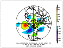
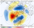
Really love the big blocking signals up in the cold regions but that -PNA is really cutting into our fun .. if can’t fix that that SER isn’t going to have a problem winning all these battles through March. I’d lose hope (already have really) for any winter precip come late March if we can’t see any drastic changes + increasingly worse climo
Lots of warm members on the temp spreads, it’s a great time of the year to be above average with that normally meaning upper 60s/70s which is great weather to do outdoor activities View attachment 114318
I think this is a good look for me!CPC, pretty classic -PNA/-EPO/SER look View attachment 114303View attachment 114304
Humidity and bugs are my 2 biggest complaints about summer.Here that means 80s, which is not good for outdoors from my standpoint unless dewpoints stay under 55. So, I'll be hoping for a lot of relatively dry air with any warmth. Who needs 80s when we get 80s+ almost every day for 5+ months straight? And of course there are the dreaded bugs. I love the dead of winter with virtually no flying bugs!
If it can stay dry, then at least the skeeters will be delayed.
