olhausen
Member
Got down to 22 last night! Wasn’t excepting that.

Hope you get to see some snow, looks like the event is trending N with the snow!I’ll be in Mason City IA Thursday through Sunday for work.
56 today might as well have been -30
winter...is that you?56 today might as well have been -30
Lol records being set with bogus sensorOnly made it to 34 at RDU after a forecast low of 32. Earliest freeze on record potential still intact, but we’ll see what happens.
GSO hit 28, so they’re good, though.
Tbf it was only 2 degrees warmer than surroundings , within reason to expect it to read that given its settingLol records being set with bogus sensor
OkTbf it was only 2 degrees warmer than surroundings , within reason to expect it to read that given its setting
Lol records being set with bogus sensor


It's weird though isn't it? That in a field as scientific as meteorology that "records" are based off of one data point, seems the least scientific way to meThat may be, but it’ll be the record if it stands, either way. I’m sure it was below freezing in the surrounding countryside.
Kinda sad we got beat by ATL for last night's low.
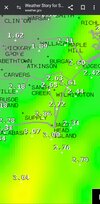
You know it's getting bad when the "normally cold" location was roxboro and now it's roxboro, Oxford, lousuburg, Siler city, sanford, southern pines, asheboro. Strange how the cold locations grew right?It's weird though isn't it? That in a field as scientific as meteorology that "records" are based off of one data point, seems the least scientific way to me
It's weird though isn't it? That in a field as scientific as meteorology that "records" are based off of one data point, seems the least scientific way to me
You know it's getting bad when the "normally cold" location was roxboro and now it's roxboro, Oxford, lousuburg, Siler city, sanford, southern pines, asheboro. Strange how the cold locations grew right?
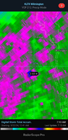
That's interesting. I know at least ground level got below freezing last night my yard got smokedIndeed, although in last night’s case in particular it doesn’t look like Sanford, Siler City, Asheboro, or Southern Pines got below freezing, either.
Sanford: 35Indeed, although in last night’s case in particular it doesn’t look like Sanford, Siler City, Asheboro, or Southern Pines got below freezing, either.
That was my fault I opened a bunch of freezers facing your yard last night … all on your power as well !That's interesting. I know at least ground level got below freezing last night my yard got smoked

This look right here is the new normal.Way out there GFS but continues to point to cool start to April with potential for another frost freeze for mtn/piedmont peeps;
View attachment 147157


 hope everyone that loves cold is out enjoying it
That low mid to late week could be a hell of a rain maker
Yay. More rain. And going to be so awesome having winter in spring.Lol wind chills in the mid 20s tomorrow morning
Can’t wait for the 70s and 80s to come backYay. More rain. And going to be so awesome having winter in spring.
Pool weather tomorrowCan’t wait for the 70s and 80s to come back
Looks like after that mid to late week rain. Easter weekend looks gorgeousCan’t wait for the 70s and 80s to come back
 we'll see what happens but apparently the winds are super high tomorrow already even without storms
I miss Shetley!Looks like another non-interesting quick-hitting rain event mid-week. This weather is so boring. Hopefully Easter weekend will be nice.
")

Looks like we get another couple chances at freezes at RDU the next couple nights. Can we do it?
 KGSO only made it down to 34, too.
What are you doing outside to enjoy it?What picture perfect weather today, my goodness!
It was rough this morn and still feeling those WC's mid afternoon.Lol wind chills in the mid 20s tomorrow morning