lexxnchloe
Member
I saw where the euro also shows a very big ridge and that is why we still need to watch
06z Icon still shifting west.....Yeah but with that trough coming off the east coast it can only go so far west. However this is a change from previous runs so we need to see if any other guidance jumps on board

In my opinion if Renee was not there to help weaken the Ridge then this would have been a very serious threat to the East Coast but as it stands as long as she hangs out as a Remnant low it should help to recurve TD 20I saw where the euro also shows a very big ridge and that is why we still need to watch

I agree.....about the time I'm ready to ditch it, the model finds a subtle idea that the rest are not seeing......moments of brillianceEven though the ICON is not the best model (for example, it did the worst with 94L), this is the kind of thing that keeps me at about a 95% chance of OTS instead of near 100% as it is too soon to do so, especially considering the complexities of the pattern and that is is La Niña. Regarding this ICON run, one has to wonder if at least a short term WNW move would have soon started after this near stall considering that massive 1036 mb NE US high would be traversing to the north of it along with probably at least a short lived upper ridge building back in.
Even though the ICON is not the best model (for example, it did the worst with 94L), this is the kind of thing that keeps me at about a 95% chance of OTS instead of near 100% as it is too soon to do so, especially considering the complexities of the pattern and that is is La Niña. Regarding this ICON run, one has to wonder if at least a short term WNW move would have soon started after this near stall considering that massive 1036 mb NE US high would be traversing to the north of it along with probably at least a short lived upper ridge building back in.
Does this get closer to what you have in mind?@GaWx looking at the 18z gfs I think the only way we see any change to the track idea is if that trough is more east to west oriented so it stalls Teddy out. The the high would need to anchor as the trough weakened.
Just don't see that happening.


Same day, 9/23, GFS gets closer but doesn't anchor......I'd think you want the high centered more off of the NE coast versus down over NC and the ridge axis to be east west and further east........that's just to stall itand keep it from following Paulette. Sort of like this.

Same day, 9/23, GFS gets closer but doesn't anchor......
View attachment 48496


It's interesting to note that Teddy continues to move further westward on the models. It breaks the trough on the GFS.I mean if that big ridge is moving east a bit faster then maybe Teddy is gonna get further west than forecast...
View attachment 48532


It's interesting to note that Teddy continues to move further westward on the models. It breaks the trough on the GFS.View attachment 48533
Teddy leaves something behind with High over northeast.....and its headed west.....What would really change the game is if this center relocation tonthe SW allows him to stay more WNW for a while before turning. Long shots and unlikely but this wasnt an insignificant move to the west.

For Teddy: This 12Z EPS, out to 240, gets a few members close to the NE US!

Strong members too
.png")
All the modes except Icon pull it north at 60w. Incon is running over 60w but at north west path.Still shifting west?
Sent from my iPhone using Tapatalk


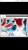
The 12z ICON gets extremely close to the NE due to a trough, and a stronger ridge to the NE.View attachment 48652View attachment 48653
One click away....The 12z ICON gets extremely close to the NE due to a trough, and a stronger ridge to the NE.View attachment 48652View attachment 48653
But....it did rather well for Laura, when no other models were picking it up....this is what I've been worried about. The models are never precise in movement of the highs.....a little window can make a big dfference.Although the ICON is far from the best model (look at how bad it did with 94L in NC...it was the worst model for that), a NE US hit can’t at all be ruled out as even some EPS members have shown hits there.
I think the Icon overamplifies storms, therefore showing signals of development. For example, I remember it showing Isaias in the mid-960's. 94L into a tropical storm, laura developing etc.But....it did rather well for Laura, when no other models were picking it up....
But....it did rather well for Laura, when no other models were picking it up....this is what I've been worried about. The models are never precise in movement of the highs.....a little window can make a big dfference.


The 12z ICON gets extremely close to the NE due to a trough, and a stronger ridge to the NE.View attachment 48652View attachment 48653