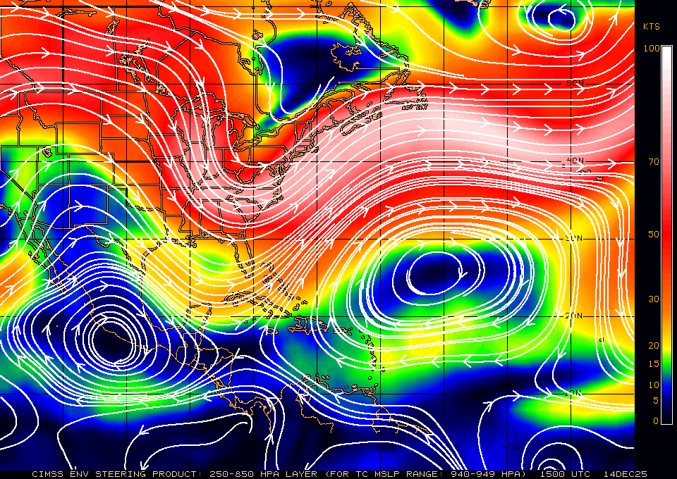
That's a pretty good jump west both at coast and inland right?
Honestly that doesn't surprise me Larry.....That is more than likely because of the center relocation. lets see where this goes.Wow, 0Z Euro at 24 is a whopping 100 miles east of the 12Z run!
From hr 24 to hr 48 it picks up speed and strength and moves NNW into Center GOM
looks like its a bit faster than the 00z run last night...def stronger.After all of that, he looks like he may actually landfall a little WEST of the 12Z due to getting to the coast sooner!
I just noticed that.In other news recon almost supports a hurricane
it did speed up a little bit. I t think the EURO is about the most southern/East I think at this point. or at least the possible track, on the southern side. GFS would obviously be the furtherest West track at this point.0Z Euro landfall near Apalachicola again but 6 hours earlier.
Yeah Florence looked like this on the HWRF also, but we all know how that played out. I’m sure they’ve already started seeding Michael
View attachment 6768
Taking on that shape other storms have before before exploding into monsters Reference Maria and Irma...ughh
over SGA and kicking....still looks like this run is a bit West from comparing it to the 00z run last night. trying to see about the 12z run...Larry, it appears its a little W from the 12z run as well?
That tells me this will have a general N to NNW movement, IF** it reaches that strength. That level is for if this gets down in the 94x mb range.what is this steering map telling us? if it stays this way a more WNW track for a bit?
![]()
Yes sir...I did notice that the heavier rain shield and the higher wind gusts, as forecasted by the doc, was a bit West this run. mainly made a bigger difference over Central GAChris,
It looks to be about the same from landfall on vs 12Z with it being about 6 hours faster. The inland track looks very similar to the last 2 Euros to me.