Brent
Member
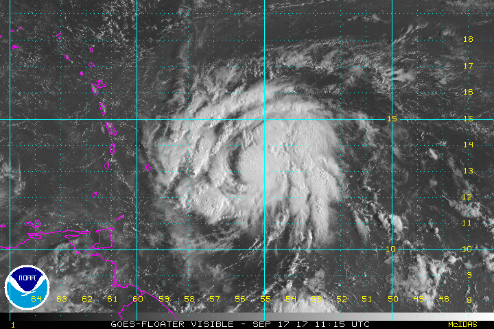
It has a closed eye per vdm

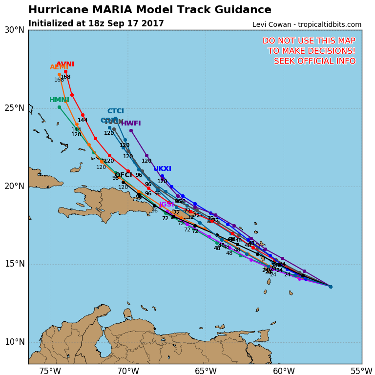
and comes off at 957 ... but looking north ... this run ...Euro goes right over the eastern part of Hispaniola
Sent from my SM-J320VPP using Tapatalk


Maria will be following it inland this run I'm sure.And Jose hits Virginia....
Maria will be following it inland this run I'm sure.
For the SE US, the 12Z GEFS members illustrate well that a further SW than expected track in the vicinity of the Greater Antilles would mean an increased danger.

Still heading N but has no path
Sent from my SM-J320VPP using Tapatalk
Looks like Maria will likely be a Hurricane soon, if not already. Cloud tops starting to blossom close to the COC. Here we go.
Yep, I think that we will see a much better storm later today. She may even be a hurricane now per recon, but I am waiting on the nest pass to confirm.
Still heading N but has no path
Sent from my SM-J320VPP using Tapatalk

If Jose does that it will be officially the most anoying storm in history.
Yep, officially will be one at 5.Maria is a hurricane per ATCF
Probably a NE hit this run.Still headed due North
Sent from my SM-J320VPP using Tapatalk
Good they can have itYep, officially will be one at 5.
Probably a NE hit this run.

Why annoying? Jose may save the SE from a major problem if he hangs around.

Im with ya on that one. Ready to move onGood they can have it
Sent from my SM-J320VPP using Tapatalk
The very slow northward movement of a H just offshore the NE US has been pretty rare. The last one I could find that was fairly similar was Esther of 1961:
http://weather.unisys.com/hurricane/atlantic/1961/ESTHER/track.gif
Before that, you may have to go all of the way back to 1899:
http://weather.unisys.com/hurricane/atlantic/1899/3/track.gif
Before that, I found 2 in 1889:
http://weather.unisys.com/hurricane/atlantic/1889/3/track.gif
http://weather.unisys.com/hurricane/atlantic/1889/4/track.gif

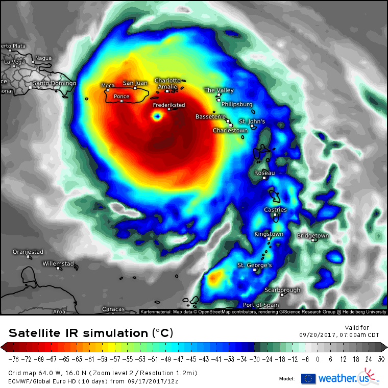
You have a link to this site, really love the IR color scheme on the Euro.