12z WRF-NMM keeps it over the ocean all the way to the panhandle.
-
Hello, please take a minute to check out our awesome content, contributed by the wonderful members of our community. We hope you'll add your own thoughts and opinions by making a free account!
You are using an out of date browser. It may not display this or other websites correctly.
You should upgrade or use an alternative browser.
You should upgrade or use an alternative browser.
Tropical Major Hurricane Irma (Part 2)
- Thread starter ForsythSnow
- Start date
WTH..?.. Well... an unprecedented storm like this is going to throw everyone for a loop I suppose.
MOVE Be-Otch !!
MOVE Be-Otch !!
- Joined
- Sep 4, 2017
- Messages
- 216
- Reaction score
- 260
We'll see how long this lasts. Steering has temporarily broken down. The storm is left to its own accord determining motion. Will the steering remain neutral for the next 6 hours? Will the storm drift SW back into Cuba due to land friction? Will the digging SW finally latch on and the storm move straight North? Has the weakening changed the level of the steering flow to more neutral? If it gets through this ERC thingy and begins to deepen what level of the steering will have the most influence? Back W, WNW, NNW hell SSW? The plot thickens lmfao. Then again it could just last an hour and we're back to the races 
- Joined
- Sep 4, 2017
- Messages
- 216
- Reaction score
- 260
All I can say is this is why, this freakin why I'm obsessed lol
pcbjr
Member
This is an interesting map. It is the maritime traffic flow, reflecting live updates for commercial vessels.
If you want to see how shipping companies are reacting to (and in reality projecting) the storm, this is an interesting view, since it shows how mariners and their companies are seeing it. Lives, ships, and money are what they are dealing with.
You can zoom in and out and move across the world. You can see the directions ships are headed, as well as what the ships are, by type and by name. Plus more!
It’s certainly a few minutes of fun! At least for me.
https://www.marinetraffic.com/en/ais/home/centerx:-78.3/centery:25.4/zoom:6
pcbjr
Member
that and it's like listening to Bob and Jerry do something totally dissimilar with the same note and create harmony ...All I can say is this is why, this freakin why I'm obsessed lol
pcbjr
Member
Hey - $280 more and a member has a matching 10% ...
All I can say is this is why, this freakin why I'm obsessed lol
This and the Inauguration Day Windstorm of 1993 in Seattle have fascinated me more than any other storms I have monitored.. I love that this time around I get to share my geekdom with all you awesome folks as well!!!
We'll see how long this lasts. Steering has temporarily broken down. The storm is left to its own accord determining motion. Will the steering remain neutral for the next 6 hours? Will the storm drift SW back into Cuba due to land friction? Will the digging SW finally latch on and the storm move straight North? Has the weakening changed the level of the steering flow to more neutral? If it gets through this ERC thingy and begins to deepen what level of the steering will have the most influence? Back W, WNW, NNW hell SSW? The plot thickens lmfao. Then again it could just last an hour and we're back to the races
Well the problem is the weakness is just that, a weakness, it is not a strong trough or ULL. I guess the strong hot outflow is enough to pump the ridge enough to slow it down.
I think she might have hit the breaks. Y’all know what that means?
pcbjr
Member
Yea and it would be censored to use the word ...I think she might have hit the breaks. Y’all know what that means?
Storm5
Member
Yep east and OTSI think she might have hit the breaks. Y’all know what that means?

Sent from my SM-J320VPP using Tapatalk
VegasEagle
Member
LIVE Southern Most Beach Resort Beach & Pier
VegasEagle
Member
LIVE Two Friends Roof Top Key West
Xtreme Weather
Member
HMON again little W early and way W into AL basically Montgomery to Birmingham track
accu35
Member
Irma still moving W/WNW on radar. Slow but shes moving
pcbjr
Member
If this storm goes anywhere that does not devastate forcasted mankind, all the better ... except, next time, no one will pay attention ... the conundrumYep east and OTS
Sent from my SM-J320VPP using Tapatalk
Storm5
Member
HWRF similar inland track fwiwHMON again little W early and way W into AL basically Montgomery to Birmingham track
Sent from my SM-J320VPP using Tapatalk
NWMSGuy
Member
Not sure if it's been posted but has anyone seen the footage from Long Island in the Bahamas of the water being pulled away from the shoreline?
Storm5
Member
Saw it this afternoon , amazing videoNot sure if it's been posted but has anyone seen the footage from Long Island in the Bahamas of the water being pulled away from the shoreline?
Sent from my SM-J320VPP using Tapatalk
Xtreme Weather
Member
Looking at surface wind gust approaching 60-70mph now for most of E Central AL and W GAHWRF similar inland track fwiw
Sent from my SM-J320VPP using Tapatalk
W
WeatherLC
Guest
Looking at surface wind gust approaching 60-70mph now for most of E Central AL and W GA
Assuming north Georgia is now getting lesser gusts per that model?
Sent from my iPhone using Tapatalk
- Joined
- Sep 4, 2017
- Messages
- 216
- Reaction score
- 260
Yes. Which is why I haven't been buying into any of the re curves the models have been selling for the last week.Well the problem is the weakness is just that, a weakness, it is not a strong trough or ULL. I guess the strong hot outflow is enough to pump the ridge enough to slow it down.
W
WeatherLC
Guest
Yes. Which is why I haven't been buying into an of the re curves the models have been selling for the last week.
Then what's stopping it from going to
 ?
?Sent from my iPhone using Tapatalk
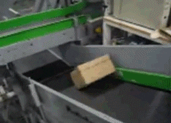
pcbjr
Member
Ignoring everything else ... there is a conveyor belt ... but that factory is out of commission ... https://earth.nullschool.net/#current/wind/isobaric/500hPa/orthographic=-99.29,49.14,586Then what's stopping it from going to?
Sent from my iPhone using Tapatalk
Looking at surface wind gust approaching 60-70mph now for most of E Central AL and W GA
It's OK we will be fine. Another day and it will be in MS.
DadOfJax
Member
With a PCB landfall!It's OK we will be fine. Another day and it will be in MS.
pcbjr
Member
we'll see ...With a PCB landfall!
doubt it ...
but would beat a pcbjr landfall ....
BHS1975
Member
Pretty decent couplet

Sent from my iPhone using Tapatalk

Sent from my iPhone using Tapatalk
accu35
Member
Anything from 18z gefs?
Storm5
Member
Looks like a turn North should take place soon

Sent from my SM-J320VPP using Tapatalk

Sent from my SM-J320VPP using Tapatalk
- Joined
- Sep 4, 2017
- Messages
- 216
- Reaction score
- 260
Think it's reached the edge of the ridge. The SW is just now rounding the bottom of the main trof. The SW is forecast to erode the steering ridge just enough and provide a weakness for the storm to go poleward. As I and others have been saying none of these features are strong enough to dominate the playing field so other more subtle influences play a bigger part, i.e. the ULL to it's SW in the carib is altering the steering flow around the storm, the ridge to the west is altering the steering flow for the SW, the ridge in the Atlantic is stubbornly strong with it's westward extension. Not to mention the upper level high on top of the storm thats been very strong is altering the upper levels directly around the storm. With none of these being dominate it's kind of a stand off. Not your normal trof swoops down and picks up a storm scenario, never has been. just my opinion.Then what's stopping it from going to
Sent from my iPhone using Tapatalk
Storm5
Member
Here ya goAnything from 18z gefs?

Sent from my SM-J320VPP using Tapatalk
Xtreme Weather
Member
I say this with caution but appears Irma may be moving little faster now... Resumes the WNW track LoL
Sent from my iPhone using Tapatalk
Sent from my iPhone using Tapatalk
I said this earlier but do not be surprised to see Irma not weaken as much if at all when the shear increases. The shear will be mostly south to southwesterly, Irma will speed up moving north. The speed increase will nullify a good bit of the shear. We see this happen all of the time in the north Atlantic.
accu35
Member
Thats what i stated earlier Lol.I say this with caution but appears Irma may be moving little faster now... Resumes the WNW track LoL
Sent from my iPhone using Tapatalk
pcbjr
Member
2 minor things -Think it's reached the edge of the ridge. The SW is just now rounding the bottom of the main trof. The SW is forecast to erode the steering ridge just enough and provide a weakness for the storm to go poleward. As I and others have been saying none of these features are strong enough to dominate the playing field so other more subtle influences play a bigger part, i.e. the ULL to it's SW in the carib is altering the steering flow around the storm, the ridge to the west is altering the steering flow for the SW, the ridge in the Atlantic is stubbornly strong with it's westward extension. Not to mention the upper level high on top of the storm thats been very strong is altering the upper levels directly around the storm. With none of these being dominate it's kind of a stand off. Not your normal trof swoops down and picks up a storm scenario, never has been. just my opinion.
1) No real change from 2:00 PM officially; and
2) It is about time for now-casting.
Having said as much, my gut tells me more east by about 20 - 40 miles since that looks like the path of least resistance, at this point in time, anyway (sure to change in 3 hours) ...