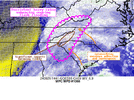
My back yard in Pendleton is going to have fun. Told wife to prepare for extended power issuesIt’d be a lot cooler storm to track if HRRRRR kept me out of the NE eyewallView attachment 151993
-
Hello, please take a minute to check out our awesome content, contributed by the wonderful members of our community. We hope you'll add your own thoughts and opinions by making a free account!
You are using an out of date browser. It may not display this or other websites correctly.
You should upgrade or use an alternative browser.
You should upgrade or use an alternative browser.
Tropical Major Hurricane Helene
- Thread starter SD
- Start date
- Status
- Not open for further replies.
my live stream will start around 5-6 pm est


Benholio
Member
I believe it is a matter of which models. The global models are going more east, but the more specialized tropical models are pretty consistent with the NHC cone:Based on modeling, the center is far more likely to go over Athens than Atlanta.
And yes, it's beyond frustrating the NHC continues to not explain their reasoning. Especially in this social media age with so much modeling data available to the layman.

Sat over the last few hours has a pretty consistent NE movement
Makeitsnow
Member
Isn't it that the truth. I'm essentially ground zero for the eye on much of the guidance and it's not fun worrying about how much damage there will be and how many days am i going to be without power. I don't normally get nervous or worried over big weather events but I have been with this one.It’d be a lot cooler storm to track if HRRRRR kept me out of the NE eyewall
WPC with a large high risk of flooding
Impressive. I'm up to around 3.75 so far. They have some ominous wording in their meso discussions.
Mesoscale Precipitation Discussion 1066
NWS Weather Prediction Center College Park MD
1049 AM EDT Thu Sep 26 2024
Areas affected...Southern Appalachians
Concerning...Heavy rainfall...Flash flooding likely
Valid 261449Z - 262030Z
Summary...Widespread heavy rain downstream of Hurricane Helene
will continue today into the Southern Appalachians. Rainfall rates
of 1-2"/hr are likely, which through repeating rounds could
produce 2-3" of rain with local maxima of 5". This will enhance
flash flooding, with significant impacts becoming likely across
the Southern Blue Ridge.
Discussion...The regional radar mosaic this morning shows an
expansive area of heavy rain across much of the Southeast and into
the Southern Appalachians. This is associated with a pronounced
moisture plume noted in the GOES-E WV imagery extending downstream
from Hurricane Helene in the Gulf of Mexico. PWs within this
moisture plume have been measured as high as 1.75 to 2.0 inches on
the 12Z U/A observed soundings from KRAX and KFFC. Instability is
somewhat limited, only around 100-250 J/kg of MLCAPE, but deep
layer ascent is impressive. Mid-level divergence between Helene
and a pronounced upper low over IN is combining with a nearly
stationary poleward arcing jet streak over TN to leave favorable
RRQ over the region, while low-level SE flow continues to upslope
into the terrain. In this environment, rainfall rates have already
been measured via MRMS as high as 1.25", and these will likely
continue through the aftn.
During the next several hours, persistent moderate to heavy rain
with rates 0.5-1"/hr will lift northward across the area, with
embedded convective cells producing locally enhanced rain rates to
2"/hr as reflected by HRRR 15-min rainfall exceeding 0.5". 850mb
inflow will remain out of the S/SE through the aftn while
gradually intensifying to above 30 kts, resulting in moisture flux
that is progged by the SREF to exceed +3 sigma later today. This
impressive moisture advection combining with nearly unchanging
robust ascent will result in continuous rainfall into areas that
have already received 4-8+" of rain the past 24-hours. The HREF
neighborhood probabilities indicate a 50-70% (10-20%) chance of
more than 3" (5") of rain the next 6 hours, with the highest
probabilities across Upstate SC and into far western NC along the
Blue Ridge. Elsewhere in northeast GA, eastern TN, and southwest
VA, 1-3" of additional rainfall is likely through the aftn.
This rainfall occurring atop saturated soils, sensitive terrain,
and ongoing flash flooding, will almost certainly enhance impacts
across the region. FFG has been extremely compromised to as low as
0.25"/3hrs for which the HREF exceedance probabilities reach above
70%. This lends high confidence to flash flooding and impacts as
rain continues across the region. However, across the Blue Ridge,
current streamflow anomalies are as much as 400-600% of normal, so
any additional rainfall could quickly result in significant and
life-threatening flash flood impacts.
Additional rainfall this evening will almost certainly necessitate
future MPD issuances across this region with widespread
significant flash flooding, and possibly locally catastrophic
impacts, developing as the rain persists and becomes even more
intense into tonight.
Attachments
Saw this posted. It’s early boys 
NEGaweather
Member
Sent from my iPhone using Tapatalk
Part of me wishes I chased the floods vs the cane.
HRRR has been ticking west the past few runs
Shaggy
Member

Drizzle Snizzle
Member
Would have been a shorter drivePart of me wishes I chased the floods vs the cane.
- Joined
- Jan 5, 2017
- Messages
- 3,802
- Reaction score
- 6,051
I noticed that, too. Still pretty far east compared to NHC.HRRR has been ticking west the past few runs
Yeah all of the weakening talk isn’t doing a lot to calm my worries being that we’ll be on the east/northeastern side of things for the duration of the storm. Hardly a consolation prizeIsn't it that the truth. I'm essentially ground zero for the eye on much of the guidance and it's not fun worrying about how much damage there will be and how many days am i going to be without power. I don't normally get nervous or worried over big weather events but I have been with this one.
Impressive. I'm up to around 3.75 so far. They have some ominous wording in their meso discussions.
Mesoscale Precipitation Discussion 1066
NWS Weather Prediction Center College Park MD
1049 AM EDT Thu Sep 26 2024
Areas affected...Southern Appalachians
Concerning...Heavy rainfall...Flash flooding likely
Valid 261449Z - 262030Z
Summary...Widespread heavy rain downstream of Hurricane Helene
will continue today into the Southern Appalachians. Rainfall rates
of 1-2"/hr are likely, which through repeating rounds could
produce 2-3" of rain with local maxima of 5". This will enhance
flash flooding, with significant impacts becoming likely across
the Southern Blue Ridge.
Discussion...The regional radar mosaic this morning shows an
expansive area of heavy rain across much of the Southeast and into
the Southern Appalachians. This is associated with a pronounced
moisture plume noted in the GOES-E WV imagery extending downstream
from Hurricane Helene in the Gulf of Mexico. PWs within this
moisture plume have been measured as high as 1.75 to 2.0 inches on
the 12Z U/A observed soundings from KRAX and KFFC. Instability is
somewhat limited, only around 100-250 J/kg of MLCAPE, but deep
layer ascent is impressive. Mid-level divergence between Helene
and a pronounced upper low over IN is combining with a nearly
stationary poleward arcing jet streak over TN to leave favorable
RRQ over the region, while low-level SE flow continues to upslope
into the terrain. In this environment, rainfall rates have already
been measured via MRMS as high as 1.25", and these will likely
continue through the aftn.
During the next several hours, persistent moderate to heavy rain
with rates 0.5-1"/hr will lift northward across the area, with
embedded convective cells producing locally enhanced rain rates to
2"/hr as reflected by HRRR 15-min rainfall exceeding 0.5". 850mb
inflow will remain out of the S/SE through the aftn while
gradually intensifying to above 30 kts, resulting in moisture flux
that is progged by the SREF to exceed +3 sigma later today. This
impressive moisture advection combining with nearly unchanging
robust ascent will result in continuous rainfall into areas that
have already received 4-8+" of rain the past 24-hours. The HREF
neighborhood probabilities indicate a 50-70% (10-20%) chance of
more than 3" (5") of rain the next 6 hours, with the highest
probabilities across Upstate SC and into far western NC along the
Blue Ridge. Elsewhere in northeast GA, eastern TN, and southwest
VA, 1-3" of additional rainfall is likely through the aftn.
This rainfall occurring atop saturated soils, sensitive terrain,
and ongoing flash flooding, will almost certainly enhance impacts
across the region. FFG has been extremely compromised to as low as
0.25"/3hrs for which the HREF exceedance probabilities reach above
70%. This lends high confidence to flash flooding and impacts as
rain continues across the region. However, across the Blue Ridge,
current streamflow anomalies are as much as 400-600% of normal, so
any additional rainfall could quickly result in significant and
life-threatening flash flood impacts.
Additional rainfall this evening will almost certainly necessitate
future MPD issuances across this region with widespread
significant flash flooding, and possibly locally catastrophic
impacts, developing as the rain persists and becomes even more
intense into tonight.


Pressure staying steady it seems
A little off topic but with all of the overbuilding we’ve seen here in the last 3 years I’m curious to see how the rivers and new home sites look after tomorrow. I have a feeling there’s going to be a lot of issues in that department
Perhaps the current SE radar loop can offer some clues. The rain shield associated with the trough over the SE is moving north rather than NE even as the rain shield is retrograding NW. Offering some ground truth to the expected northward or even NNW turn post-landfall?
To your last point, part of the problem is in the same way we fixate over where the track of the center leans left (west) or right (east) we also get caught up over where the cone is. We seem to be having a hard time communicating that the main concern is Helene is going to have significant impacts over a swath of 400 miles. That’s what the emphasis should be about, that’s why NHC amended their forecast cone products to display weather bulletins because they want to stress that it doesn’t only matter who’s inside the cone what matters is if you’re going to be impacted in any capacity that information is properly communicated to the general public. It’s also like this weird discourse going on in this thread about impacts on Atlanta. Impacts to some degree to power outages, tree damage, and flooding will be felt across the city regardless of Helene’s center going west, east, or on top of us. Will it be as bad as Athens or further east based on the current forecast? No, probably not, but you go back 12-24hrs ago it was a different scenario. Forecasts EVOLVE and change, they don’t stay stagnant.I still think the worst of the winds will be east of a dawsonville to Lawrenceville to Forsyth line.(gusts at or over 60). I'm having a real difficult time understanding the nhcs reasoning being so far west when just about every model is to the east...some well to the east of their track. It's rather frustrating they still wont address their reasoning. My neck of the woods/Athens area seems poised to be slammed regardless...but it seems obvious very strong winds are going to be extended well into the Carolinas. One just hopes people there aren't caught off guard because they see the nhc track so far to the west.
Just to make this clear, I quoted you, but this response is not directed specifically to you. I’m speaking in general about the situation.
Don’t know how this is not a strengthening storm with a pinhole eye

- Joined
- Jan 2, 2017
- Messages
- 1,567
- Reaction score
- 4,282
One can only hope it deters further development...A little off topic but with all of the overbuilding we’ve seen here in the last 3 years I’m curious to see how the rivers and new home sites look after tomorrow. I have a feeling there’s going to be a lot of issues in that department
Gonna be a lot of new home sites washed out onto others properties...silt fences don't stand a chance and neither do building material prices..watch em sky rocket!
HugeSnowStick
Member
This was always depicted in the tropical models, coming straight North out of the Gulf, where she ends up, who knows. The last loop is a northward speed, even some NNW?Perhaps the current SE radar loop can offer some clues. The rain shield associated with the trough over the SE is moving north rather than NE even as the rain shield is retrograding NW. Offering some ground truth to the expected northward or even NNW turn post-landfall?
Drizzle Snizzle
Member
1.80” so far bringing the monthly total to 7.50”.
NWMSGuy
Member
Anyone having issues with NOAA webpages?
HugeSnowStick
Member
Yes, I have just been refreshing the page.Anyone having issues with NOAA webpages?
Shaggy
Member
Your best bet is to use the Recon data center fixes for direction path of motionThis was always depicted in the tropical models, coming straight North out of the Gulf, where she ends up, who knows. The last loop is a northward speed, even some NNW?
Brent
Member
Don’t know how this is not a strengthening storm with a pinhole eye
View attachment 152003
Because recon reported a 55 mile wide eye I guess it has double eyewalls? Until that clears up it won't bomb

The Tampa radar is starting to get this thing within range and the core structure is a lot more apparent than looking at IR satellite.
South AL Wx
Member
I called it first lol.
Though there does seem to be some dry air intrusion on the southeast side now
Well, good thing this has not super strengthened like all models said it would so far. That is a good thing. Either way, the rain and winds will obviously be a problem for many areas.
HugeSnowStick
Member
Rain is beginning to get much heavier in the ATL.
You can now see the core of the storm on Tampa Bay's radar. 
Iceagewhereartthou
Member
Guys, here's a good site to follow the rain totals. You can set for past 12, 24, 36, 72, hours etc. It's not exact for all locations of course but gives a good overall picture to see where the heaviest rainfall has occurred. My area is in the 6-8 in band (already fallen past 72 hours) but MBY is already at 9 in since Tuesday evening. You can zoom and click on certain areas. Check it out.
 app.raindrop.farm
Get Recent Rainfall Totals By Clicking On A Map - US | RainDrop
View rainfall totals across the United States. Click on any location to view rainfall totals for time frames ranging from the past hour to the last 365 days
- Joined
- Jan 5, 2017
- Messages
- 3,802
- Reaction score
- 6,051
HRRR at 15Z moved about 15 miles closer to Atlanta...FWIW.
Mahomeless
Member
- Joined
- Oct 17, 2023
- Messages
- 900
- Reaction score
- 2,158
Being 15 miles west of the eye is going to feel like a walk in the park compared to being 100 miles east of it
NWS Peachtree City going down with the western track ship. We will see how it pans out

- Status
- Not open for further replies.