Snowflowxxl
Member
I’ve seen mets on WSB and CBS who are both still trying to say Atlanta could get 60 mph gust. They also show a path that has no chance of verifying. They all need to drop the act and report the facts
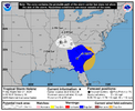
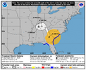
It’s going to have to make a hard left sometime soon for thatCore looks to have Toccoa in cross hair
I guess that could be a good thing for NW upstate. The further east it is the better.Core looks to have Toccoa in cross hair


"Any time now. It's going to turn north. We promise" - NHC, probablyIt’s going to have to make a hard left sometime soon for that
Exactly my thoughts. I feel it's just gonna run the savannah river..and that's where the 70mph gusts are being reported and the heaviest banding. The rainfall totals are gonna break every record known up this way. That mistake graphic nws put out is already correct here for the total...over 10"I guess that could be a good thing for NW upstate. The further east it is the better.
Sent from my SM-S911U using Tapatalk
"Any time now. It's going to turn north. We promise" - NHC, probably
Helen should turn northwestward later today
Don’t even get me started on these guys. They continued to forecast rain from the Labor Day storm while it was obvious models were completely off about it locally.I’ve seen mets on WSB and CBS who are both still trying to say Atlanta could get 60 mph gust. They also show a path that has no chance of verifying. They all need to drop the act and report the facts

Im in west Columbia/lexington area. . Wind is really howling and constant. Just lost powerEven with the slightly more north heading the center is going to get within 50 miles or so of Columbia.
Im in west Columbia/lexington area. . Wind is really howling and constant. Just lost power
Same here in Irmo, though I still have power somehow. Not expecting that to last much longerIm in west Columbia/lexington area. . Wind is really howling and constant. Just lost power
The baffling part to me is why they narrowed the cone so much when strong guidance was outside of it. The other thing is that typically when a hurricane is moving as quickly as this one has been and picking up speed, you usually don’t see the sharp turns in direction that they were showing.It looks like the Icon was right again about a major weather system days ahead of time. It’s rather baffling when the system is literally moving NE that you don’t at least widen your cone to include all possibilities.
Don’t even get me started on these guys. They continued to forecast rain from the Labor Day storm while it was obvious models were completely off about it locally.

It's definitely on the border right now...at this point anything is possible except for the predicted path of nhcIs this thing about to head into SC? Or am I not looking at it correctly.
Roughly 5000 power outages in Sumter County, SC
Yes. It’s about to cross the Savannah River into SC. As well as the NHC did with forecasting the RI and landfall point, the inland track is an utter disaster. If it doesn’t turn soon it’s literally going to track between GSP and CLTAre we already outside of the NHC cone that was issued at 5am? Sure looks close
