• Hello, please take a minute to check out our awesome content, contributed by the wonderful members of our community. We hope you'll add your own thoughts and opinions by making a free account!

Tropical Major Hurricane Helene

Status
Not open for further replies.
From RAH on Facebook.

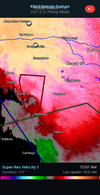
935 am: BREAKING - A period of particularly hazardous weather with very heavy rain, possible flash flooding, wind gusts of 50 mph or more and possibly a tornado will spread north into the Triangle area between 10am and 1pm. This is the time to hunker down and stay inside.
 

View attachment 152156

View attachment 152157

View attachment 152158

View attachment 152154


Edit, to be clearer

View attachment 152163
Wow..what a fail by the nhc for inland areas. They usually do well and don't deserve criticism but this one deserves it. Run after run of every model you could find showed this very path after landfall and they not only chose to ignore them...they didn't even bother to tell us why they were ignoring them. Instead choosing to stick with a path that scared the heck out of millions in Atlanta and surely catching millions off guard with the severity of the wind in the Carolinas and augusta. I simply don't understand why they did this. It's one thing to get a forecast wrong...that happens...but simply ignoring great model agreement is bizarre.
 
Wow..what a fail by the nhc for inland areas. They usually do well and don't deserve criticism but this one deserves it. Run after run of every model you could find showed this very path after landfall and they not only chose to ignore them...they didn't even bother to tell us why they were ignoring them. Instead choosing to stick with a path that scared the heck out of millions in Atlanta and surely catching millions off guard with the severity of the wind in the Carolinas and augusta. I simply don't understand why they did this. It's one thing to get a forecast wrong...that happens...but simply ignoring great model agreement is bizarre.
It could have costed lives.
 
From RAH:

950 am: A band of heavy rain and with frequent gusts of 40 to 50 mph will spread across the Triad over the next few hours. The heaviest rain and strongest storms and associated threat of a tornado will be across eastern locations including Alamance, Randolph & Guilford Counties.
 
950 AM EDT FRI SEP 27 2024

..FLASH FLOOD EMERGENCY FOR SMYTH AND GRAYSON COUNTIES


THE NATIONAL WEATHER SERVICE IN BLACKSBURG HAS ISSUED A

* FLASH FLOOD WARNING FOR...
GRAYSON COUNTY IN SOUTHWESTERN VIRGINIA...
SMYTH COUNTY IN SOUTHWESTERN VIRGINIA...

 
1002 AM EDT FRI SEP 27 2024

..FLASH FLOOD EMERGENCY FOR EMBREEVILLE


THE NATIONAL WEATHER SERVICE IN MORRISTOWN HAS ISSUED A

* FLASH FLOOD WARNING FOR...
CENTRAL CARTER COUNTY IN EAST TENNESSEE...
NORTHWESTERN UNICOI COUNTY IN EAST TENNESSEE...
WASHINGTON COUNTY IN EAST TENNESSEE...

* UNTIL 100 PM EDT.

* AT 1002 AM EDT, EMERGENCY MANAGEMENT REPORTED FLASH FLOODING.
WATER RESCUES ARE ONGOING IN EMBREEVILLE. FLASH FLOODING IS
ALREADY OCCURRING.

THIS IS A FLASH FLOOD EMERGENCY FOR EMBREEVILLE. THIS IS A
PARTICULARLY DANGEROUS SITUATION. SEEK HIGHER GROUND NOW!

 
No offense but someone needs to tell the girl on ABC11 (Raleigh/Durham station) that these cells aren't moving as much NE as her tracking points she shows. It's not accurate
 
938 AM EDT FRI SEP 27 2024

...FLASH FLOOD EMERGENCY FOR ASHE, WATAUGA, ALLEGHANY, AND WILKES
COUNTIES
...

THE NATIONAL WEATHER SERVICE IN BLACKSBURG HAS ISSUED A

* FLASH FLOOD WARNING FOR...
ALLEGHANY NC COUNTY IN NORTHWESTERN NORTH CAROLINA...
ASHE COUNTY IN NORTHWESTERN NORTH CAROLINA...
WATAUGA COUNTY IN NORTHWESTERN NORTH CAROLINA...
WILKES COUNTY IN NORTHWESTERN NORTH CAROLINA...

* UNTIL 430 PM EDT FRIDAY.

* AT 938 AM EDT, DOPPLER RADAR AND AUTOMATED RAIN GAUGES INDICATED
THUNDERSTORMS PRODUCING HEAVY RAIN ACROSS THE WARNED AREA. BETWEEN
5 AND 8 INCHES OF RAIN HAVE FALLEN. THE EXPECTED RAINFALL RATE IS
1 TO 3 INCHES IN 1 HOUR. ADDITIONAL RAINFALL AMOUNTS OF 2 TO 4
INCHES ARE POSSIBLE IN THE WARNED AREA. FLASH FLOODING IS ALREADY
OCCURRING.

THIS IS A FLASH FLOOD EMERGENCY FOR ASHE, WATAUGA, ALLEGHANY, AND
WILKES COUNTIES. THIS IS A PARTICULARLY DANGEROUS SITUATION. SEEK
HIGHER GROUND NOW!

HAZARD...LIFE THREATENING FLASH FLOODING. THUNDERSTORMS
PRODUCING FLASH FLOODING.

SOURCE...RADAR AND AUTOMATED GAUGES.

IMPACT...THIS IS A PARTICULARLY DANGEROUS SITUATION. SEEK
HIGHER GROUND NOW! LIFE THREATENING FLASH FLOODING OF
LOW WATER CROSSINGS, SMALL CREEKS AND STREAMS, URBAN
AREAS, HIGHWAYS, STREETS AND UNDERPASSES.

* SOME LOCATIONS THAT WILL EXPERIENCE FLASH FLOODING INCLUDE...
BOONE... NORTH WILKESBORO...
WILKESBORO... SPARTA...
JEFFERSON... WEST JEFFERSON...
BLOWING ROCK...

THIS INCLUDES THE FOLLOWING LOCATIONS...
APPALACHIAN STATE UNIVERSITY.

THIS INCLUDES THE FOLLOWING STREAMS AND DRAINAGES...
BEAVER CREEK, BASIN CREEK, BEECH CREEK, BIG HORSE CREEK, BEAVERDAM
CREEK, BEE TREE BRANCH AND BIG BUGABOO CREEK.

 
Status
Not open for further replies.
Back
Top