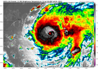
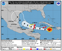
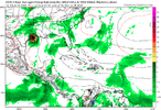
-
Hello, please take a minute to check out our awesome content, contributed by the wonderful members of our community. We hope you'll add your own thoughts and opinions by making a free account!
You are using an out of date browser. It may not display this or other websites correctly.
You should upgrade or use an alternative browser.
You should upgrade or use an alternative browser.
Tropical MAJOR Hurricane Beryl 2024
- Thread starter SD
- Start date
Brent
Member
Despite weakening, it’s putting up a fight.
This storm has consistently defied expectations
Now things may change with the Yucatan ahead but like Texas better be alert
Henry2326
Member
From NHC at 5 PM:
Hurricane-force winds extend outward up to 45 miles (75 km) from the
center and tropical-storm-force winds extend outward up to 185 miles
(295 km). Kingston, Jamaica, recently reported sustained winds of
48 mph (78 km/h) and a wind gust of 81 mph (130 km/h).
Hurricane-force winds extend outward up to 45 miles (75 km) from the
center and tropical-storm-force winds extend outward up to 185 miles
(295 km). Kingston, Jamaica, recently reported sustained winds of
48 mph (78 km/h) and a wind gust of 81 mph (130 km/h).
Weakening at a very substantial pace right now.
Brent
Member
Weakening at a very substantial pace right now.
Still near Cat 4 per recon. This is about the weirdest storm I've ever seen. Any other storm would have fallen apart by now
Still near Cat 4 per recon. This is about the weirdest storm I've ever seen. Any other storm would have fallen apart by now
Indeed. Here was the NHC update from 2 hours ago, down only a little from the 140 of 5PM:
BULLETIN
Hurricane Beryl Intermediate Advisory Number 21A
NWS National Hurricane Center Miami FL AL022024
800 PM EDT Wed Jul 03 2024
...EYEWALL OF EXTREMELY DANGEROUS CATEGORY 4 BERYL MOVING NEAR
SOUTHWESTERN JAMAICA...
...EXPECTED TO APPROACH THE CAYMAN ISLANDS LATER TONIGHT...
SUMMARY OF 800 PM EDT...0000 UTC...INFORMATION
----------------------------------------------
LOCATION...17.8N 78.3W
ABOUT 100 MI...160 KM W OF KINGSTON JAMAICA
ABOUT 215 MI...350 KM ESE OF GRAND CAYMAN
MAXIMUM SUSTAINED WINDS...130 MPH...215 KM/H
PRESENT MOVEMENT...WNW OR 285 DEGREES AT 20 MPH...31 KM/H
MINIMUM CENTRAL PRESSURE...960 MB...28.35 INCHES
————————
If you had told me that before the season started that on July 3rd we’d have a hurricane that weakened to 130 mph, I would have thought you were nuts!
Last edited:
Well, the Energizer Bunny is still a cat 4 at 11PM!
Hurricane Beryl Advisory Number 22
NWS National Hurricane Center Miami FL AL022024
1100 PM EDT Wed Jul 03 2024
...CATEGORY 4 HURRICANE BERYL PULLING AWAY FROM JAMAICA...
...EXPECTED TO PASS JUST SOUTH OF THE CAYMAN ISLANDS OVERNIGHT...
SUMMARY OF 1100 PM EDT...0300 UTC...INFORMATION
-----------------------------------------------
LOCATION...18.0N 79.2W
ABOUT 160 MI...255 KM SE OF GRAND CAYMAN
ABOUT 560 MI...905 KM ESE OF TULUM MEXICO
MAXIMUM SUSTAINED WINDS...130 MPH...215 KM/H
PRESENT MOVEMENT...WNW OR 290 DEGREES AT 21 MPH...33 KM/H
MINIMUM CENTRAL PRESSURE...961 MB...28.38 INCHES
Brent
Member
Storm just refuses to fall apart
The crews on board also reported that there was significant
turbulence in the northern eyewall.
The crews on board also reported that there was significant
turbulence in the northern eyewall.
Belle Lechat
Member
- Joined
- Aug 29, 2021
- Messages
- 336
- Reaction score
- 280
Storm just refuses to fall apart
The crews on board also reported that there was significant
turbulence in the northern eyewall.
Speed bumps up ahead.
lexxnchloe
Member
Belle Lechat
Member
- Joined
- Aug 29, 2021
- Messages
- 336
- Reaction score
- 280

Last edited:
Belle Lechat
Member
- Joined
- Aug 29, 2021
- Messages
- 336
- Reaction score
- 280
Recon stopped updating for 20 minutes. Normally it updates every 30 seconds.
041200 1917N 07828W 6968 03199 //// +080 //// 123054 057 039 007 01
041230 1915N 07829W 6970 03195 //// +080 //// 122054 054 042 005 01
041300 1914N 07831W 6967 03198 //// +078 //// 124053 054 042 005 01
043330 1821N 07923W 6968 03127 //// +066 //// 129071 072 050 029 01
043400 1819N 07925W 6972 03110 //// +063 //// 133079 082 058 078 01
043430 1818N 07926W 7010 03048 //// +063 //// 131084 086 070 059 05
There are a lot of blanks in the Extrapolated surface pressure column. The lowest that was shown after the above is 970.8 mb.
044530 1803N 07943W 6976 02964 9708 +213 +125 274070 073 054 000 00

The highest Peak 10-second average surface wind speed sampled since the period in which 118 kts was recorded
043830 1810N 07933W 6971 02982 //// +104 //// 172103 106 098 002 01
98 kts at 11:38 CDT, 113 mph.
Previous high at 9:45 CDT, 136 mph.
024530 1809N 07913W 6969 02915 9678 +129 //// 068076 088 118 004 01
041200 1917N 07828W 6968 03199 //// +080 //// 123054 057 039 007 01
041230 1915N 07829W 6970 03195 //// +080 //// 122054 054 042 005 01
041300 1914N 07831W 6967 03198 //// +078 //// 124053 054 042 005 01
043330 1821N 07923W 6968 03127 //// +066 //// 129071 072 050 029 01
043400 1819N 07925W 6972 03110 //// +063 //// 133079 082 058 078 01
043430 1818N 07926W 7010 03048 //// +063 //// 131084 086 070 059 05
There are a lot of blanks in the Extrapolated surface pressure column. The lowest that was shown after the above is 970.8 mb.
044530 1803N 07943W 6976 02964 9708 +213 +125 274070 073 054 000 00

The highest Peak 10-second average surface wind speed sampled since the period in which 118 kts was recorded
043830 1810N 07933W 6971 02982 //// +104 //// 172103 106 098 002 01
98 kts at 11:38 CDT, 113 mph.
Previous high at 9:45 CDT, 136 mph.
024530 1809N 07913W 6969 02915 9678 +129 //// 068076 088 118 004 01
Last edited:
Belle Lechat
Member
- Joined
- Aug 29, 2021
- Messages
- 336
- Reaction score
- 280
I know the speed has gone down and pressure has gone up, but compared to a few hours ago it looks like the core of Beryl is shaping up.

Beryl has finally fallen below cat 4 as it is now a strong cat 3. It appears that SW Jamaica may have been the hardest hit of that island based on that tweet I just posted.
Get ready Caymans, especially Grand Cayman!
Hurricane Beryl Intermediate Advisory Number 22A
NWS National Hurricane Center Miami FL AL022024
200 AM EDT Thu Jul 04 2024
...STRONG WINDS, DANGEROUS STORM SURGE AND DAMAGING WAVES EXPECTED
ACROSS THE CAYMAN ISLANDS OVERNIGHT...
SUMMARY OF 200 AM EDT...0600 UTC...INFORMATION
----------------------------------------------
LOCATION...18.3N 80.1W
ABOUT 110 MI...175 KM SE OF GRAND CAYMAN
ABOUT 500 MI...800 KM ESE OF TULUM MEXICO
MAXIMUM SUSTAINED WINDS...125 MPH...205 KM/H
PRESENT MOVEMENT...WNW OR 285 DEGREES AT 21 MPH...33 KM/H
MINIMUM CENTRAL PRESSURE...965 MB...28.50 INCHES
Belle Lechat
Member
- Joined
- Aug 29, 2021
- Messages
- 336
- Reaction score
- 280
Two planes in the air.


