-
Hello, please take a minute to check out our awesome content, contributed by the wonderful members of our community. We hope you'll add your own thoughts and opinions by making a free account!
You are using an out of date browser. It may not display this or other websites correctly.
You should upgrade or use an alternative browser.
You should upgrade or use an alternative browser.
Wintry Machine Learning Mauler 1/30-2/1
- Thread starter SD
- Start date
Spartanburg just got bumped to 6 to 10 as wellGSP just upped totals for charlotte to 10”!
I’ve kept the optimism fairly high. My expectations shifted on Thursday. I slept in this morning because I knew it’d be later before we saw anything. But interest has peaked on some things over the past hour or so. We’ll see.Is the Triangle Squad shifting to optimism mode?? I don’t wanna keep getting hurt but also of course a big part of me wants to believe it’s gonna still happen for us (a couple of inches that is — I don’t foresee more than that)
neelsamb
Member
It absolutely is filling in. Delayed but not denied I guess. It looks crazy when the wind kicks up and blows snow off the roofs.Oddly enough, that band seems to be pushing south down 85 towards the city... also seems the northern part of the metro is filling in. Listen at me grasping straws LOL.
The thought of this being over at some point makes me sad
Where are you seeing new projections?Spartanburg just got bumped to 6 to 10 as well
Should hit you in next 30mins as wellIs the Triangle Squad shifting to optimism mode?? I don’t wanna keep getting hurt but also of course a big part of me wants to believe it’s gonna still happen for us (a couple of inches that is — I don’t foresee more than that)
Right on que. Whole triangle will be covered in 90 mins. Moderate to heavy snow by 4 or 5pm.Small flakes but a lot of them now
Here it just keeps on pouring thankfully. We are going double digits. Close if, not over half way there now.
Wind is even gone up another notch.
rburrel2
Member
Heelyes
Member
Well that escalated quickly
My friends in Gwinnett between Mall of GA and Lawrenceville just told me it has been spectacular with incredible rates and beautiful scenes looking out the window. They had already had 1” 2 hours ago. They had very roughly estimated about 2” ~20 minutes ago w/o going outside. I bet they’re now ~2.5” and still coming down impressively. They’re wishing I was there but I told them I’m hopeful to get some later.
- Joined
- Jan 23, 2021
- Messages
- 4,602
- Reaction score
- 15,197
- Location
- Lebanon Township, Durham County NC
You might have the hot hand bud. I hope so!Right on que. Whole triangle will be covered in 90 mins. Moderate to heavy snow by 4 or 5pm.
Here it just keeps on pouring thankfully. We are going double digits. Close if, not over half way there now.
chuckhendo
Member
I’ve never seen snow fall so hard and just not accumulate. It’s been snowing nonstop for over 5 hours and I might have a half inch, if that
Better than watching it on radar evaporate over my head like these storms normally play out for us
Better than watching it on radar evaporate over my head like these storms normally play out for us
How is it falling if u can tell? Heavy, Moderate?Well that escalated quickly
Sent from my A600DL using Tapatalk
wow
Member
H
How much longer you think we got?The thought of this being over at some point makes me sad
wow
Member
Hey, Wow, can you post link to that radar? I'm using a couple of different ones but this one is centered more over you and I than the one I'm using.View attachment 192610the 2" hr rates are coming
NWS GSP....also has 1 to 2 inches tonightWhere are you seeing new projections?
Heelyes
Member
Moderate but blowingHow is it falling if u can tell? Heavy, Moderate?
Sent from my A600DL using Tapatalk
Truly puking snow right now, latest HRRR says we still have another 10ish hours of snow in the CLT metro area.
I’m hoping the combined lift from the upper low along with the bombing coastal would converge right over us and slam us with heavy rates for a few hours. Maybe???I admire him not letting up, but if it doesn't happen that will be a huge bust.
LukeBarrette
im north of 90% of people on here so yeah
Meteorology Student
Member
2024 Supporter
2017-2023 Supporter
It’s actually snowing moderately again here in VA. Thought we were done
Yeah that future radar on WYFF 4 makes the snow disappear in GVL county.
I think 4 is likely.
May already be there here in Taylors!
Shadow of the Apps
Member
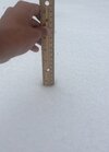
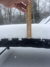
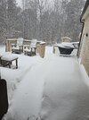
Just a little over 4 inches, light snow continues to fall 18.5°
Sent from my iPhone using Tapatalk
Sent from my iPhone using Tapatalk
Ahhh that's means the winds are picking up probably in even the moderate bands of snowModerate but blowing
Sent from my A600DL using Tapatalk
Reminds me of last year when the coast got several inches. Snowed all day in west Columbia and very little accumulationI’ve never seen snow fall so hard and just not accumulate. It’s been snowing nonstop for over 5 hours and I might have a half inch, if that
Better than watching it on radar evaporate over my head like these storms normally play out for us
It’s been snowing since 8:00. But little to show for it.
@jackendrickwx @rburrel2 GSP has slipped the 8+ shade on top of me. Update 20mins ago. Aint no way right? Right!? What am I missing?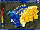

Iceagewhereartthou
Member
Makeitsnow
Member
it's coming back...it's not unusual for bands to oscillate. still pouring here. Those convective bands burrel went through are getting stronger...praying i get some of that action later.Athens area getting dry slotted lol. What’s the rest of the afternoon chances @ronburgundy
crazy temp gradient between myself in athens. i'm 27 on the elevated station, 28 on the 2 meter. athens is 24 while the west side is 22.
WXinCanton
Member
I got about 20 flurries lol
I’m hoping for the same thing. The dry slot along the coast earlier had me interested. Sometimes a dry slot along the coast means the sfc low is deepening fast and/or the ULL tilt was going neutral or negative faster helping the sfc low deepen faster. Don’t know from here. Only time will tell.I’m hoping the combined lift from the upper low along with the bombing coastal would converge right over us and slam us with heavy rates for a few hours. Maybe???
We are also around 19° vs low to mid 20s further sw. So we should have higher ratios, right?I was just looking at that. It’s filling in some to the south and moving NE. I’m holding out some hope. View attachment 192600

