most now-casty storm i've ever seen. can't help but sit back and laugh. in order to stay sane it is imperative you maintain the same exasperated "what next" attitude clark griswold has on national lampoon's christmas vacation. at this point we just got the "bonus"Actually...that's a good point. 3km is the clear outlier, can't argue that. The FV3 is kind of the middle of the road. Let's see what the RGEM shows.
-
Hello, please take a minute to check out our awesome content, contributed by the wonderful members of our community. We hope you'll add your own thoughts and opinions by making a free account!
You are using an out of date browser. It may not display this or other websites correctly.
You should upgrade or use an alternative browser.
You should upgrade or use an alternative browser.
Wintry Machine Learning Mauler 1/30-2/1
- Thread starter SD
- Start date
BrickTamland
Member
I try to look at which models have been the most consistent, too. Euro has jumped around more than the others. It had some of the same big totals as the GFS, ICON, Canadian and NAM, but hasn't been as consistent as those. I know people say the Euro is the king, but sometimes it looks like it just jumps around and throws different outcomes at the wall to see if one sticks and then people say it was right.I would think if it makes it this far west, you'll get in that band on the way here and on the way out. Who knows, perhaps even what it's showing is underdone. 2009 keeps dancing in my head.
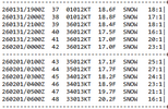
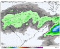
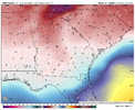
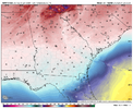
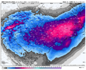
Definitely interested in this! There is a chance Tampa could set their all-time snowfall record (0.2") if the streamer sets up right! Florida doubled their all-time snowfall record with last year's Gulf Coast Blizzard, so why not?NWS Tampa office really going to have to address this Gulf effect snow being modeled by the 3K NAM -- 12z run shows a strip of 2 inch Kuchera accums (gulp!) from Pasco County down into Hillsborough. Would obviously be historic.
View attachment 191772
Sctvman
Member
Always the case with ULLmost now-casty storm i've ever seen. can't help but sit back and laugh. in order to stay sane it is imperative you maintain the same exasperated "what next" attitude clark griswold has on national lampoon's christmas vacation. at this point we just got the "bonus"
No model does it right
I can't remember an event within 18 hours of start that had this big a spread...the butterfly effect.most now-casty storm i've ever seen. can't help but sit back and laugh. in order to stay sane it is imperative you maintain the same exasperated "what next" attitude clark griswold has on national lampoon's christmas vacation. at this point we just got the "bonus"
NCWeatherhound
Member
Imagine a Tampa newscaster showing the NAM 3km on TV.
They talked a little bit about it in their discussion, but they aren't showing snow in their forecast.
I've seen some Florida people show their futurecast and what not show some snow down that way too.
It makes you wonder what the point of these last few days was, if it's <24 hours before it starts and I might know less than ever about what's going to happen. I guess I could default to "trust the experts" and NWS RAH's 4-7" Winter Storm Warning for here, and honestly that seems like a pretty reasonable prediction at this point.most now-casty storm i've ever seen. can't help but sit back and laugh. in order to stay sane it is imperative you maintain the same exasperated "what next" attitude clark griswold has on national lampoon's christmas vacation. at this point we just got the "bonus"
Yeah I noticed that. That is a trend we need to see heading toward home.12z NAM just looking better and better with the ULL -- don't know how it will translate, but it's deeper and better tilted vs. 6z and 0z at 30 hours.
Bigedd09
Member
The RRFS is absolutely destroying the piedmont of nc
Sent from my iPhone using Tapatalk
Sent from my iPhone using Tapatalk
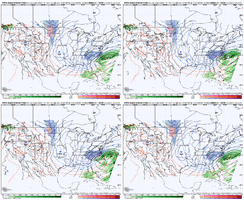
Using what I saw last night in a tweet from ContentWXGuy I thought I'd take a stab and seeing where the upper air players are at currently. This is what I'm thinking it's at rn lmk if this is wrong. SW1 is lead shortwave and 2 is the main ShortwaveI noticed the low popping off the SC coast as well. Thinking the ULL drove a little further south, causing the atlantic low to pop further south. Thoughts?

Sent from my SM-S156V using Tapatalk
BrickTamland
Member
I think 6 to 8 is reasonable now looking at all the data, and could end up more. Maybe the model showing the least amount ends up right and it is a lot less, but that would be ignoring all the other models and totals, and just going with the least amount for the sake of going with the least amount.It makes you wonder what the point of these last few days was, if it's <24 hours before it starts and I might know less than ever about what's going to happen. I guess I could default to "trust the experts" and NWS RAH's 4-7" Winter Storm Warning for here, and honestly that seems like a pretty reasonable prediction at this point.
blueheronNC
Member
And the icon & GFS!So my hopes lie with Roofus and the FV3? Maybe I should just start drinking now.
Yeah, might be time to pull out the bottle…
RRFS is replacing the NAM this year, right?
As several have mentioned, the tilt has everything to do with the amount of moisture. The big runs we've seen, we were able to get to neutral or slightly negative. If that tilt stays more positive, then you get the lesser amounts with a dry slot somewhere. Right now it looks like it'd be somewhere close to RDU. Could be a little west or east.
This is pseudo-wishcasting, but if we go with the assumption that warm noses will always overperform, then it kind of follows that we could expect the warm front to be on the northern side of guidance (or even further north). Of course, that doesn't always happen and may not here.12z 3km Roofus versus NAM couldn’t be more different in the existence and placement of the elevated warm front -
RRFS -
View attachment 191778
NAM -
View attachment 191779
BHS1975
Member
This will be a great test.RRFS is replacing the NAM this year, right?
rburrel2
Member
Ruffus is much further north with the 5h low track when compared to the Euro/Euro AI/ GFS AI/3km NAM/Rgem. I'd use it with extreme caution.12z 3km Roofus versus NAM couldn’t be more different in the existence and placement of the elevated warm front -
RRFS -
View attachment 191778
NAM -
View attachment 191779
Edward Nygma
Member
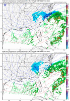
I actually completely disagree. It's all about whether the coastal low tracks along the gulf stream or not. 12z 3km NAM had better tilt at H5 and much drier outcome over central NC because it placed the coastal low further offshore.As several have mentioned, the tilt has everything to do with the amount of moisture. The big runs we've seen, we were able to get to neutral or slightly negative. If that tilt stays more positive, then you get the lesser amounts with a dry slot somewhere. Right now it looks like it'd be somewhere close to RDU. Could be a little west or east.
rburrel2
Member
Big shift west with the 5h lobe at hr12 on the icon. I expect it'll come more in line with the Euro/Euro AI/NAM here.
LukeBarrette
im north of 90% of people on here so yeah
Meteorology Student
Member
2024 Supporter
2017-2023 Supporter
Can’t lie it’s coming down way harder than I thought it would, roads starting to get slick again.
Just the question is, how strong will the winds be in the mountains?
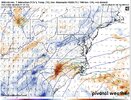
you and i have been lockstep in this detail. totally agree.I actually completely disagree. It's all about whether the coastal low tracks along the gulf stream or not. 12z 3km NAM had better tilt at H5 and much drier outcome over central NC because it placed the coastal low further offshore.
View attachment 191781
easy 55+ at ridgetops. best spots (grandfather mtn, maybe leconte or mitchell) will get 70+Just the question is, how strong will the winds be in the mountains?
a_gilmore88
Member
wow
Member
Brandon10
Member
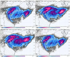
GRAF and HRR look very similar to me
Tsappfrog20
Member
Rgem looks really good for SC and NC
Sent from my iPhone using Tapatalk
Sent from my iPhone using Tapatalk
Snowing at Beech Mountain and Laurel Springs NC
BHS1975
Member
The 12z HRRR is the only CAM missing that.Can’t lie it’s coming down way harder than I thought it would, roads starting to get slick again.
WSNC
Member
- Joined
- Jan 2, 2017
- Messages
- 1,566
- Reaction score
- 4,279
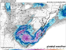
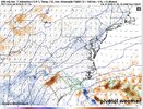
Hopefully its wrong but prob not. As it transfers or pulls out the side will get dry slotted pretty fast. But if it slows just off the coast it would likely be enhanced instead....stay tunedView attachment 191754
It will be interesting to see if the 3K is drying out the backside a little too fast. Some of the globals keep the snow going into the night even in the upstate. Either way there's a swath of 0.5"+ QPF in the upstate now

