• Hello, please take a minute to check out our awesome content, contributed by the wonderful members of our community. We hope you'll add your own thoughts and opinions by making a free account!

Wintry Machine Learning Mauler 1/30-2/1

No. More like 1-2”. The further east areas won’t be getting as high ratios as areas further west.

No reason they won’t be unless I’m missing something. We were 15:1 down to within a few miles of the coast last January. I can see sleet/rain lasting longer at first tamping down totals but when the 850mb 0C line is east of Frying Pan Tower I think they’ll be fine in Wilmington.
 
I am in the boat of you look at all of them. People say stop looking at globals at a certain point, but I think it's important to put weight in all of them.
Brother I’m channeling you right now. Up bright and early today, lol. Thanks for the insight. What particularly do you look for in the global vs mesoscale at this point before go time?
 
I’m unconcerned with the euro or gfs or cmc at this point. Focused on the short range cams and what they pick up on. If they do this then I’ll take note.
 
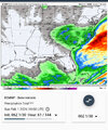
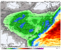
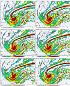
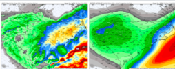
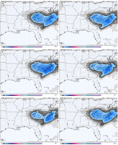
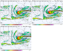
Tilt issue. Energy trending West, tilt trending worse so naturally snow intensity decreases. View attachment 191670What a whirlwind. Welcome to the jungle. View attachment 191668

The only area that’s staying consistent ish is back over the upstate and around Charlotte to just west of there where you have the mesolow and upper low forcing together. That’s why I went bullish yesterday on my forecast
 
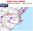
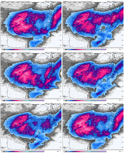
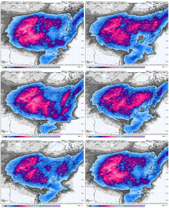
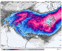
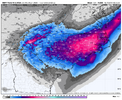
I think the resounding message from this event is that most everyone that frequents this board is going to get some amount of snow with this system. Especially in NC, SC and NE GA. That in and of itself in this area is unusual. I think the best advice is to meter expectations and be pleasantly surprised if your back yard is under a band and overperforms. I doubt the map below and others like it for SC will be entirely filled with a solid color and a date of Jan 31-Feb 1 on it will be posted after this event. Could be but seems doubtful.

 
Euro is out to lunch I’d wager.

Just a reminder it did terribly January 2025 with our coastal storm.
It all has to do with the tilt. The precipitation output is just a reflection of what the energy is doing. Maybe it is handling the energy wrong. I don't know, but I would not be so quick to dismiss it. Right now, there is no consistence. That being said, I do believe it is time to put more weight on the short-range high-res models. I will be watching the Hrrr, Rgem, and Nams closely today for some clarity.
 
Central/western ATL metro placed under a winter weather advisory for up to 2”.

URGENT - WINTER WEATHER MESSAGE
National Weather Service Peachtree City GA
344 AM EST Fri Jan 30 2026

GAZ021-032-033-044>046-048-055-057>059-072-083-084-310000-
/O.UPG.KFFC.WS.A.0002.260131T0000Z-260201T1200Z/
/O.NEW.KFFC.WW.Y.0003.260131T0600Z-260201T0000Z/
Cherokee-Cobb-North Fulton-South Fulton-DeKalb-Rockdale-Newton-
Clayton-Henry-Butts-Jasper-Jones-Twiggs-Wilkinson-
Including the cities of East Point, Toomsboro, Gray, Marietta,
Decatur, Stockbridge, Jeffersonville, Monticello, Conyers, Covington,
Jackson, Woodstock, Atlanta, and Riverdale
344 AM EST Fri Jan 30 2026

...WINTER WEATHER ADVISORY IN EFFECT FROM 1 AM TO 7 PM EST
SATURDAY...

* WHAT...Snow expected. Total snow accumulations up to 2 inches.
Winds gusting as high as 35 mph.

* WHERE...Portions of central and north central Georgia.

* WHEN...From 1 AM to 7 PM EST Saturday.

* IMPACTS...Any snow is expected to rapidly stick to roads and other
surfaces due to temperatures in the 20s. Gusty winds could result
in areas of blowing snow and poor visibility. Plan on difficult
travel conditions.

* ADDITIONAL DETAILS...Wind chills will range from 5 to 10 degrees
above zero on Saturday.
 
FWIW the hrrr has trended farther west with the ull and more cut off/separated since the 06z run came out. But also looks more broad-based and maybe will have a more positive tilt later on.

I think, maybe, this trend is good for NE GA/Upstate becuase it keeps us further Northeast of the ull as it drops down in to Georgia... but possibly bad for Eastern NC, b/c the less amperage keeps the focus on the ull/meso surface low stuff, instead of blossoming a new precip shield in Central NC.
But there's so much stuff going on, who knows.

hrrr-conus-vort500_z500-1769767200-1769832000-1769832000-20.gif
 
Back
Top