-
Hello, please take a minute to check out our awesome content, contributed by the wonderful members of our community. We hope you'll add your own thoughts and opinions by making a free account!
You are using an out of date browser. It may not display this or other websites correctly.
You should upgrade or use an alternative browser.
You should upgrade or use an alternative browser.
Wintry Machine Learning Mauler 1/30-2/1
- Thread starter SD
- Start date
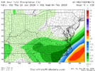
Raleigh NWS with 6-14 here. By my math
Friday Night
Snow likely, mainly after 1am. Cloudy, with a low around 17. Wind chill values as low as 5. Northeast wind 8 to 13 mph, with gusts as high as 21 mph. Chance of precipitation is 70%. New snow accumulation of 1 to 3 inches possible.
Saturday
Snow. High near 22. Wind chill values as low as 5. Northeast wind around 16 mph, with gusts as high as 29 mph. Chance of precipitation is 90%. New snow accumulation of 3 to 7 inches possible.
Saturday Night
Snow likely, mainly before 1am. Cloudy, with a low around 12. Blustery, with a northwest wind 15 to 20 mph, with gusts as high as 29 mph. Chance of precipitation is 60%. New snow accumulation of 2 to 4 inches possible.
Sunday
Mostly sunny, with a high near 28. Blustery.
I surmise Brad P's tweet regarding "dry air" created the post in which you responded.no
snow or rain
no inbetween
the snow growth region, when saturated to make snowflakes, will make it all snow
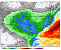
Crazy that when you enter NC on I 95 you could go from nothing to 6”+ in literally a 15-20 minute’s drive southboundUkmet did look even better but that freaking gradient in my county though, 0 to a foot, sheesh
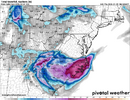
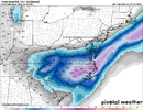
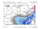
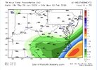
View attachment 191443
Yep. Looks like the AI models. I’m going to try to be happy for the SC crew.
View attachment 191425
It's crazy that this starts in just over 24 hours and we don't know if GSO-RDU getting 6" or CAE to MYR is getting 6". Both areas aren't getting 6"...somoeone going to be disappointed. I took the afternoon off from models and I come back and the first model I look at is the 18z Euro which has the precip min for all of NC around Raleigh....the entire state of NC, Raleigh is shown with the least of amount of precip.
I can't ever recall an event this close with this spread among models...
- Joined
- Jan 2, 2017
- Messages
- 1,566
- Reaction score
- 4,279
You're in a bullseye that's pretty safe imo
That swath of 10" at @Stevo24 house has been inching closer to Oconee every run.
Tsappfrog20
Member
From Jonathan Wall
Sent from my iPhone using Tapatalk
Sent from my iPhone using Tapatalk
ajr
Member
Anyone know how well RDU handles snow? Have a flight Sunday AM, wondering if I need to reschedule
I’m not sure but I would imagine not well. The one saving grace is the snow will be powder and not the snow we normally get.Anyone know how well RDU handles snow? Have a flight Sunday AM, wondering if I need to reschedule
Dunkman
Member
I had a flight last month that was delayed an hour and a half because they had to deice the plane. That’s it. We boarded on time.Anyone know how well RDU handles snow? Have a flight Sunday AM, wondering if I need to reschedule
- Joined
- Jan 2, 2017
- Messages
- 1,566
- Reaction score
- 4,279
I saw Cary on Fox weather a while ago. After the last event scraping the interstate. Looked like yall did well.I’m not sure but I would imagine not well. The one saving grace is the snow will be powder and not the snow we normally get.
znel52
Member
NWS Newport NC

Sent from my Pixel 8 Pro using Tapatalk

Sent from my Pixel 8 Pro using Tapatalk
packfan98
Moderator
This is 4 runs in a row of the euro showing more than 6 inches here. Even though technically it was a tiny decrease from the previous run, it looks more like noise as the low track was nearly identical. It's interesting that i don't see evidence of the snow band across ne ga that the other models are showing so i'm not sure what the deal is there. One thing seems certain, the upstate is in a great spot.
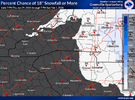
btw, for the upstate folks.
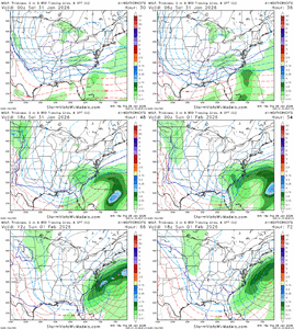
View attachment 191432
As a rule of thumb I would cut those in half.
AJ1013
Member
This seems like a warmer repeat of 1989. Chances of *accumulating* snow in central FL. If things look promising come Saturday afternoon I may have to drive a few hours to see it!


UpstateSC
Member
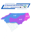
Easy there. Let’s not kick that thing too far North… for my toddler’s sake (and mine)Here's my second call map! View attachment 191449
AJ1013
Member
Down here in Miami it won't snow but it will be the coldest it's been in many years, even according to the normally conservative NWS. This is cold enough that it won't just stun our iguanas but will kill a large percentage of them.


Im willing to bet as we draw closer to start time, our 50/50 lets up a tick on its grip. Not saying its gonna take its hands off the wheels. But enough to nudge the confluence a small notch,fraction.
BrickTamland
Member
From everything I have see with the models today I still think at least 6 to 8 for central NC from Sanford up to Raleigh/Durham and to Roanoke Rapids looks pretty good.
If I could erase that stupid dip along the NC/VA border once and for all
If all of these drier models come true over the NC Piedmont, then the WthrNxt is going to drop a couple of tiers.
I feel like I've seen this before over Montana or something
packfan98
Moderator
Better coastal enhancement has been a trend on most models today. Interested on the 0z runs with the hi-res and AI. It’s time for the NAM to get juiced up and will the AI stuff lock on to the right thing?
Makeitsnow
Member
I have my expectations in check but it's hard to ignore the model agreement for my local, the track of the upper level low, and the track of the mid level lows. 3 inches is the floor i expect for this event and probably would be a little disappointing. My general thought is 4 to 6.As a rule of thumb I would cut those in half.
Bigedd09
Member
Low end for charlotte at 5 inches is insane

Sent from my iPhone using Tapatalk

Sent from my iPhone using Tapatalk
Any other winter event like this would tick NW and verify NW of modeled…but this one fighting like an infectious disease.If I could erase that stupid dip along the NC/VA border once and for all
This storm feels like the opposite of Jan 3-4 2018 for me. That one had a last minute deform band sit up over me here and i ended up at 11in where people 20 miles away got just 4in.If I could erase that stupid dip along the NC/VA border once and for all
Personally not feeling too good with every model looking to show a precip min just east of I-95 right along the border. I have some hope the obvious NW trend happens towards gametime but im not sure it would benefit with how dry it is up this way.
That's teetering on some monimentsl stuff, it tried to catch, stall, bomb 48-60 but it kept progressing E which seems most likely at this point
I’m still waiting on that tick. There’s been some things turning our way this afternoon. But I’d like to see the SC folks score as well and everyone win.Any other winter event like this would tick NW and verify NW of modeled…but this one fighting like an infectious disease.
I dont think this is ticking north…it’s remarkable how stubborn that 50/50 is. It just won’t move out…never seen anything like it. Every single winter storm we’ve ever had that has lifted out quicker than modeled as we approached go time. But not this time…I’m still waiting on that tick. There’s been some things turning our way this afternoon. But I’d like to see the SC folks score as well and everyone win.
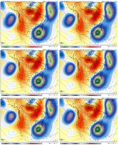
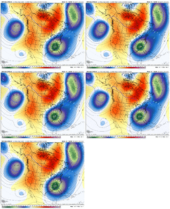
I feel pretty good here too.You're in a bullseye that's pretty safe imo
That swath of 10" at @Stevo24 house has been inching closer to Oconee every run.
It's like being a 5 year old at Christmas time with all these great runs in the Western Carolinas!
BOL to everyone so long as it doesn't interfere with my foot of snow!!!
In ran away during the last storm. Moved 100 miles north every model run for the last 72 hoursI dont think this is ticking north…it’s remarkable how stubborn that 50/50 is. It just won’t move out…never seen anything like it. Every single winter storm we’ve ever had that has lifted out quicker than modeled as we approached go time. But not this time…
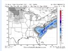
View attachment 191465View attachment 191466

