-
Hello, please take a minute to check out our awesome content, contributed by the wonderful members of our community. We hope you'll add your own thoughts and opinions by making a free account!
You are using an out of date browser. It may not display this or other websites correctly.
You should upgrade or use an alternative browser.
You should upgrade or use an alternative browser.
Wintry Machine Learning Mauler 1/30-2/1
- Thread starter SD
- Start date
BrickTamland
Member
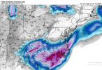
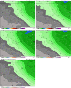
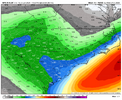
Great run for NC from the ICON and RGEM.
packfan98
Moderator
Yeah. I’d say the coastal has been trending better on most models today. Just got to figure out the ULL and interaction between the two entities.And so it was written, what the 12z runs taketh away, the 18z runs giveth back ...
wow
Member
packfan98
Moderator
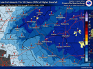
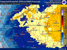
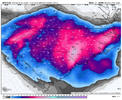
I don't know how I feel about being in the 19" potential zone on the BOOM map. I could see my area being part of the dryslot more so than the jackpot.

WolfpackHomer91
Member
That’s only 10:1 too
Sent from my iPhone using Tapatalk
Webberweather53
Meteorologist
The big band on the RGEM over east-central NC basically sets up where the elevated warm front stalls out ahead of our upper trough.
Very interesting
Very interesting
n1accord93
Member
2nd paragraph from NWS Winter Weather discussion from 3:15 today might explain why they are bullish on totals. I'm no meteorologist though just lurking and learning on here.
By 12Z Saturday, most guidance is in agreement that the 500mb
shortwave takes on a more neutral tilt (oriented N-S) over the TN
Valley and becomes a closed low over GA. PVA becomes maximized
over the Southeast while a surface low spawns along a coastal
front east of the Carolinas. As the 850mb low deepens over northern
GA and heads east into SC, easterly 850mb theta-e advection will
direct low-level moisture around the 850mb low and support a band
of moderate-to-heavy snow from northern GA to central SC. Farther
north, the same tongue of 850mb theta-e is funneling along the
850mb front to the north of the 850mb low track from northern SC
on east through the heart of NC. This is where the deformation zone
is likely to form, pivoting over central NC and northern SC with
1-2"/hr snowfall rates likely. This band of heavy snow is likely to
ensue farther east into southeast VA, where 700mb FGEN is more
ideally placed to support strong vertical velocities within a fully
saturated DGZ. Similar to NC, look for intense bands of heavy snow
over southeast VA to form late Saturday afternoon and persist into
Saturday night. These bands of heavy snow in eastern NC and
southeast VA depict 700-500mb lapse rates >6.5C/km Saturday
afternoon and evening. It is here where not only are 2"/hr snowfall
rates achievable, but so is the likelihood for thundersnow. The
intense vertical velocities in eastern NC and southeast VA may
result in some subsidence in north-central NC and south-central VA.
Snowfall is still likely to reach warning criteria, but these
regions are potentially susceptible to lesser snowfall amounts as
they are caught between the influence of the strong upper-low to
the south, and the strengthening coastal low.
Stormsfury
Member
Helps greatly that the upper low is so far south and providing some upper level diffluence over that region.The big band on the RGEM over east-central NC basically sets up where the elevated warm front stalls out ahead of our upper trough.
Very interesting
Last edited:
Mpirone12
Member
I think NWS Raleigh waits for these afternoon models to come in before sending out the warning
Sent from my iPhone using Tapatalk
Sent from my iPhone using Tapatalk
packfan98
Moderator
Bigedd09
Member
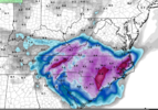
Latest graf filled in dry slot over Greensboro
Sent from my iPhone using Tapatalk
Sent from my iPhone using Tapatalk
wow
Member
SandySpringswx
Member
- Joined
- Jan 2, 2017
- Messages
- 17
- Reaction score
- 48
Atlanta is now under a Watch and possibly 2 inches of snow. Where'd that come from?
foothillscrewzone
Member
Where is everyone finding these GRAF forecasts?
ChattaVOL
Member
Where is everyone finding these GRAF forecasts?
Usually on X
Sent from my iPhone using Tapatalk
Stormsfury
Member
Local news stations usually have them. Locally WCSC TV5 in Charleston uses it.Where is everyone finding these GRAF forecasts?
AlabamaWxWatcher
Member
Hmmm - getting interesting back towards Bama.
foothillscrewzone
Member
Thank you all. Is it similar to the HRRR? What is it based off of?
18z GFS starting to pivot at hr 42, should be a better run for central NC than 12z (which was kinda crappy).
BrickTamland
Member
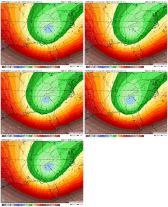
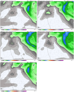
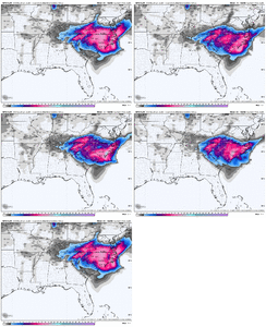
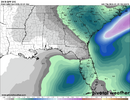
It's interesting the AIGFS is more bullish with GA then the GFS.This storm is HELL for Atlanta forecasters. Like what am I supposed to make of this??
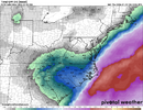
View attachment 191394View attachment 191395
Showmeyourtds
Member
Not entirely sure to be honest. Decent Euro runs overnight & some of the other Ops were supportive in my opinion...but just as soon as those were placed by FFC, most of the 18z op & SR models have backed away.Atlanta is now under a Watch and possibly 2 inches of snow. Where'd that come from?
Full disclosure- I haven't had a chance to look at much of the AI output or any of the Ensemble products...and oh yeah, I'm just a weather hobbyist- not a meteorologist.
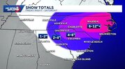
18z GFS is laying down 6-12" over most of NC and is going to have a big area of over a foot south and east of Raleigh.
wow
Member
Stormsfury
Member
Swear it seems like the GFS SFC low looks in a better position on what we'd expect on yge other guidance but doesn't have a clue on how to handle the two together. Nightmarish forecast thereThis storm is HELL for Atlanta forecasters. Like what am I supposed to make of this??
View attachment 191394View attachment 191395
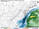
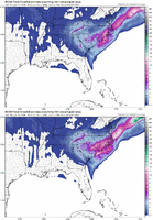
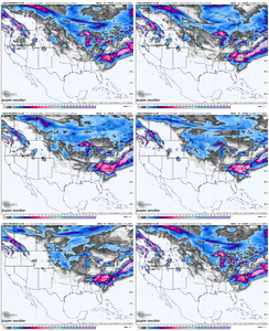
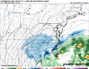
Pretty locked in, if I must say so myself.18z GFS snow map trend
View attachment 191398
ATLien
Member
It seems from their video this afternoon that they feel like the RGEM is depicting the most likely scenario for the metro, and the forecast/WSW is reflective of that. We shall see - I'll believe it when I see it.Not entirely sure to be honest. Decent Euro runs overnight & some of the other Ops were supportive in my opinion...but just as soon as those were placed by FFC, most of the 18z op & SR models have backed away.
Full disclosure- I haven't had a chance to look at much of the AI output or any of the Ensemble products...and oh yeah, I'm just a weather hobbyist- not a meteorologist.

