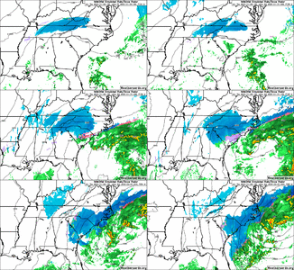
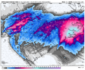
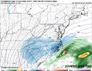
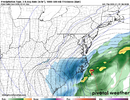
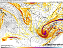
When you want snow as bad as some of us do, any model that shows higher snowfall amounts for your vicinity is a good modelThe NAM is such a bad model. They cant trash that thing fast enough
-
Hello, please take a minute to check out our awesome content, contributed by the wonderful members of our community. We hope you'll add your own thoughts and opinions by making a free account!
You are using an out of date browser. It may not display this or other websites correctly.
You should upgrade or use an alternative browser.
You should upgrade or use an alternative browser.
Wintry Machine Learning Mauler 1/30-2/1
- Thread starter SD
- Start date
Bigedd09
Member
Yeah it decreased from 12Z too.. No wonder GSP is hesitant to issue WSW
I didn’t see a big decrease at all
Sent from my iPhone using Tapatalk
Webberweather53
Meteorologist
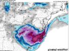
The 12km NAM really cranks up the mid level warm front ahead of the upper trough this run, which is why Raleigh and the NC coastal plain into the Sandhills get nuked.
I mean.. I think it's been pretty clear in the discussion that we do understand this brother... And I am not sure if I agree with the area you are talking about.A lot of people don't seem to quite understand that this system isn't exactly 1 piece of energy. Someone is getting dryslotted. My best guess is between CAE and the CLT region, probably north of Columbia SC. These areas will still receive snow, but may be a little less than the area around. 2 main pieces to this system, a costal low and a separate meso low that develops in the GSP region. Insanely strong meso low i might add.
BrickTamland
Member
3K NAM keeps cranking the snow. Going on 21 hours for the Triangle and most of NC now.
It had precip under an inch in Baltimore and we got 2.02 inches of liquid equivalentWhile the 3K NAM looks way better than the reg NAM even it is too dry in the longer range. See last weekend when it was still barely dropping 0.3" of liquid precip over mby
iwantsouthernsnow123
Member
I kind of did word that poorly, that's my fault. I meant there's a few people here overreacting about 1 run doing something off, shouldn't have used "A lot" in that situation. Yeah I did some more digging and the dry slot is more about Raleigh from what it looks, I kind of got the regions mistakenI mean.. I think it's been pretty clear in the discussion that we do understand this brother... And I am not sure if I agree with the area you are talking about.
Notice where it’s moving the LP to. That area just off the coast that divides that goes quickly from very cold SSTs to warm
Webberweather53
Meteorologist
The NAM still tries to dry slot the Triangle and Fayetteville area Saturday night but that will not matter if the mid level warm front went bonkers beforehand
BrickTamland
Member
Looked like it was starting to pull away at hour 56 on the 3K and then at 58 it builds back in for the Triangle.
BrickTamland
Member
NBAcentel
Member
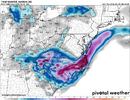
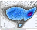
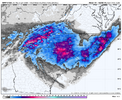
That dry slot over Wake and Johnston counties needs to go away right now. What do you mean we get one inch while everyone else sees a generational stormAIFS vs nam 3KM. Pretty close View attachment 191353View attachment 191355
BrickTamland
Member
Not sure how there wasn't more for the Triangle on the 3K. It had snow for over 24 hours.
disassociated_vort
Member
keep it away from chathamThat dry slot over Wake and Johnston counties needs to go away right now. What do you mean we get one inch while everyone else sees a generational storm
Blue_Ridge_Escarpment
Member
Footprint, yes. The AIFS is showing 10:1 so those would be double in some cases.AIFS vs nam 3KM. Pretty close View attachment 191353View attachment 191355
The Bahamas low is keeping the Atlantic low from being further west. You can see it on the loop Jimmy posted above. Rather than riding the coast, it pulls east, which in turn causes the dry slot and bye bye big totals in central NC.
rburrel2
Member
The nam handling 5h way different than all the ai models/euro etc, I doubt it’s right.
- Joined
- Jan 23, 2021
- Messages
- 4,602
- Reaction score
- 15,197
- Location
- Lebanon Township, Durham County NC
Yeah that was meDidn’t someone say the other day that the DGZ would start about the top of the BOA building? This is fairly close
I hope that Bahamas low will take its vacation somewhere else besides where it is.The Bahamas low is keeping the Atlantic low from being further west. You can see it on the loop Jimmy posted above. Rather than riding the coast, it pulls east, which in turn causes the dry slot and bye bye big totals in central NC.
JimBobs
Member
What's the absolute earliest we see snow falling anywhere in NC from the foothills and any points east of that tomorrow? 3:00 pm? Aren't we within 24 hours now of potential snowfall?
Stormsfury
Member
It's completely latched onto that low 600 miles away like a golden retriever does with its chew toy. The ULL is so far north compared to the consensus. ..The nam handling 5h way different than all the ai models/euro etc, I doubt it’s right.
Edit: still ends up diving but it goes negative late AF.
Last edited:
The entire CLT metro area with 6”+ expect for inside the 485 loop
With the ULL and even maybe the coastal, isn’t that going to provide some upslope enhancement on the escarpment and down to GSP area possibly? With flow out of the E/SE??
Tsappfrog20
Member

From WRAL
Sent from my iPhone using Tapatalk
reasonable and sensible tbh
From WRAL
Sent from my iPhone using Tapatalk
Webberweather53
Meteorologist
The elevated warm front ahead of the upper trough is really driving the bus on the 12km NAM. Basically all of your heavy snow there SE of Raleigh is co-located with strong 850mb warm advection.
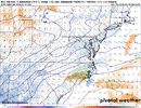
The 18z RRFS also shows this 850mb warm advection/elevated warm front, but it’s in a slightly different spot than on the NAM. If most of the CAMs can get into agreement on this general idea of strong warm advection ahead of the main upper low and its placement, etc, I might be willing to bite on the aggressive solutions for the Triangle area.
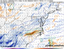
At this point and what we're seeing on the models, I think this is actually a good call. I've been thinking 3-6 is a good spot for RDU.
From WRAL
Sent from my iPhone using Tapatalk
WXinCanton
Member
disassociated_vort
Member
WWAs extended into Eastern KY not sure if that was expected or not. in my humble few years watching, observing around here sometimes these ULLs keep precip west and central NC underperforms if we have no forcing entering from the east. Prayers for 850mb WAA, coastal low sticking to the gulfstream & "ample moisture".
Blue_Ridge_Escarpment
Member
Icon much more juiced this run
iGRXY
Member
ICON NAMs both lighter and further east with Georgia snowfall.
BrickTamland
Member
Stormsfury
Member
beanskip
Member
And so it was written, what the 12z runs taketh away, the 18z runs giveth back ...
The 18z ICON really cranks the coastal in a way you love to see if you're in C / E NC. Also the ULL is great for areas further west.

