Xlhunter3
Member
Should be Lee side enhancementYou still thinking the leeside gets screwed?
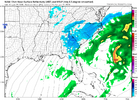
View attachment 190763
KCHS's new graphic for those interested. Admittedly a bit perplexed to see me at only 20% of .1 inch or greater, but whoever made this is a lot smarter than me.
If we can wrap up this ULL with a little more neg tilt, these totals can really explode for this part of state.View attachment 190769Would not be surprised to continue to see this tick up

Yeah, can't blame them for being conservative. Would think that the ceiling has been raised for those of us on the periphery since 20:1 rates have been floated (assuming things stay modeled as is). Do you think that the best-case scenarios for us actually result in quite a bit of accumulation, albeit unlikely?Thanks for posting that! I think the odds based on both history and the dryness/hit and miss setup mean that <50% chance for measurable makes sense with 20% seemingly reasonable. Model snow maps tend to overdo. They can show a few tenths and end up as just a T. Also, the ones that have snow nearby are dependent on SE moving narrow streams of snow that tend to dry up as they move SE due to lack of moisture source plus any one area has to get lucky to be under one of the bands.

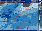
RNK doesn't even have a snowfall map for this time period. There's ends at 7am saturday, Why is that??Holy moly! I snagged this off the NWS Raleigh’s latest briefing.
View attachment 190767

Yeah that would make sense with the deepening coastal to see a deformation band. If you’re fortunate enough to get under the pivot point of it, you can get dumped on in a very short amount of timeBrad P was talking about a band of heavy snow on the backside as the low goes off the coast
Sent from my iPhone using Tapatalk
For those interested, here is a link to the March 1980 storm WeatherNC mentioned above. Good read.Almost time to start dialing in liquid amounts with the CAMs. I’ve been in a handful of occlusions in the MA and NE, ~970 mb into Long Island Sound, subs 980s inside the B/M, and typically ~2" liquid equivalent is about the upper end. I certainly wouldn’t fret if I were in central or eastern NC, there’s going to be one hell of a deformation axis setting up shop, and wherever that pivots, jackpot.
Climo usually favors RWI–ECG–ORF, but to be honest there aren’t many case examples of an occlusion occurring ivo HAT, so we’re charting into some real unknowns. Dare I say it, 1980 may be the best analog.
The map I posted was from their special weather briefing video that they put out to local agencies. Not sure if RNK did a special briefing.RNK doesn't even have a snowfall map for this time period. There's ends at 7am saturday, Why is that??
View attachment 190779
Oh ok, let me check on that. Thanks!The map I posted was from their special weather briefing video that they put out to local agencies. Not sure if RNK did a special briefing.
The map I posted was from their special weather briefing video that they put out to local agencies. Not sure if RNK did a special briefing.
I was surprised they said they’re not going to put out a watch until tomorrow.The map I posted was from their special weather briefing video that they put out to local agencies. Not sure if RNK did a special briefing.
Without hitting banter territory. RNK is often very conservative and only updates graphics when the forecast period switches (usually 5pm it switches from this afternoon tonight).RNK doesn't even have a snowfall map for this time period. There's ends at 7am saturday, Why is that??
View attachment 190779
