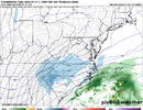
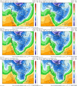
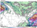
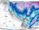
The maddening part of me is we have a Cheer Comp for my daughter in Gwinnett on Saturday. I really do not feel like getting stuck a hour and half away from my house in snow and frozen highways. It's gonna be maddening to tie down just what's gonna happen because I would prefer to have that Comp called if it's gonna be dicey. The ULL is the story and that's gonna be held close to the vest until right before
-
Hello, please take a minute to check out our awesome content, contributed by the wonderful members of our community. We hope you'll add your own thoughts and opinions by making a free account!
You are using an out of date browser. It may not display this or other websites correctly.
You should upgrade or use an alternative browser.
You should upgrade or use an alternative browser.
Wintry Machine Learning Mauler 1/30-2/1
- Thread starter SD
- Start date
BrickTamland
Member
There is no downward trend.Yes the downward trend has started for sure. We will be lucky to see a widespread 1-3 inch event in central NC. Rug pull once again. Those large total clown maps are pure fantasy and nothing more. I have been watching them for 25 years and have NEVER seen one verify.
BrickTamland
Member
dsaur
Member
It's great to be excited, but none of this is real until it's on the ground. Might get nothing, might get under a band and see glory. All to be decided during the actual event.it feels like a feast or famine kind of place to me, and modeling represents that. i could see the verification map looking like tiger stripes. if i were there i would bring a mindset of, if it happens, awesome, if it doesn't, we knew this was a possibility
Yep, for sure.Which is horrible for areas on the Southern edge of the footprint.
TigerSnow
Member
If I remember correctly didn't this model catch on pretty quick with cutting back totals from our last storm?
need that to keep coming swPosition is ever so slightly west and the strength look similar, but the tilt looks a tad worse. Small changes, big differences, I guess. No expert disclaimer.
Bigedd09
Member
If I remember correctly didn't this model catch on pretty quick with cutting back totals from our last storm?
No that was the weathernext
Sent from my iPhone using Tapatalk
Bigedd09
Member
Assuming the further west it goes the worse it is for western Carolina’s right?
Sent from my iPhone using Tapatalk
BrickTamland
Member
Euro seems to be stuck at 72.
iGRXY
Member
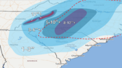
First Call:
I feel the best along and west of 77 right now. ULL driven precip looks solid and I think as we get into the mesos range we will start seeing some increased totals with leeside enhancement and just typically overperforming NW from these things. Mix that with the fact that places further west will have like 20:1 ratios, 0.3-0.5" of liquid which has been the average looks likely. The biggest question for me remains the coastal at this point. You could get a foot plus or get blanked.
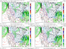
pleasant surprise for yours truly. not a fun cycle for richmond, but i do still think i'm advantageously positioned on the northern fringe of the envelope12z EPS...looks good. Trend past 48 hours of just the 0z/12z runs...
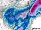
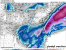
View attachment 190688View attachment 190689
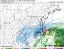
idk about 1-3 for (atleast the western metro) but I like that overall Georgia forecast, very very good imoView attachment 190686
First Call:
I feel the best along and west of 77 right now. ULL driven precip looks solid and I think as we get into the mesos range we will start seeing some increased totals with leeside enhancement and just typically overperforming NW from these things. Mix that with the fact that places further west will have like 20:1 ratios, 0.3-0.5" of liquid which has been the average looks likely. The biggest question for me remains the coastal at this point. You could get a foot plus or get blanked.
ULL stuff scares me. They misbehave often and even when you have consistency from CAMs can still do stuff you didn't see coming. I'd get ready for some spooky NAM runs at some point
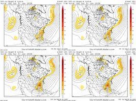
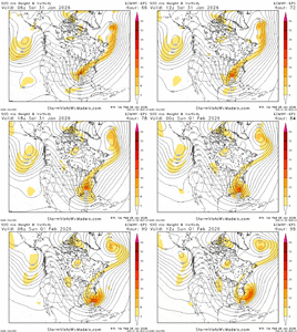
two things jump out:Need an expert here to answer, but looking at the 500mb maps there's very little major movement. Some back and forth tweaks is all I see. Best to stick with a blend for precip forecast.
View attachment 190687
1. vort trail over new england trending south. indicates less 'seperation' and lowers heights ahead of storm. we already have plenty of cold air. need those heights to rise to sharpen things
2. florida shortwave is tucking in further west. we want that east, that piece helps 'slingshot' the trough into neutral/negative tilt.
small features but they matter
BrickTamland
Member
Euro still stuck. It doesn't know how to handle all the snow.
SnowNiner
Member
Just catching up on the models runs overnight, I like where CLT is for a nice several inch snow event. But I don't buy the crazy high numbers the gfs is spitting out, and I think ratios tend to be overdone. Generally speaking, I think qpf is too high on op models and like to go with the Euro EPS for it. Whatever it says, it's usually close to that. Right now, my guess is the ULL doesn't produce huge totals, the coastal really doesn't give 77 west that much precip if at all (it never seems to in my recollection), and the precip ends sooner than modeled every time west to east. Therefore right now, I'd expect around .3 inches or so from the ULL. So a 3-4 inch storm seems reasonable, and the best we've seen since 2018 I believe.
That drying is what you have to look for though out west. I think Raleigh area ends up better due to the coastal.
That drying is what you have to look for though out west. I think Raleigh area ends up better due to the coastal.
BrickTamland
Member
Bigedd09
Member
There is no downward trend.
Pr downward trend for areas further north and west near Charlotte . That 1 inch snow inching down into Iredell county
Sent from my iPhone using Tapatalk
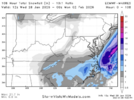
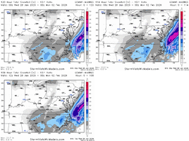
12z Euro is ~3-6" for CLT / GSO, ~4-8" for GSP, ~5-10" for RDU (ratio dependent - lower bound when using 10:1 and upper bound using 20:1). Not too shabby, although perhaps not the insanity we saw from the GFS / Canadian. PGV jackpot, though. Could this be another December 2010 for them? Very spicy for upstate SC, too!
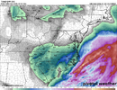

12z Euro has NC metros and upstate SC around 15-18 degrees for the snowfall.
BrickTamland
Member
iGRXY
Member
Webberweather53
Meteorologist
Yeah, it's not as much as the GFS and Canadian, but this is still a major snow storm. And the ratios would be higher than 10:1.
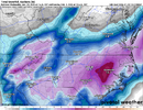
View attachment 190705
There is a pretty good amount of low to mid level warm advection on the euro over eastern NC as the low cranks up. Probably underestimating that as usual (& arguably too dry)
NWG_WX14
Member
12z Euro started picking up on the coastal more than in past runs. I think that it might be starting to latch on to the idea of a stronger coastal like the GFS or CMC
iGRXY
Member
Chase1983
Member
Could really go for that ol' NW trend here in NE Ga
Btownheel
Member
I’m sure as hell not turning my nose up at 7-8 inches of snow 6 days after a 2 inch sleet bomb. Most juice we’ve had since 2018!
I think everyone is just amped because we know the potential here, how rare getting a synoptic setup this perfect is and we want the thing to bomb so everyone can get the once every decade or so 17 inch paste job. I get it.
FTR, I think that’s still very much on the table. These things wind up more than thought all the time.
Sent from my iPhone using Tapatalk
BrickTamland
Member
Yeah, and a little further west and everyone gets more. It wouldn't take much for it to be like the GFS and Canadian.View attachment 190706Not sure what some of y'all are whining about honestly lol
There is a pretty good amount of low to mid level warm advection on the euro over eastern NC as the low cranks up. Probably underestimating that as usual (& arguably too dry)
Curious if you think the ~18-20:1 ratios the Kuchera is banking on are realistic? I'm just always a little hesitant to bank on crazy ratios around here no matter how cold it is.
I know it's happened before where ratios were truly phenomenal (January 2003 being the biggest one I can think of - supposedly, ratios were 30-40:1 in some areas of the southern NC foothills), but it is a rarity.
rburrel2
Member
Amazing how every single model and mean has .2 to .5 qpf for the upstate, like literally every one including the ukmet. And they’re giving us a 10% chance at 1 inch. Where do they come up with this stuff?
Do they mean a 10% chance we “only” get one inch? lol
Do they mean a 10% chance we “only” get one inch? lol
iGRXY
Member
Kuchera so it's closer to exact ratios but probably not exact. For example these are around 17:1 ratios in the upstate. In reality with the type of cold air in the column and surface, I don't see how we aren't at 20:1Is that based off 10:1 ratios?
Sent from my iPhone using Tapatalk

