Brandon10
Member
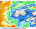
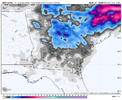
I think if the NAM went out to 87 you would see that big band starting to set up from Chesapeak Bay down to Faeyetville and east.
Are these increased ratios
How are you feeling about our neck of the woods as for the possibility of just getting some snow accumulation? It's tough being right on the edge.
What is Google for this weekends storm at this range? or will we find out at noon?The Google...0z Saturday run was pretty good then? Below is right at the 1.5" QPF...I call that fairly good for a smoothed mean.
View attachment 190525
Nam's wonky precip outputs aside, the 06z and 12z runs take the 850mb low much further south than the gfs through ga. same with the euro. we will see what the rest of the 12z runs show but the gfs is on it's own with it's much further north track.despite the poor start to nam for atlanta, it somehow recovers lol


Nam's wonky precip outputs aside, the 06z and 12z runs take the 850mb low much further south than the gfs through ga. same with the euro. we will see what the rest of the 12z runs show but the gfs is on it's own with it's much further north track.
View attachment 190547
View attachment 190544
And still snowing over central and eastern NC for at least a few more hours.
The upper low actually was going neg tilt at hr 84 and ended up a little south of where I thought it was going to tick. It appears that the surface low depicted was on a convective cluster well out east of Florida.
Glad to not be in the Nam bullseye this far out...never works out that way. Maybe by Friday at 12z different storyCouple things on the NAM.
1. It's the long range NAM.
2. It looks like it has feedback issues even with the precip like it usually does even with the more progressive look.
3. It's the long range NAM
Thanks for this! Last year was awesome and I appreciate you explaining how this setup differs. Much like you, it’s nice to be in the game and I would be more than happy with a dusting.As of now, I feel that SAV will most likely get either no or a trace of snow but favoring a trace. If we’re lucky, we could get a few tenths of an inch from a SE moving streamer that happens to center near us and doesn’t dry up too much on the way to the coast. Though unlikely based on our long history, that’s doable with how cold it looks to be if the very strong upper low verifies and so I’m excited about at least having that chance. Just getting a tenth of an inch or a couple of tenths is as you must know a big deal based on history as a strong majority of winters get no measurable wintry precip here.
This isn’t the very rare classic very moist storm setup like 2018 and 2025, which had cold enough air and lots of moisture in advance of the surface low. For our area, this one is much less moist and is mainly upper low generated.
If I get time, I’m going to look for similar mainly upper low generated analogs.

Yep it's precip output at this range is almost 100% useless. But i don't think the nam is going to be alone in giving your local snow.It looks great in my area with a very rare 1.7-1.9” of snow, but it’s the terrible long range NAM and nothing else has anything like that. I’m heavily discounting this at this time.
Not everyone can read the models. I get no banter but responses like this doesn’t encourage anyone to ever try to participate.The individual wasn't asking for a model, they were asking if it's going to snow in their area.
I would not expect this at this point, despite what some of the other models have shown unless there's further corrections to the west in the next few days.There is a decent chance atl gets 1 to 3 just based on the average of models. It won't take but 0.07 to get an inch with 15 to 1 ratios and 0.20 to get 3. In general models are showing that
Interesting that the Baby CMC has a tightly closed off VM at this timestamp. It'll be interesting to see where this goes from here.
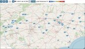
Almost every square inch of both carolinas on the mean. I think the last storm we could point to that did this was Christmas 2010.Looks like the SREF might’ve been trying to do a Murphy-to-Manteo (granted this is a smoothed mean). Precip is still ongoing and is spooling up in central / eastern NC.
View attachment 190559
Still a lot less bullish than the globals but respectable. Looks like "the big one" for most of NC!Looks like the SREF might’ve been trying to do a Murphy-to-Manteo (granted this is a smoothed mean). Precip is still ongoing and is spooling up in central / eastern NC.
View attachment 190559

