BHS1975
Member
That kind of stuff happens in Canada not here.Especially since the GFS output is the Low basically stalling/meandering off NC/VA for 12-18 hours. No other model show is getting captured. They show gradual NE movement not a crawl
That kind of stuff happens in Canada not here.Especially since the GFS output is the Low basically stalling/meandering off NC/VA for 12-18 hours. No other model show is getting captured. They show gradual NE movement not a crawl
Nope this is all I needed thanks. I don't like the vague posts of oh I think this or that is going to happen and then not state reasons.Based on:
-Global models inability to properly place ULL’s
-2.5 days worth of westward trends that coincide with how these setups dig way further west and south as they approach more often than not
-NAM and RGEM already showing this with expanded qpf fields when they are normally very dry at this range
-Increased heights off the east coast
-Trends showing increased interaction with energy in the SW
Need more?
It does happen. When you get a pivot and left behind deform/ death band that just washes itself outThat kind of stuff happens in Canada not here.
Didn't the Euro and Canadian show that a day or two ago when they showed 20-30" for some? Unlikely, but not an impossible scenario.Especially since the GFS output is the Low basically stalling/meandering off NC/VA for 12-18 hours. No other model show is getting captured. They show gradual NE movement not a crawl
There is a decent chance atl gets 1 to 3 just based on the average of models. It won't take but 0.07 to get an inch with 15 to 1 ratios and 0.20 to get 3. In general models are showing thatdo yall think atlanta is sitll in the game
I’d be very wary about the crazy high qpf of the last several GFS over C and E NC. It had 2-4” of qpf for the previous storm in many areas like ATL and much of N GA ended up with only ~0.75”. I’d at least cut the GFS’ in half. Besides we know it is an inferior model in general. Compare the GFS crazy high qpf to the other models and it isn’t really close for the most part:
GFS way out on limb:
View attachment 190515
Euro: way less than GFS
View attachment 190516
CMC: much less than GFS except within 75 miles of coast:
View attachment 190517
ICON: way less than GFS
View attachment 190518
UKMET: way less than others/likely way underdone
View attachment 190519
I’d favor going with the middle ground combo of Euro and Icon as of now for overall qpf amounts and favor the Euro’s C NC for the heaviest at this point.
I was talking about a low getting captured and meandering in one spot.It does happen. When you get a pivot and left behind deform/ death band that just washes itself out
It s all dependent on fully phased cyclogensis evolvng. If you don't get that, only partial, then yes, qpf will be lower. If you get it wound up, pressure to bottom out, rapidly intensify like the GFS suite does at h5. you will get the high qpf its advertising.I’d be very wary about the crazy high qpf of the last several GFS over C and E NC. It had 2-4” of qpf for the previous storm in many areas like ATL and much of N GA ended up with only ~0.75”. I’d at least cut the GFS’ in half. Besides we know it is an inferior model in general. Compare the GFS crazy high qpf to the other models and it isn’t really close for the most part:
GFS way out on limb:
View attachment 190515
Euro: way less than GFS
View attachment 190516
CMC: much less than GFS except within 75 miles of coast:
View attachment 190517
ICON: way less than GFS
View attachment 190518
UKMET: way less than others/likely way underdone
View attachment 190519
I’d favor going with the middle ground combo of Euro and Icon as of now for overall qpf amounts and favor the Euro’s C NC for the heaviest at this point.
NWS Raleigh mentions this possibility in their forecast discussion. It is wonderful that practically everyone in the Carolinas is almost guaranteed to see snow this weekend but it would be sad to see a dry slot cut down totals across the Piedmont. Lets root for the GFS which keeps all of the energy for this storm primarily with the coastal low.The dry slot (lesser amounts) near our area though looks real on several model outputs now.
We're over here on top of the old Lillington town dump. It's a little bit of a knife twist when other folks say "Wow! This run will be great for everybody!" knowing it's another dagger for the Sandhills.I grew up in Coats so I know all too well! Still a lot to change possibly between now and Sat morn!
The CMC did to a degree...not as much as GFS. But IMO that is a rare occurence here. Not impossible but is it plausible?Didn't the Euro and Canadian show that a day or two ago when they showed 20-30" for some? Unlikely, but not an impossible scenario.
I’d be very wary about the crazy high qpf of the last several GFS over C and E NC. It had 2-4” of qpf for the previous storm in many areas like ATL and much of N GA ended up with only ~0.75”. I’d at least cut the GFS’ in half. Besides we know it is an inferior model in general. Compare the GFS crazy high qpf to the other models and it isn’t really close for the most part:
GFS way out on limb:
View attachment 190515
Euro: way less than GFS
View attachment 190516
CMC: much less than GFS except within 75 miles of coast:
View attachment 190517
ICON: way less than GFS
View attachment 190518
UKMET: way less than others/likely way underdone
View attachment 190519
I’d favor going with the middle ground combo of Euro and Icon as of now for overall qpf amounts and favor the Euro’s C NC for the heaviest at this point.
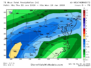
Roanoke saw at least 1.75 inches of liquid so it was not exactly locked in for further northEPS was pretty good and Google nailed it for RDU to GSO, for the most part. But, to be expected the ens mean doing better.
RDU recorded .5" and GSO recorded .80" per NWS/RAH.
View attachment 190521
I would think it’s the in between land due to phasing but I’m an amateur!We're over here on top of the old Lillington town dump. It's a little bit of a knife twist when other folks say "Wow! This run will be great for everybody!" knowing it's another dagger for the Sandhills.
To keep this from being banter: Am I correct that the reduced totals are from a projected energy transfer? I'd think any warm nose issues would be overcome. Or is it merely difficulties with convective noise?
That precip cliff along I-95 on the Euro looks a bit specious to me.
EPS was pretty good and Google nailed it for RDU to GSO, for the most part. But, to be expected the ens mean doing better.
RDU recorded .5" and GSO recorded .80" per NWS/RAH.
View attachment 190521
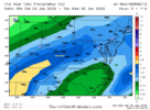
How are you feeling about our neck of the woods as for the possibility of just getting some snow accumulation? It's tough being right on the edge.I’d be very wary about the crazy high qpf of the last several GFS over C and E NC. It had 2-4” of qpf for the previous storm in many areas like ATL and much of N GA ended up with only ~0.75”. I’d at least cut the GFS’ in half. Besides we know it is an inferior model in general. Compare the GFS crazy high qpf to the other models and it isn’t really close for the most part:
GFS way out on limb:
View attachment 190515
Euro: way less than GFS
View attachment 190516
CMC: much less than GFS except within 75 miles of coast:
View attachment 190517
ICON: way less than GFS
View attachment 190518
UKMET: way less than others/likely way underdone
View attachment 190519
I’d favor going with the middle ground combo of Euro and Icon as of now for overall qpf amounts and favor the Euro’s C NC for the heaviest at this point.
It s all dependent on fully phased cyclogensis evolvng. If you don't get that, only partial, then yes, qpf will be lower. If you get it wound up, pressure to bottom out, rapidly intensify like the GFS suite does at h5. you will get the high qpf its advertising.
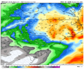
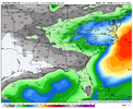
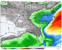
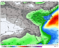
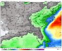
There is a decent chance atl gets 1 to 3 just based on the average of models. It won't take but 0.07 to get an inch with 15 to 1 ratios and 0.20 to get 3. In general models are showing that
i would agree, honestly, im cool with any amount of snow as long as it lasts longCould, but you have to factor in sublimation in as well if that plays out.Anything on the west and southwest side will be from mostly bands. So in effect, you may get 1-2" worth of snow and only see a dusting several times because it disappears between bands.
It will be pretty though.
I saw this in Christmas 2010 or 2011 - one of the analogs. Everyone talks about the white Xmas in the ATL area. I am in East Cobb and it was more of a opaque Xmas as we never got more than slush. BUT, slush may not be an issue w/ temps this go. If I remember some folks nearby had a few inches.Could, but you have to factor in sublimation in as well if that plays out.Anything on the west and southwest side will be from mostly bands. So in effect, you may get 1-2" worth of snow and only see a dusting several times because it disappears in the lulls.
It will be pretty though.
and yet the outcomes are so significant, that really tells you how delicate this setup is
and yet the outcomes are so significant, that really tells you how delicate this setup is
