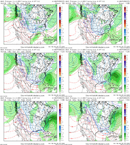
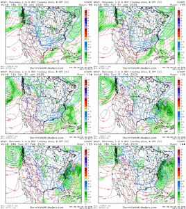
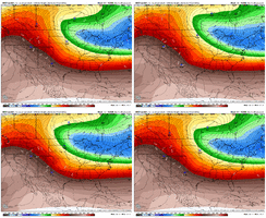
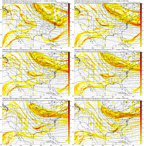
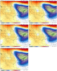
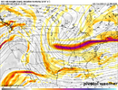
Probably banter so I’ll just say it once, but this storm is definitely personal. Got a whopping 0.9 off the January system last year. Potential was for so much more. So it would be crushing to miss this one. Even getting an inch while two hours up the road get half a foot would stink. 3-4 inches is the standard here. Gonna be greedy. I’m done. Lol
-
Hello, please take a minute to check out our awesome content, contributed by the wonderful members of our community. We hope you'll add your own thoughts and opinions by making a free account!
You are using an out of date browser. It may not display this or other websites correctly.
You should upgrade or use an alternative browser.
You should upgrade or use an alternative browser.
Wintry Machine Learning Mauler 1/30-2/1
- Thread starter SD
- Start date
SnowNiner
Member
I would love this. Looks like it digs so much further south and west. Let’s go Pangu! Would get so many more into the game imo. And would be a more classic miller A that gets the gulf involved for us in western Carolina’s.
This just seems so far east to me that a warm cow poot would push it north east and miss mby completely. Stoked for Raleigh though, it looks like their storm no matter what.
Edit looks like the spire does the SW dig too.
iGRXY
Member
I continue to like where we are here even with east shifts today. I’m like 80% sure it’ll eventually start shifting back west as we get closer. A. Northern stream ULL typically dig more. B. It’s almost a guarantee that whatever the models show in the day 4-6 range, the opposite happens in the short range. C. ULL themselves almost always overperform
Sctvman
Member
I & @Shaggy & @lexxnchloe & @Avalanche & the Beach Crew are holding on too our,, rugs.. ALWAYS the Warm Nose Noise..
I hope We can cash in with High Ratio's! 13"+ or bust!
I hope We can cash in with High Ratio's! 13"+ or bust!
Last edited:
Speaking for eastern NC. Bombing coastal makes me a little nervous, more times than not they definitely come W/NW some, at least enough for warm nose to ruin part of the party. But as others have mentioned, artic airmass over snow pack to our N/NW helping that temp gradient and should keep baroclinic zone suppressed off the coast.
BrickTamland
Member
Euro with an even bigger storm this time. I think it's safe to say the GFS is an Eastern outlier with the Euro, ICON and Canadian all showing pretty much the same footprint with the snow in NC. Euro AI and WeatherNext are similar, too.
Last edited:
Edward Nygma
Member
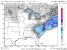
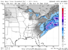
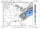
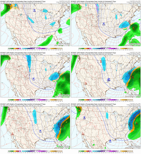
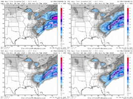
Already super impressive, but considering most of the ops are giving 15 to 20:1 ratios, it's all the more so considering these are just the 10:1 maps.18z Google came in mostly the same…matched up with EPS
Hopefully we can hang around here for a couple of more days
View attachment 189721View attachment 189722
View attachment 189723
It’s been said but it’s wild how google locks in 144-168 hrs and just holds steady. No crazy run to run changes like we all see with the gfs and euro. I wonder what makes it less susceptible to these swings?
NBAcentel
Member
Just like how YB betta, WN betta. It’s a model that shows promise more so then anything so farIt’s been said but it’s wild how google locks in 144-168 hrs and just holds steady. No crazy run to run changes like we all see with the gfs and euro. I wonder what makes it less susceptible to these swings?
It's crowded. Lots of traffic, even in the suburbs these days. It's the city where Barney goes to party. Most of the population is from other states who have moved there in recent years. The people are friendly for the most part.If things keep going like they going,thinking about chasing to Raleigh,don’t know anything about the place..peeps ,give me some info
Tsappfrog20
Member
If things keep going like they going,thinking about chasing to Raleigh,don’t know anything about the place..peeps ,give me some info
Raleigh is awesome I love it here
Sent from my iPhone using Tapatalk
Mahomeless
Member
It’s quite impressive with how locked in most all of these models are at this time.
because it is a better model. Simple as that! It initializes the same as all other ecmwf-initialized models.It’s been said but it’s wild how google locks in 144-168 hrs and just holds steady. No crazy run to run changes like we all see with the gfs and euro. I wonder what makes it less susceptible to these swings?
LovingGulfLows
Member
- Joined
- Jan 5, 2017
- Messages
- 1,499
- Reaction score
- 4,100
It’s quite impressive with how locked in most all of these models are at this time.
It's really not a complicated set up for models to resolve like the last system. This is why I would really love to be in the Carolinas right now especially around Raleigh.
I still believe Atlanta and east in GA can see accumulating snow with slight adjustments. Will it be a major snow? No, but as long as its accumulating, it's signficant.
Shaggy
Member
Wilmington had a good discussion today. Our fear in mine and @SENC @Avalanche @lexxnchloe is going to be if it can develop fast enough to tap moisture. The later bloomer certainly favors your neck of the woods.Speaking for eastern NC. Bombing coastal makes me a little nervous, more times than not they definitely come W/NW some, at least enough for warm nose to ruin part of the party. But as others have mentioned, artic airmass over snow pack to our N/NW helping that temp gradient and should keep baroclinic zone suppressed off the coast.
Think I'm going on a 24 hour model blackout
Avalanche
Member
I share those sentiments as wellWilmington had a good discussion today. Our fear in mine and @SENC @Avalanche @lexxnchloe is going to be if it can develop fast enough to tap moisture. The later bloomer certainly favors your neck of the woods.
Think I'm going on a 24 hour model blackout
They call it the weathernext because it is the weather that is going to happen next
iwantsouthernsnow123
Member
Feel that way up here too.. Feels like we've been stuck in a bubble of just dry slots.. Seen them go to my south, to my north and even hit, but get dryslotted in the system like last year. We haven't seen snow over an inch here since 2022 during Izzy. Gotta hope for the bestProbably banter so I’ll just say it once, but this storm is definitely personal. Got a whopping 0.9 off the January system last year. Potential was for so much more. So it would be crushing to miss this one. Even getting an inch while two hours up the road get half a foot would stink. 3-4 inches is the standard here. Gonna be greedy. I’m done. Lol
I'm very well considering he same @Shaggy, I'm feeling like Charlie Brown & lucy.... Well,, I'll not say the rest..Wilmington had a good discussion today. Our fear in mine and @SENC @Avalanche @lexxnchloe is going to be if it can develop fast enough to tap moisture. The later bloomer certainly favors your neck of the woods.
Think I'm going on a 24 hour model blackout
13" + or bust!
dsaur
Member
I got stung over 20 times by rabid yellow jackets a few months back. I'm hoping they heard about the "dumpster fire" winter in the fall and only dug down a few inches instead of below the frost line. I carry a grudge when I'm attacked. Me an innocent.... a good boy. A delicate sweet boy.10-14 days of lows in the teens/low 20s and our newly formed glacier may actually kill the fire ants.
WolfpackHomer91
Member
It’s quite impressive with how locked in most all of these models are at this time.
It was last Monday too, Tuesday evening the
 show began. Make it to Weds night 00z runs and I’m in
Sent from my iPhone using Tapatalk
Mitch, I've been pulling for ya from the beginning man. Hope you score here. Wish I could send some of what I get Southeast to you sometimes.Probably banter so I’ll just say it once, but this storm is definitely personal. Got a whopping 0.9 off the January system last year. Potential was for so much more. So it would be crushing to miss this one. Even getting an inch while two hours up the road get half a foot would stink. 3-4 inches is the standard here. Gonna be greedy. I’m done. Lol
bncho
Member
Here's what I think the major possibilities are, just based off our current situation.
1. Jan 2000/Jan 1996-like; a blizzard from Raleigh to Boston.
2. Jan 2022-like; a blizzard from the Outer Banks, Delmarva, Jersey Coast, and eastern New England. The I-95 corridor receives snowfall, but it's less than option one.
3. OTS; it's a fish storm.
What is the most likely possibility? I am not sure. These are the three major possibilities, not all the possibilities.
wow
Member
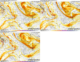
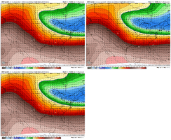
Was just running the comparisons on that. This is how we can get this one firing in the GOM.Big shift west on the 0z NAM with the Canadian energy at h51. Probably a precursor to different looks with tonight's 0z suite.
View attachment 189733
NBAcentel
Member
Was just running the comparisons on that. This is how we can get this one firing in the GOM.
View attachment 189734
One move to get more people in the game. Good first step of the models tonight.
CNCsnwfan1210
Member

18z EPS trend beginning to show less spread/a little more certainty of the surface low positions and more consolidation, perhaps trending toward a stronger solution. There are some members closer to the Carolina coast.
Sent from my iPhone using Tapatalk
Atlanta has struggled to get a nice event. Last one was 2017 and that barely affected Atlanta proper. Has been a snow drought.We haven't seen much since '22.. there was maybe 1-2" here last year but it was gone fast, just wasn't super fun. I can't remember the last 5-6" snow I've seen. I was in ATL for a few years, and feel I missed one in Athens a ways back. Maybe it was way back in ATL in early 2011, I think 5ish inches.
As soon as I saw an eastern coastal and north trend on this I pretty much mentally checked out. It's possible a gufl low could pop but we should be seeing more sign of that and very soon, or this is a big fail for most of us on the board
Every event has had Atlanta at or near the edge of the fun. always on the side of no fun. (oops forgot to put this in banter)
iGRXY
Member
iGRXY
Member
This might be a big run from the icon
Ron Burgundy
Member
I got 4” last Jan in Chastain Park. That seemed pretty nice. Maybe we were in the lollipopAtlanta has struggled to get a nice event. Last one was 2017 and that barely affected Atlanta proper. Has been a snow drought.
Every event has had Atlanta at or near the edge of the fun. always on the side of no fun. (oops forgot to put this in banter)
LovingGulfLows
Member
- Joined
- Jan 5, 2017
- Messages
- 1,499
- Reaction score
- 4,100
Atlanta has struggled to get a nice event. Last one was 2017 and that barely affected Atlanta proper. Has been a snow drought.
Every event has had Atlanta at or near the edge of the fun. always on the side of no fun. (oops forgot to put this in banter)
I think last year was pretty good...parts of the city got up to 4.5 inches of snow and it happened very fast with super heavy rates. It could be worse(Look at areas in Upstate SC, Charlotte, NC down to Augusta, GA). That's a true snow drought.

