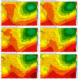
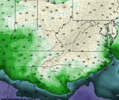
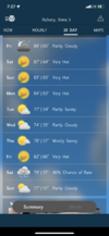
Looks to be an interesting month. First shot at some summer like weather the first few days of the month. Maybe a severe weather threat or 2 between 6/4-11, probably another eastern trough as the conus pattern retrogrades in the 6/4-13 period, likely to move toward a climo summer pattern after the 15th, may make a big run at heat 6/22-30.
-
Hello, please take a minute to check out our awesome content, contributed by the wonderful members of our community. We hope you'll add your own thoughts and opinions by making a free account!
You are using an out of date browser. It may not display this or other websites correctly.
You should upgrade or use an alternative browser.
You should upgrade or use an alternative browser.
Pattern June 2023 Thread
- Thread starter SD
- Start date
Iceagewhereartthou
Member
Well, really for the first time, I am not seeing any 50s show up for morning lows in the 2 week outlook and all but 1 day in the 80s after Thurs; with many of those being mid 80s. Summer is going to be here after the weekend for my area and that's just the reality. It's been a fantastic run of nice weather the past couple of months but we knew we couldn't escape it forever. Now I'll start the slow countdown till Sept 15th, I'm ok after that.
Edit: actually just looked at the GFS and it still shows that little cool down around the 8th-10th, but then really cranks the heat after that. Its been over doing the heat and that is long range so I expect that will moderate but regardless, summer is only a few days away for most.
Edit: actually just looked at the GFS and it still shows that little cool down around the 8th-10th, but then really cranks the heat after that. Its been over doing the heat and that is long range so I expect that will moderate but regardless, summer is only a few days away for most.
severestorm
Member
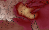
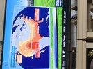
El Nino starting with a vengeance
It has to be spring or summer, cause you can’t get that look in winter! ??
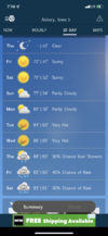
Currently 79
Iceagewhereartthou
Member
Pretty entertaining write up by GSP on the GFS for next week! ?
LONG TERM /SATURDAY NIGHT THROUGH WEDNESDAY/...
As of 215 PM EDT Wednesday: Oh what a challenge it has been to gain
steady insight into the synoptic pattern for the end of the weekend
and next week. As noted by the previous forecaster, the pattern
does look to become more amplified by Sunday, but it remains unclear
exactly how that will play out since each guidance source is off in
its own little world. The CMC and ECWMF are in decent enough
agreement through Sunday night, depicting a fleshed-out upper low
off the New England coastline...which remains too far north and east
of the forecast area to promote much moisture or synoptic forcing in
the Carolinas. This would promote some isolated to widely scattered
low-end diurnally-forced convection...but little else. And granted,
the 06z and 12z GFS cycles are showing this as well...it`s just that
where the other guidance keeps this feature to our northeast, the
GFS (and the majority of its ensembles, for what that`s worth)
depict some retrograde motion of the low, westward into the Ohio
Valley through Monday. Were this scenario to play out, it`d pretty
strongly enhance the dynamical forcing over the Carolinas by by
Monday afternoon, and more active weather could be in order. I like
to imagine the GFS as similar to an 80s-style action movie villain:
sitting in its dark lair laughing, its intentions unclear and yet
definitively at odds with everyone else. In the case of 80s movies,
of course, this typically resulted in various popcorn-worthy action
sequences...while in the case of the GFS, the "villainous" solution
would just result in far better convective potential than what the
rest of the guidance favors.
Regardless of which solution plays out for Monday...most of the
guidance depicts some flavor of shortwave rotating across the Mid-
Atlantic on Wednesday, though impacts will hinge on timing and
intensity of this feature, which at this point is about as clear as
mud. Temperatures will fall a little below normal for Monday (maybe
a lot below normal if the GFS`s deep-upper-low solution pans out)
before rebounding to at least a category above normal by Wednesday.
Downeastnc
Member
PGV has never made it past June 13th without hitting 90.....according to the daily monthly data on NWS there has not been a day to hit 90 yet this year, though I thought it had.
The latest run of the GFS remedies this on June 11th....so close to the latest ever first 90 degree day for this area...
The latest run of the GFS remedies this on June 11th....so close to the latest ever first 90 degree day for this area...
It'll be close. We are riding a fine line these first 10 days to 2 weeks between upper 90s and upper 70s so it wouldn't be surprised if we snuck a 90 throughPGV has never made it past June 13th without hitting 90.....according to the daily monthly data on NWS there has not been a day to hit 90 yet this year, though I thought it had.
The latest run of the GFS remedies this on June 11th....so close to the latest ever first 90 degree day for this area...
Yeah, not sure how the LR will play out for when it gets hot (>90). As Downeast just said the 6z GFS would get many of us above 90 around the 11th. But who knows if it'll verify. We were supposed to get hot now from the GFS a week ago. Even so, this run would have this right before our warmup (Dew points day 7):
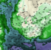
We would then warm up afterwards and hit the 90s for a day or two before dropping back down to dew points in the 50s to end the run. I would take this setup any day.

We would then warm up afterwards and hit the 90s for a day or two before dropping back down to dew points in the 50s to end the run. I would take this setup any day.
LickWx
Member
Those are all-time record low level dews for June...12z GFS still shows the cool down on day 6/7 and then the warmup into the 90s for a couple of days (`~day 10). It then shows another cool down by day 12.
Dew Points ~ day 12:
View attachment 135345
Incredible for mid-June!
Humid as crap out there today. Can't wait for 90s.
If we can keep the humidity down it will feel good. The euro is not as gung-ho on the day 10 warm up. It does have temps getting well up into the 80s but the dew points stay really nice.Humid as crap out there today. Can't wait for 90s.
Day 9 midday temps:
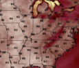
Day 9 midday dew points:
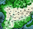
For us, 85/48 would be really nice.
Drizzle Snizzle
Member
Is it just me or are we not getting as many afternoon pop up storms as we usually do this time of year ? On a typical June day, there is usually a good bit of afternoon storms.
Hot and dry is worse than cold and dry! ?If we can keep the humidity down it will feel good. The euro is not as gung-ho on the day 10 warm up. It does have temps getting well up into the 80s but the dew points stay really nice.
Day 9 midday temps:
View attachment 135348
Day 9 midday dew points:
View attachment 135347
For us, 85/48 would be really nice.
NoSnowATL
Member
It’s June 1st. Haha.Is it just me or are we not getting as many afternoon pop up storms as we usually do this time of year ? On a typical June day, there is usually a good bit of afternoon storms.
Models don't have a single 90 degree day here for next 10 days (gets close but not actually 90), I don't buy it. In fact, usually. especially if it's dry, and full sun models under perform on afternoon highs like they usually do with overnight lows on calm, clear nights. Still, if that were to verify what an amazing stretch of no 90 degree days that would be.
The warmest day here of the next 10 right is the 87 for tomorrow. Even more there’s 6 nights with lows of 60 or below… really unusually. The latest first 90 degree high on record for KCLT is 2003 and that was on 7/3… I’m curious to how the overall pattern compares between that year and what we’re seeing now. I’m 2003 we were coming out of El Niño and this year we’re going into one.Models don't have a single 90 degree day here for next 10 days (gets close but not actually 90), I don't buy it. In fact, usually. especially if it's dry, and full sun models under perform on afternoon highs like they usually do with overnight lows on calm, clear nights. Still, if that were to verify what an amazing stretch of no 90 degree days that would be.
The spectrum of outcomes the next 2 weeks is fairly high. 80s low humidity, stalled front muggy lots of rain, mcs train, front to the north and highs well into the 90s are all out there. Given the amount of high latitude blocking still present we may end up with a piece of each through mid June. Unless something changes any "heat" will be relatively short lived in our area but to the south and west may have more staying power. Like we have seen over the lat few years hitting 90 isn't that hard this time of year so I wouldn't be shocked if we do soon but then again I wouldn't be shocked if we revisit this on 6/15 and we still haven'tModels don't have a single 90 degree day here for next 10 days (gets close but not actually 90), I don't buy it. In fact, usually. especially if it's dry, and full sun models under perform on afternoon highs like they usually do with overnight lows on calm, clear nights. Still, if that were to verify what an amazing stretch of no 90 degree days that would be.
If we don't clear out Sunday that record low max is in trouble
JHS
Member
Nothing to back this up of course, but I bet we pay for this later in the summer.The warmest day here of the next 10 right is the 87 for tomorrow. Even more there’s 6 nights with lows of 60 or below… really unusually. The latest first 90 degree high on record for KCLT is 2003 and that was on 7/3… I’m curious to how the overall pattern compares between that year and what we’re seeing now. I’m 2003 we were coming out of El Niño and this year we’re going into one.
Iceagewhereartthou
Member
I noticed many locales in the MA and NE reached the low to mid 90s today. Many areas just to the west of the apps and MS river valley will be in low to mid 90s over the next week, so summer has definitely arrived. HOWEVER, much of the Carolinas and VA had a relatively pleasant day today. Gotta escape 90 tomorrow and Tues and then the rest of next weeks looks pleasant for June. Keep it coming!
Drizzle Snizzle
Member
You left out the Midwest. It was in the 90s in Michigan today.I noticed many locales in the MA and NE reached the low to mid 90s today. Many areas just to the west of the apps and MS river valley will be in low to mid 90s over the next week, so summer has definitely arrived. HOWEVER, much of the Carolinas and VA had a relatively pleasant day today. Gotta escape 90 tomorrow and Tues and then the rest of next weeks looks pleasant for June. Keep it coming!
JHS
Member
Yep three sub 60 lows forecast where I am. Glad to have below normal temps now. Have not had AC on yet. That may change tomorrow though.I noticed many locales in the MA and NE reached the low to mid 90s today. Many areas just to the west of the apps and MS river valley will be in low to mid 90s over the next week, so summer has definitely arrived. HOWEVER, much of the Carolinas and VA had a relatively pleasant day today. Gotta escape 90 tomorrow and Tues and then the rest of next weeks looks pleasant for June. Keep it coming!
JHS
Member
We may miss the worst of the heat all summer. I would not want to be in Kansas and nearby areas though. Someone out there will see 110 this summer. This pattern looks a bit like 1988 when a major drought and high heat hit much of the country, but never settled into the Carolinas. The worst stretch here that year was the 3rd week of August when many of us hit 100, but it only lasted a few days.I noticed many locales in the MA and NE reached the low to mid 90s today. Many areas just to the west of the apps and MS river valley will be in low to mid 90s over the next week, so summer has definitely arrived. HOWEVER, much of the Carolinas and VA had a relatively pleasant day today. Gotta escape 90 tomorrow and Tues and then the rest of next weeks looks pleasant for June. Keep it coming!
iGRXY
Member
We look to keep dropping troughs in the Atlantic and Northeast which makes those of us east of the Apps cooler and with way less humidity vs average. Can't tell the last time I had consistent days in the 70's and lows in the 50's. When mid 80's is considered to be the upper end of the heat during June, consider it a gift. We will be seeing multiple chances at CAD the way we are dumping troughs in the NE and east of the mountains. There will be chances at low to mid 60's back my way if we keep this going.
Brent
Member
The heat building here is one thing but the bigger issue is I haven't seen rain in nearly 2 weeks either
Yeah… it looks like we’re following a Niño climo with the most intense heat out in the Plain over to the MidwestWe may miss the worst of the heat all summer. I would not want to be in Kansas and nearby areas though. Someone out there will see 110 this summer. This pattern looks a bit like 1988 when a major drought and high heat hit much of the country, but never settled into the Carolinas. The worst stretch here that year was the 3rd week of August when many of us hit 100, but it only lasted a few days.
BHS1975
Member
Yeah… it looks like we’re following a Niño climo with the most intense heat out in the Plain over to the Midwest
We had the same with a La Nina last year.
Sent from my iPhone using Tapatalk
Very true, though you can add the Pacific Northwest to that the last couple summers.We had the same with a La Nina last year.
Sent from my iPhone using Tapatalk
Forecast low of 49 Monday morning. I'm really not looking forward to 90s and humid but my lawn has taken a beating with this cool spring. Centipede grass hates cold nights
First official 90 degree high today at KCLT as of 3pm. Interesting to note that the airport is the only observation site in the area to hit 90… the max for me today has been 88.
84.9F so far today. Looks like KATL has been 88F to this point.
Twister
Member
87 here today so far. Haven't had any rain for a few days now
Sent from my SM-S911U using Tapatalk
Sent from my SM-S911U using Tapatalk

