Sooooo when will it storm again
November.
Sooooo when will it storm again
November.
Nahh remember November is our new winter
It literally didEverything in 2020 is poop. Or as Fro used, 2020 NAMed us.
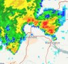
It literally did View attachment 44113
That day was a snow weenie's worst nightmare. In middle TN, it snowed heavily for 6 hours, only for it all to melt when hitting the ground. It was 36 degrees THE. WHOLE. TIME. ?????Ahh, so that's when it all went to hell! That map makes me angry.
ThE sUn ANgLeThat day was a snow weenie's worst nightmare. In middle TN, it snowed heavily for 6 hours, only for it all to melt when hitting the ground. It was 36 degrees THE. WHOLE. TIME. ?????
That day was a snow weenie's worst nightmare. In middle TN, it snowed heavily for 6 hours, only for it all to melt when hitting the ground. It was 36 degrees THE. WHOLE. TIME. ?????


Better advection of EL temps/better llvl moisture has started so it wouldn’t shock meIf we somehow end getting storms tonight, which I know as the sun sets is pretty much impossible, I will literally just give up.

I have become quite curious in how many watches have been issued during the summer months in parts of the southeast. So I went ahead and looked up the amount of watches issued in both Charlotte and Raleigh during the summer months (JJA) to compare to what has been a quiet summer in terms of organized severe weather.Did some digging to see how many watches have been issued over the past 10 years during the summer months (JJA) for my county (Gwinnett) All of them are severe thunderstorm watches.
2010: 4
2011: 5
2012: 0
2013: 1
2014: 2
2015: 2
2016: 1
2017: 1
2018: 4
2019: 5
2020: 0 (so far)
Out of the last 10 years the only year without any watch being issued here during the summer months is 2012 which was the year dominated by that crazy heat.
Looks like outflow trying time keep things alive tonight .. no models really seeing this even the HRRR shows nothing .. looks like a nowcast with our ears tonight
Looks like outflow trying time keep things alive tonight .. no models really seeing this even the HRRR shows nothing .. looks like a nowcast with our ears tonight
And just like that we awake to claps of thunder ... beautiful thingLooks like outflow trying time keep things alive tonight .. no models really seeing this even the HRRR shows nothing .. looks like a nowcast with our ears tonight
As long as it stays there: 1. We probably avoid triple digits, and have mostly low-mid 90s for highs. 2. Opens the door for MCS activity as storm clusters love to ride down the eastern periphery of the ridge. The question is, will the ridge eventually slide our way or stay to our west the entire summer....mid range gfs still trying to throw us a 100 degree day, but so far 95 is the hottest we've been. Next few days should see 97 at least. The bulk of the heat ridge stays in the middle of the country though.
That was the sound of today's rain chances going down the drain.What's Happening outside

That was the sound of today's rain chances going down the drain.
Probably but I'll take the .35 from last night to the bank and hope we can add extra todayThat was the sound of today's rain chances going down the drain.
Man that's rough. I don't know how much I got last night, but the Raleigh radar estimate shows a big min over SE Wake. I heard thunder for 3 hours but never heard a downpour. But the ground is a little wet. I dunno.This one picture sums up my entire summer. It did hold together enough to give my house a quick shower and it sprinkled here at work as it dried up over Pitt county.
Wind is can around to the south here looks like we are east of the boundary at this point. Lets see

Yeah looking at satellite it looks like the outflow from last night's storms is to our south but being forced back north with a secondary boundary near gso to just nw of rduLooks like it’s right on top off us.

Sent from my iPhone using Tapatalk