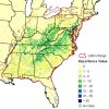
Must be the brushy mountainsLooks active on the 3k NAM today for Wilkes area
-
Hello, please take a minute to check out our awesome content, contributed by the wonderful members of our community. We hope you'll add your own thoughts and opinions by making a free account!
You are using an out of date browser. It may not display this or other websites correctly.
You should upgrade or use an alternative browser.
You should upgrade or use an alternative browser.
July Surprise!
- Thread starter Ollie Williams
- Start date
Why is the new GFS model continued to be used for temperatures when it isn't even on the same planet as verification? Or is this thing considered trash at all levels. It is always to cold during the winter, and way to warm in the summer. It has shown that KATL would be above 97-100 just about every day, it never happens.
This is what the GFS showed one week ago Saturday 7/25
Low:

High:

What actually occurred:

The low was off by a mere 10 degrees, and the high 7 degrees. I just can't understand how this is acceptable day after day.
This is what the GFS showed one week ago Saturday 7/25
Low:

High:

What actually occurred:
The low was off by a mere 10 degrees, and the high 7 degrees. I just can't understand how this is acceptable day after day.
GeorgiaGirl
Member
2.3" yesterday
Guess that is summer for you. Go for a while with almost nothing and then rake in almost 5" in a week.
Guess that is summer for you. Go for a while with almost nothing and then rake in almost 5" in a week.
I’ve been wondering the same thing. What could possibly be the error in this model that would cause a bias to extremes based on the season. How many times this past winter was it showing temps 15-20 degrees below normal and now in the summer it’s wanting to always show triple digits a week or so out.Why is the new GFS model continued to be used for temperatures when it isn't even on the same planet as verification? Or is this thing considered trash at all levels. It is always to cold during the winter, and way to warm in the summer. It has shown that KATL would be above 97-100 just about every day, it never happens.
This is what the GFS showed one week ago Saturday 7/25
Low:
View attachment 45085
High:
View attachment 45084
What actually occurred:
View attachment 45086
The low was off by a mere 10 degrees, and the high 7 degrees. I just can't understand how this is acceptable day after day.
Interesting, lower heights and energy sliding through so severe would make sense this weekend View attachment 45087View attachment 45088View attachment 45089View attachment 45090
That sounds about right. I am moving on Saturday, so BET on it!
Stone MTN. Looks to create outflow boundaries with more storms to Yadkin later this evening maybe reaching Raleigh per 3k NAM.Must be the brushy mountains
Dewpoint Dan
Member
Good grief. It's 90 with a dp of 86 in the town of Washington, IA with a heat index of 121 !
Dewpoint Dan
Member
It's comforting knowing that pretty much everyone except maybe Brent has reached their hottest avg temps of the year.
That sucksAfter averaging around 7" each month through June, this has been the norm in July.... localized flash drought
View attachment 45102
Yeah I've noticed a downward trend, the tide has definitely turned imby....as mentioned around 7" a month prior months and now just 1.33 for July with all but .16 of that falling the first week. Heck .54 July 1, remove that and less than an inch during the hottest stretch of the year.And just like that womp womp womp
View attachment 45114
Just started pouring rain out of nowhere
Nice loud thunder now and still pouring


